1930s Maps of the United States
Explore 5,659 historic maps of the United States from the 1930s. These maps offer a rare glimpse into what life looked like during the 1930s — showing old roads, neighborhoods, homes, and landmarks that have changed or disappeared over time.
Whether you're researching your family's past, planning a metal detecting trip, or studying how the United States's landscape evolved across the 1930s, these high-resolution maps are a powerful tool for exploring the history of this region.
- Focus on a specific era: All maps on this page are from the 1930s, giving you a focused view of this time period.
- See what’s changed: Compare century-old streets, trails, and buildings to today's modern landscape using overlays and satellite layers.
- Research with precision: Use these maps for genealogy, historical research, land use analysis, or educational projects.
- View, download, or print: Maps are fully viewable online in high resolution, and can be downloaded or printed for your own records.
Start exploring the United States's history through authentic maps from the 1930s. This is your window into the past.
United States maps
- 1930 Map of Austin-2
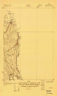
 1930 Austin-21930 Print · USGSThe winding loops of the Colorado River dominate this 1930 survey of Travis County before the era of major dams. Researchers can trace early crossings like Stewart Ford and locate local landmarks such as the Jack Sch and Ch.
 - 1930 Map of Juneberry
 1930 Juneberry1930 Print · USGSThe northern Minnesota borderlands come into focus at the start of the 1930s, showing the early efforts to drain the vast marshy plains. Genealogists and local historians can locate rural schoolhouses like Oak Point Sch and family-named features such as Johnson Sch and Moose Point.
 - 1930 Map of Three Oaks
 1930 Three Oaks1930 Print · USGSSouthwest Michigan's lakeshore and interior townships are captured in detail during the late twenties. Genealogists and historians can trace family roots through numerous rural schoolhouses like California Sch or visit the settled blocks of Three Oaks and New Buffalo.3 unique versions available
 - 1930 Map of Greenup
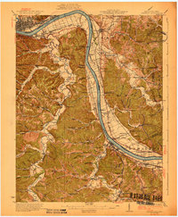 1930 Greenup1930 Print · USGSThe industrial corridor of the Ohio River valley is captured here in the early twentieth century, showing the borderlands of Greenup County and southern Ohio. Researchers can trace the legacy of iron production at Franklin Furnace or locate family roots near Tongs P O and Wurtland.3 unique versions available
 - 1930 Map of Oban
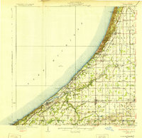
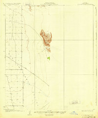
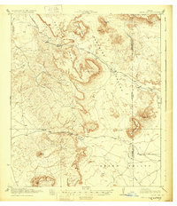
 1930 Oban1930 Print · USGSAntelope Valley was a landscape of remote rail sidings and scattered wells during the early 1930s. Genealogists and local historians can trace the early layout of Lancaster, the location of the Lancaster Airport, and the Southern Pacific rail corridor.
 - 1930 Map of Galveston
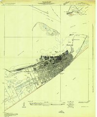 1930 Galveston1930 Print · USGSGalveston thrived as a premier Gulf port and rail terminus during the interwar years. Genealogists and maritime historians can trace the harbor's layout through Union Station, the Fort Crockett Flying Field, and the Immigrant Station.
 - 1930 Map of Joshua
 1930 Joshua1930 Print · USGSAntelope Valley in the early 1930s is a landscape of high desert solitude and frontier surveying. Genealogists and desert historians can trace early tracks like Well Road and locate the remote settlement of Darrwin near the southern edge of Rogers Dry Lake.
 - 1930 Map of Weed Patch
 1930 Weed Patch1930 Print · USGSKern County farmland was rapidly expanding in the 1930s as irrigation networks transformed the valley floor. Genealogists and historians can trace the early layout of Weed Patch and the Vineland Sch along with the path of the Southern Pacific Railroad.
 - 1930 Map of Blanco-1
 1930 Blanco-11930 Print · USGSCentral Texas river valleys appear in high detail during the early 1930s, showing the landscape before later reservoir projects. Trace the original paths of the Colorado River and Pedernales River past Pleasant Grove Sch and Buggy Ford.
 - 1930 Map of Vanceboro
 1930 Vanceboro1930 Print · USGSThe Maine and New Brunswick border comes alive in 1930, centering on the rail hub of Vanceboro and the St Croix River. Trace early 20th-century landmarks like the Cold Water Tavern, Camp Solitaire, and the intricate river rapids at Pork Rips.2 unique versions available
 - 1930 Map of Danvers
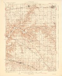 1930 Danvers1930 Print · USGSCentral Illinois farming communities are frozen in time just before the Depression, showing a landscape defined by the Mackinaw River and thriving rail lines. Genealogists can locate family-named schoolhouses like Strubhar Sch and early religious centers like East White Oak Ch.2 unique versions available
 - 1930 Map of Lovejoy Springs
 1930 Lovejoy Springs1930 Print · USGSAntelope Valley was a landscape of scattered homesteads and high-desert outposts in the early thirties. Researchers can trace the layout of early rural life near Wilsona Road, identifying the Wilsona Sch, the Yato Kya Desert Home, and Lovejoy Springs.
 - 1930 Map of Aguila Mountains
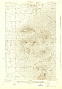
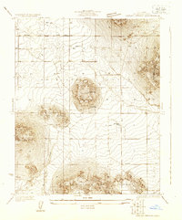
 1930 Aguila Mountains1930 Print · USGSIn the Yuma County desert during the late 1920s, this survey captures a landscape of extreme verticality and open space. Researchers can trace early desert transit along the Yager Road or study the terrain surrounding the Aguila Mountains and Aztec Hills.3 unique versions available
 - 1930 Map of Moosehead Lake
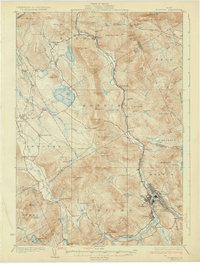
 1930 Moosehead Lake1930 Print · USGSMoosehead Lake in the early twentieth century was a landscape of remote rail junctions and lakeside settlements. Trace the old routes of the Maine Central Railroad to Rockwood or locate the Masterman School near the shores of North Bay.
 - 1930 Map of Pearl
 1930 Pearl1930 Print · USGSThe Illinois River valley in the late 1920s shows a landscape of river-bottom farms and rugged bluff-top settlements. Genealogists can locate family landmarks like Miller Cem, Farmers Ridge Ch, and schools such as Summit Grove Sch or Village Green Sch.3 unique versions available
 - 1930 Map of Bear Mountain
 1930 Bear Mountain1930 Print · USGSKern County's dramatic southern ascent is documented in the early 1930s as state and federal engineers charted the valley edge. Researchers can trace the steep topography of Bear Mountain and the initial path of the Boulevard near Sycamore Canyon.2 unique versions available
 - 1930 Map of Chandlerville
 1930 Chandlerville1930 Print · USGSThe confluence of the Illinois and Sangamon rivers defines this Depression-era landscape of floodplains and island farms. Genealogists can trace family footprints across Grand Island or locate rural landmarks like Mt Olive Ch and the Chicago and Illinois Midland RR.2 unique versions available
 - 1930 Map of Chewelah
 1930 Chewelah1930 Print · USGSStevens County's mining and timber landscape comes alive in the late 1920s, showing the vital rail-to-river corridor. Trace family roots and vanished industrial sites from Springdale to Chewelah, including the United Copper Mine and Bear Creek Sch.2 unique versions available
 - 1930 Map of McFarland
 1930 McFarland1930 Print · USGSThe San Joaquin Valley's agricultural heart is captured here in the late twenties as irrigation and rail lines transformed the landscape. Researchers can trace the development of McFarland and Jasmin along the Southern Pacific and the Golden State Highway.2 unique versions available
 - 1930 Map of Tunk Lake
 1930 Tunk Lake1930 Print · USGSHancock County was a landscape of timber and tide in the early 1930s, where the Maine Central rail line linked small coastal villages to the deep woods. Genealogists and historians can trace old homesteads in Donnells, rural education at Tunk Lake Sch, and the locations of sporting retreats like the Wichyup Club.
 - 1930 Map of Grand Coulee Sheet 3
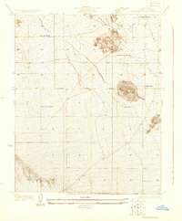
 1930 Grand Coulee Sheet 31930 Print · USGSGrant County is captured during a period of transition in the late twenties, showing the area's complex geology before major development. Researchers can trace local landmarks like the Grand View Sch and the significant geological formation of the Bacon Monocline.
 - 1930 Map of Jordan Gap
 1930 Jordan Gap1930 Print · USGSPresidio and Brewster Counties are captured in the interwar years, showing a landscape of high mesas and desert passes. Genealogists and historians can trace old trails To Marfa and locate family-named landmarks like McKinney Mtn and McTurney Pk.3 unique versions available
 - 1930 Map of Black Butte
 1930 Black Butte1930 Print · USGSAntelope Valley ranching life is frozen in time in the 1930s, showing a sparse network of family outposts and desert trails. Genealogists and historians can locate early homesteads like Hibbard Ranch and Brase Ranch or trace the old Palmdale-Victorville Road.
 - 1930 Map of Rumford
 1930 Rumford1930 Print · USGSRumford and the Androscoggin River valley are shown here just before the Great Depression, highlighting a bustling landscape of rail and industry. Genealogists and historians can trace local families through many district schools like Woodrow Sch and landmarks like Stockbridge Cem or Rumford Falls.5 unique versions available
 - 1930 Map of Robbins
 1930 Robbins1930 Print · USGSThe Vilas and Oneida County lake country comes into focus in the early 1930s as tourism and industry overlap. Locate vanished rural schoolhouses like Evergreen Sch. and Sebastian Sch. or trace the early path of the Chicago and Northwestern RR.2 unique versions available
Showing maps 1-25
Top regions of the United States
- California historical maps
- Texas historical maps
- Florida historical maps
- New York historical maps
- Pennsylvania historical maps
- Illinois historical maps
See more
Top cities of the United States
- New York historical maps
- Los Angeles historical maps
- Chicago historical maps
- Houston historical maps
- Phoenix historical maps
- Philadelphia historical maps
See more
Frequently asked questions
- What are the different types of historical maps available for United States?
- What is the oldest map of United States?
- Where can I purchase historical maps of United States for my home or office?
- Where can I download high-res historical maps of United States?
- Are there historical topographic maps available for United States?
- Is there historical aerial imagery available for United States?
- Where are historical maps of United States sourced from?