1900-1909 Maps of the United States
Explore 5,145 historic maps of the United States from 1900-1909. These maps offer a rare glimpse into what life looked like during the 1900s — showing old roads, neighborhoods, homes, and landmarks that have changed or disappeared over time.
Whether you're researching your family's past, planning a metal detecting trip, or studying how the United States's landscape evolved across the 1900s, these high-resolution maps are a powerful tool for exploring the history of this region.
- Focus on a specific era: All maps on this page are from the 1900s, giving you a focused view of this time period.
- See what’s changed: Compare century-old streets, trails, and buildings to today's modern landscape using overlays and satellite layers.
- Research with precision: Use these maps for genealogy, historical research, land use analysis, or educational projects.
- View, download, or print: Maps are fully viewable online in high resolution, and can be downloaded or printed for your own records.
Start exploring the United States's history through authentic maps from the 1900s. This is your window into the past.
United States maps
- 1900 Map of Baldwinsville
 1900 Baldwinsville1900 Print · USGSOnondaga and Oswego counties are seen here at the close of the nineteenth century, when the Erie Canal still drove local commerce. Genealogists can trace family roots through canal towns like Jordan and river hubs like Baldwinsville and Phoenix.9 unique versions available
 - 1900 Map of Accident
 1900 Accident1900 Print · USGSGarrett County highlands at the turn of the century reveal a landscape of mountain settlements and river-valley industry. Genealogists can trace family roots through the Blooming Rose Settlement, early milling sites like Speelman Mills, and the Baltimore and Ohio RR corridor.6 unique versions available
 - 1900 Map of Passaic
 1900 Passaic1900 Print · USGSNorthern New Jersey and the New York Harbor are captured here at the close of the nineteenth century, showing a landscape defined by rail, river, and coastal defense. Researchers can trace the original path of the Morris Canal, locate Seton Hall College, and explore the batteries at Fort Wadsworth.
 - 1900 Map of Pawpaw
 1900 Pawpaw1900 Print · USGSThe Potomac River's intricate meanders define this borderland at the close of the nineteenth century. Researchers can trace the parallel routes of the Chesapeake and Ohio Canal and the Baltimore and Ohio Railroad past Magnolia, Dam No. 6, and Fisher Ford.8 unique versions available
 - 1900 Map of Silver Peak
 1900 Silver Peak1900 Print · USGSSilver Peak and the surrounding mining districts were centers of industry at the turn of the century. Genealogists and historians can trace old wagon routes through Emigrant Pass and locate remote desert sites like the Drinkwater Mine or Tarantula Spring.5 unique versions available
 - 1900 Map of Pasadena
 1900 Pasadena1900 Print · USGSThe San Gabriel Valley is captured here at a pivotal moment of expansion just as the rail networks reached the foothills. Researchers can trace the layout of early Pasadena and Monrovia, locate the Echo Mountain Mt. Lowe Hotel, or find the historic Mission and Raymond Hotel.10 unique versions available
 - 1900 Map of Spanish Peaks
 1900 Spanish Peaks1900 Print · USGSSouthern Colorado at the turn of the century is a landscape of high peaks, Spanish land grants, and booming coal towns. Genealogists can trace family roots through traditional plazas like Trujillo Plaza or industrial centers like Aguilar and Starkville.
 - 1900 Map of Colfax
 1900 Colfax1900 Print · USGSThe Sierra Nevada foothills and high peaks are shown at the turn of the century as the mining economy and transcontinental rail travel reached their maturity. Researchers can trace historic industrial sites like the Alaska Mine, remote camps such as Moores Flat, and the path of the Southern Pacific RR.
 - 1900 Map of Little Falls
 1900 Little Falls1900 Print · USGSThe Mohawk River valley serves as a bustling industrial artery at the turn of the century, dominated by canal and rail traffic. Genealogists can trace the early footprints of Little Falls, find the County House, or locate vanished stops like Ingham Mills Sta.
 - 1900 Map of Kanawha Falls
 1900 Kanawha Falls1900 Print · USGSThe Kanawha and Elk rivers converge here at the turn of the century as the coal and rail industries were rapidly transforming the West Virginia landscape. Genealogists and historians can trace riverside settlements like Montgomery and Coalburg or follow the paths of the Chesapeake and Ohio RR and early river navigation at Lock 2.
 - 1900 Map of Syracuse
 1900 Syracuse1900 Print · USGSWestern Kansas at the turn of the century shows a frontier landscape shaped by the Arkansas River and the arriving railroad. Genealogists and researchers can locate early settlements like Hatton, Edwin, and Gognac along with the path of the Atchison Topeka and Santa Fe.5 unique versions available
 - 1900 Map of Gaines
 1900 Gaines1900 Print · USGSThe Cowanesque River valley at the turn of the century shows a landscape defined by new rail lines and remote timbering settlements. Genealogists can trace family holdings near Sunderlinville, Harrison Valley, and the rural crossroads of Mixtown and Lansing.5 unique versions available
 - 1900 Map of Fort Payne
 1900 Fort Payne1900 Print · USGSNortheast Alabama is defined by its deep ridges and river valleys in the late nineteenth century. Researchers can trace the era's ferry network across the Coosa River and find old family-run landmarks like Wagners Store and Santy Mills.6 unique versions available
 - 1900 Map of Anniston
 1900 Anniston1900 Print · USGSNortheast Alabama thrived as a railroad and industrial crossroads at the turn of the century. Genealogists and researchers can trace family landmarks and early transport hubs from the Coosa River to Anniston, including Salt Creek Church and Fowler Ferry.6 unique versions available
 - 1900 Map of Lakin
 1900 Lakin1900 Print · USGSSouthwestern Kansas at the close of the nineteenth century is defined by the rail corridor along the Arkansas River and the early grid of prairie townships. Genealogists can trace pioneer-era locations like Ulysses and Shockey, or the remote station at Conductor.5 unique versions available
 - 1900 Map of St Croix Dalles
 1900 St Croix Dalles1900 Print · USGSThe river gorge at the Wisconsin-Minnesota border comes alive in this late nineteenth-century survey, showing the twin hubs of the Dalles before modern expansion. Genealogists can trace family roots in Dresser Junction, El Salem, and the scattered lakefront farms of Farmington.
 - 1900 Map of Sansbois
 1900 Sansbois1900 Print · USGSIndian Territory in the late nineteenth century is documented here through its tribal boundaries and early river settlements. Genealogists can trace family roots near Stigler, Porum, and Whitefield, or locate the isolated station at Sandtown along the St L & S F R R.2 unique versions available
 - 1900 Map of Spearfish
 1900 Spearfish1900 Print · USGSThe Black Hills gold and timber country comes alive in this late nineteenth-century survey of Lawrence County. Trace the early railroad networks of the Deadwood Central and locate mountain camps like Greenmont P.O. and Terry.
 - 1900 Map of Chicago
 1900 Chicago1900 Print · USGSChicago at the turn of the century shows a city of massive infrastructure, from its emerging park system to its complex rail hubs. Researchers can trace the development of early neighborhoods like Mayfair and South Lynn or locate grounds like Rose Hill Cemetery and the historic Illinois and Michigan Canal.
 - 1900 Map of Paterson
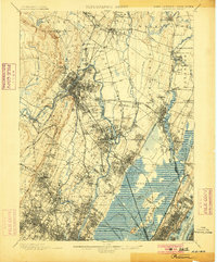 1900 Paterson1900 Print · USGSNortheastern New Jersey at the turn of the century shows a landscape defined by the Morris Canal and a dense network of early railroads. Researchers can trace ancestral roots through vanished rail stops and sites like Laurel Grove Cemetery, Wortendyke, and Sicomac.
 - 1900 Map of Oelrichs
 1900 Oelrichs1900 Print · USGSFall River County at the close of the nineteenth century reveals a landscape defined by the arrival of the railroad and the growth of early quarrying operations. Genealogists and historians can trace the Missouri Valley and Elkhorn RR through stops like Buffalo Gap and Oelrichs.4 unique versions available
 - 1900 Map of Dunkirk
 1900 Dunkirk1900 Print · USGSThe Lake Erie shoreline and Chautauqua hills are shown here in the late nineteenth century during a peak era of railroad expansion. Genealogists can trace early post offices like Van Buren (Cushing P.O.) and established towns such as Fredonia and Brocton.6 unique versions available
 - 1900 Map of Engineer Mountain
 1900 Engineer Mountain1900 Print · USGSHigh in the San Juan Mountains during the mining boom, this area served as a vital junction for four Colorado counties. Genealogists and historians can trace the Silverton Line railroad, find the Old Tollgate, and locate West Ranch.
 - 1900 Map of Utica
 1900 Utica1900 Print · USGSThe Mohawk Valley was at its industrial peak at the turn of the century, anchored by the rail and canal nexus of Utica. Genealogists can trace family names through rural crossroads like Martin Corners and Brayton Corners, or follow the industrial sprawl of the Erie Canal into Ilion.9 unique versions available
 - 1900 Map of Canadian
 1900 Canadian1900 Print · USGSIndian Territory at the turn of the century shows a landscape of tribal nations and developing rail towns along the CANADIAN RIVER. Genealogists and historians can trace early settlements like Fishertown and Indianola or the original Creek Nation Choctaw Nation Boundary Line.6 unique versions available
Showing maps 1-25
Top regions of the United States
- California historical maps
- Texas historical maps
- Florida historical maps
- New York historical maps
- Pennsylvania historical maps
- Illinois historical maps
See more
Top cities of the United States
- New York historical maps
- Los Angeles historical maps
- Chicago historical maps
- Houston historical maps
- Phoenix historical maps
- Philadelphia historical maps
See more
Frequently asked questions
- What are the different types of historical maps available for United States?
- What is the oldest map of United States?
- Where can I purchase historical maps of United States for my home or office?
- Where can I download high-res historical maps of United States?
- Are there historical topographic maps available for United States?
- Is there historical aerial imagery available for United States?
- Where are historical maps of United States sourced from?