1960s Maps of Iowa
Explore 334 historic maps of Iowa from the 1960s. These maps offer a rare glimpse into what life looked like during the 1960s — showing old roads, neighborhoods, homes, and landmarks that have changed or disappeared over time.
Whether you're researching your family's past, planning a metal detecting trip, or studying how Iowa's landscape evolved across the 1960s, these high-resolution maps are a powerful tool for exploring the history of this region.
- Focus on a specific era: All maps on this page are from the 1960s, giving you a focused view of this time period.
- See what’s changed: Compare century-old streets, trails, and buildings to today's modern landscape using overlays and satellite layers.
- Research with precision: Use these maps for genealogy, historical research, land use analysis, or educational projects.
- View, download, or print: Maps are fully viewable online in high resolution, and can be downloaded or printed for your own records.
Start exploring Iowa's history through authentic maps from the 1960s. This is your window into the past.
Iowa maps
(334)- 1960 Map of Bigelow, 1961 Print
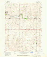
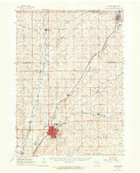
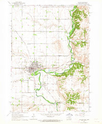
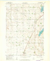 1960 Bigelow1961 Print · USGSNobles County's southern border at the turn of the 1960s reveals a landscape of prairie farms and vital rail links. Genealogists can locate Ransom Cem and the settlement of Org near the Chicago and North Western railroad.2 unique versions available
 - 1960 Map of Marshalltown, 1962 Print
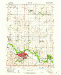
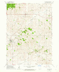
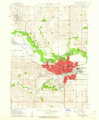 1960 Marshalltown1962 Print · USGSMarshalltown at the dawn of the sixties shows a thriving central Iowa hub defined by its river and rail connections. Genealogists and historians can trace neighborhood developments near Riverside Cemetery or locate family schools like Woodbury Sch and Glick Sch.2 unique versions available
 - 1960 Map of Worthington South, 1962 Print
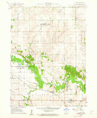
 1960 Worthington South1962 Print · USGSWorthington and the surrounding prairie townships are captured here at the start of the sixties, where rail lines and lakefront parks met rural farmsteads. Researchers can trace the legacy of local congregations and commerce at Indian Lake Ch, St Marys Cem, and the old Drive-in Theater.2 unique versions available
 - 1960 Map of Round Lake, 1962 Print
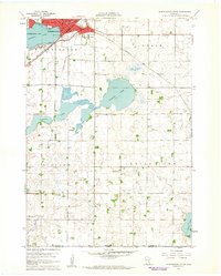
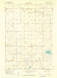
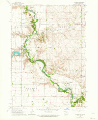
 1960 Round Lake1962 Print · USGSNear the Minnesota and Iowa border in the early sixties, this prairie landscape shows a mix of rail-side commerce and engineered wetlands. Trace the path of the Chicago Rock Island and Pacific through the village of Round Lake or locate rural landmarks like Grace Ch and Townhall.
 - 1960 Map of Marshalltown, 1962 Print
 1960 Marshalltown1962 Print · USGSIn the early 1960s, Marshalltown stood as a bustling rail and manufacturing center along the Iowa River. Genealogists can trace family names through several historic sites, including Riverside Cem, Rose Hill Memorial Gardens, and the rural Prairieville Cem.2 unique versions available
 - 1960 Map of Le Grand, 1962 Print
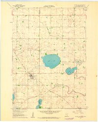
 1960 Le Grand1962 Print · USGSMarshall County farm country and the industrial river valley are captured here in the early sixties. Researchers can trace the dual rail lines of the Chicago Great Western and the Chicago and North Western or locate family plots at Rock Valley Cem and Pleasant Hill Cem.2 unique versions available
 - 1960 Map of Sioux Valley, 1962 Print
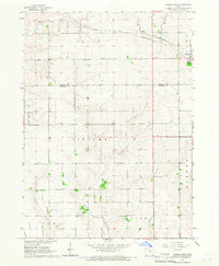
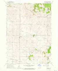
 1960 Sioux Valley1962 Print · USGSCrossing the Minnesota and Iowa border in the 1960s, this area showcases a landscape of prairie water management and family farming. Genealogists can trace local history through the Norwegian Cem, St Pauls Cem, and the Sioux Valley Sch.
 - 1960 Map of Conrad West, 1966 Print
 1960 Conrad West1966 Print · USGSThe Grundy and Marshall county line in the early sixties is defined by the intersection of rail and stream. Genealogists and researchers can trace local land patterns through Conrad, the Prairieville Cem, and the industrial Quarry site.2 unique versions available
 - 1960 Map of Conrad East, 1966 Print
 1960 Conrad East1966 Print · USGSMid-century Marshall County agriculture and commerce meet in this survey of the Grundy and Tama county borders. Genealogists and historians can trace the paths of the Chicago and North Western rail line through Beaman and locate family sites at Vienna Cem or Oakland Cem.
 - 1961 Map of Dubuque
 1961 Dubuque1961 Print · USGSThe Tri-State region's river-and-rail landscape is captured here during the early sixties, showing the convergence of Iowa, Illinois, and Wisconsin. Trace mid-century rail lines like the Chicago Great Western Ry and explore sites like the Savanna Ordnance Depot and Backbone State Park.
 - 1961 Map of Burlington
 1961 Burlington1961 Print · USGSThe tri-state borderlands along the Mississippi River are captured here during the late fifties and early sixties, showing the vital river-and-rail economy of Iowa, Illinois, and Missouri. Genealogists and historians can trace the development of major hubs like Galesburg and Macomb alongside landmark sites such as the Iowa Ordnance Plant and the historic river town of Nauvoo.
 - 1961 Map of Davenport
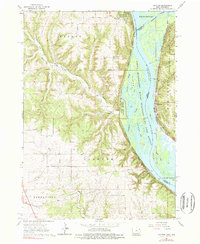
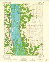
 1961 Davenport1961 Print · USGSThe Quad Cities and the eastern Iowa riverlands are captured here in the early sixties, showing the region's transition into a modern industrial and transit hub. Genealogists and historians can trace the paths of major railroads and find river landmarks like Rock Island Arsenal, Huron Island, and the Coralville Reservoir.
 - 1961 Map of La Crosse
 1961 La Crosse1961 Print · USGSThe Driftless Area at the start of the 1960s reveals a complex network of river towns and rail lines along the Mississippi River. Genealogists and historians can trace old settlements like New Amsterdam and Wyattville or locate major landmarks like Camp McCoy Military Reservation and Effigy Mounds National Monument.
 - 1962 Map of Dubuque
 1962 Dubuque1962 Print · USGSThe Tri-State region's river-and-rail economy is captured here in the early sixties, centered on the Mississippi River bluffs. Genealogists and historians can locate Numerous lead and zinc mines, the New Melleray Abbey Monastery, and rural hubs like Saint Olaf.2 unique versions available
 - 1962 Map of Davenport
 1962 Davenport1962 Print · USGSThe Quad Cities and the Mississippi River corridor are shown at their industrial peak just before the interstate era fully transformed the region. Researchers can trace the sprawling rail networks of the Chicago Rock Island and Pacific and find landmarks like the Rock Island Arsenal and Wild Cat Den State Park.
 - 1962 Map of Clayton
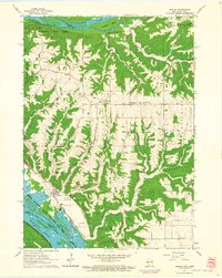
 1962 Clayton1962 Print · USGSThe Upper Mississippi riverfront in the early sixties is defined by a dense network of islands and competing rail lines. Genealogists can locate family sites at the Norwegian Ch Cem or Clayton Cem while tracing the old river village of Clayton.3 unique versions available
 - 1962 Map of New Vienna, 1963 Print
 1962 New Vienna1963 Print · USGSDubuque County’s agricultural and woodland landscape is captured here in the early sixties, showing a region defined by its German-Catholic heritage and winding river valleys. Genealogists and local historians can trace the early layouts of New Vienna, Luxemburg, and the wooded depths of White Pine Hollow State Park.
 - 1962 Map of Garnavillo, 1964 Print
 1962 Garnavillo1964 Print · USGSGarnavillo and its surrounding townships show a classic Iowa farm landscape in the early sixties, defined by steep hollows and high ridges. Genealogists can locate several family and parish burial sites, including St Joseph Cem, St Michael Cem, and the small settlement at Ceres.
 - 1962 Map of Le Mars, 1964 Print
 1962 Le Mars1964 Print · USGSNorthwestern Iowa's agricultural heartland is documented here in the early sixties, centered on the growing community of Le Mars. Researchers can trace old rail corridors like the ILLINOIS CENTRAL, locate family plots at Resthaven Cemetery, or find historical landmarks like Westmar College.
 - 1962 Map of Klondike, 1964 Print
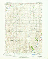
 1962 Klondike1964 Print · USGSThe Big Sioux River valley comes alive in the early sixties, showing the rural landscape where Iowa meets South Dakota. Trace family roots at Springdale Cem or locate old rail sidings in Granite and Klondike.
 - 1962 Map of Petersburg, 1964 Print
 1962 Petersburg1964 Print · USGSEastern Iowa's farming heartland is captured here in the early sixties, centered on the village of Petersburg and its rail connections. Genealogists can locate family sites such as St Patrick Cem or trace the Chicago Great Western rail line.
 - 1962 Map of Bagley, 1964 Print
 1962 Bagley1964 Print · USGSThe confluence of the Wisconsin and Mississippi Rivers comes to life in the early sixties, showing the vital rail-and-river hub of Grant County. Genealogists can trace the rural landscape near Bagley, Brodtville, and family sites like Lumpkin Cem.
 - 1962 Map of Canton, 1964 Print
 1962 Canton1964 Print · USGSThe South Dakota and Iowa border comes alive in the early sixties as the Big Sioux River winds past bustling prairie towns. Genealogists can locate several rural schools and cemeteries, including Augustana Academy, Beloit Cem, and York Sch.2 unique versions available
 - 1962 Map of Union Center, 1964 Print
 1962 Union Center1964 Print · USGSThe agricultural heartland of Plymouth and Woodbury Counties is documented here in the early sixties, showing a landscape defined by rail lines and section roads. Researchers can locate family landmarks like St Josephs Cem, the small settlement of Neptune, and the path of the Illinois Central Railroad through Merrill.
 - 1962 Map of Guttenberg, 1964 Print
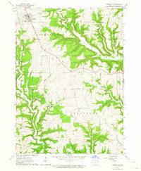
 1962 Guttenberg1964 Print · USGSThe Mississippi River corridor appears in transition during the early sixties, marking the state line between Iowa and Wisconsin. Trace old rail lines, family burial sites like Scott Cem, and river navigation landmarks including Lock and Dam No 10.2 unique versions available
Showing maps 1-25 of 334
Top cities of Iowa
- Des Moines historical maps
- Cedar Rapids historical maps
- Davenport historical maps
- Sioux City historical maps
- Iowa City historical maps
- West Des Moines historical maps
See more
Top counties of Iowa
- Polk County historical maps
- Linn County historical maps
- Scott County historical maps
- Johnson County historical maps
- Black Hawk County historical maps
- Woodbury County historical maps
See more
Frequently asked questions
- What are the different types of historical maps available for Iowa?
- What is the oldest map of Iowa?
- Where can I purchase historical maps of Iowa for my home or office?
- Where can I download high-res historical maps of Iowa?
- Are there historical topographic maps available for Iowa?
- Is there historical aerial imagery available for Iowa?
- Where are historical maps of Iowa sourced from?