1970s Maps of Iowa
Explore 458 historic maps of Iowa from the 1970s. These maps offer a rare glimpse into what life looked like during the 1970s — showing old roads, neighborhoods, homes, and landmarks that have changed or disappeared over time.
Whether you're researching your family's past, planning a metal detecting trip, or studying how Iowa's landscape evolved across the 1970s, these high-resolution maps are a powerful tool for exploring the history of this region.
- Focus on a specific era: All maps on this page are from the 1970s, giving you a focused view of this time period.
- See what’s changed: Compare century-old streets, trails, and buildings to today's modern landscape using overlays and satellite layers.
- Research with precision: Use these maps for genealogy, historical research, land use analysis, or educational projects.
- View, download, or print: Maps are fully viewable online in high resolution, and can be downloaded or printed for your own records.
Start exploring Iowa's history through authentic maps from the 1970s. This is your window into the past.
Iowa maps
- 1970 Map of Little Sioux, 1972 Print
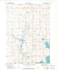
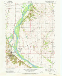
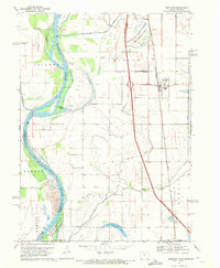
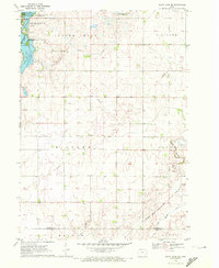
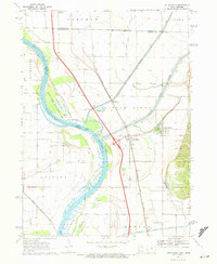 1970 Little Sioux1972 Print · USGSThe Missouri River floodplain comes into sharp focus during the 1970s, showing a landscape shaped by both nature and heavy engineering. Genealogists and local historians can trace early residents through Little Sioux Cem and Roughcorn Cem, or follow the path of the Chicago and North Western railroad.
 - 1970 Map of Milford, 1972 Print
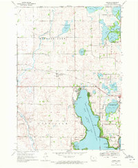
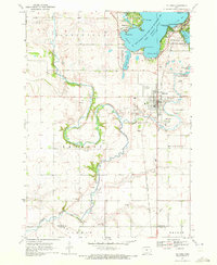 1970 Milford1972 Print · USGSThe Iowa Great Lakes region shows its mid-century recreational and agricultural character as the 1970s began. Genealogists and local historians can trace the Milwaukee Road rail line and locate community landmarks like Old Town and St Josephs Cem.2 unique versions available
 - 1970 Map of Tekamah NW, 1972 Print
 1970 Tekamah NW1972 Print · USGSThe Missouri River floodplain comes into sharp focus during the 1970s, showing a landscape of managed drainage and small rural hubs. Researchers can trace family ties at the Riverside Ch or locate landmarks like Lake Quinnebaugh and the Huff Access County Park.
 - 1970 Map of Blencoe, 1972 Print
 1970 Blencoe1972 Print · USGSMonona County agriculture was at its peak in the early seventies, defined by a massive network of irrigation and drainage canals. Trace the paths of the Chicago and North Western rail line and local landmarks like Graceland Cem and Creswell Landing Strip.
 - 1970 Map of Lakefield SW, 1972 Print
 1970 Lakefield SW1972 Print · USGSThe Minnesota-Iowa borderlands come to life in this early 1970s survey, showing a landscape of sprawling wildlife areas and prairie wetlands. Genealogists and local historians can locate Holy Trinity Cem and St Johns Ch or trace the winding Little Sioux River and Sangle Slough.
 - 1970 Map of Cotter, 1972 Print
 1970 Cotter1972 Print · USGSLouisa County, Iowa, is captured in the early seventies, showing a landscape defined by the convergence of the Iowa River and major rail lines. Genealogists can locate several family burial sites like Bethel Cem and Boston Cem or trace the early town layouts of Cotter and Columbus City.
 - 1970 Map of Ceylon, 1972 Print
 1970 Ceylon1972 Print · USGSSouthern Minnesota and the Iowa borderlands are captured here in the early 1970s, showing a prairie landscape shaped by drainage and rail. Researchers can trace family sites at Lone Cedar Cem or follow the path of the Chicago and North Western railroad through Ceylon.
 - 1970 Map of Jackson, 1972 Print
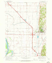
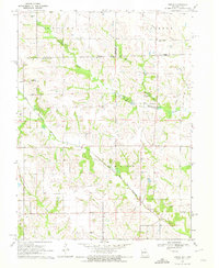
 1970 Jackson1972 Print · USGSJackson and the Des Moines River valley appear here in the early seventies as the region balanced its role as a county seat with a river-based economy. Researchers can locate several family burial sites including Riverside and Petersburg Cem, alongside local landmarks like the Powerplant and Getty Park.
 - 1970 Map of Logan, 1972 Print
 1970 Logan1972 Print · USGSHarrison County in the early seventies shows the vital connection between the Boyer River and the local rail network. Researchers can trace the layout of Logan and Magnolia, locating landmarks like Boyer Cem and the local Landing Strip.
 - 1970 Map of Columbus Junction, 1972 Print
 1970 Columbus Junction1972 Print · USGSLouisa and Muscatine Counties are captured here in the early 1970s at the strategic meeting of the rivers. Genealogists can trace rural roots through several local burial grounds like Newell Cem and Concord Cem or the community life at the Fairground.
 - 1970 Map of Hartley SW, 1972 Print
 1970 Hartley SW1972 Print · USGSNorthwestern Iowa farm country is documented here during the early seventies, showing the section-line roads and stream networks of O’Brien and Clay counties. Researchers can trace land ownership patterns across Grant and Omega or follow the winding courses of Waterman Creek and McCreath Creek.
 - 1970 Map of Cantril, 1972 Print
 1970 Cantril1972 Print · USGSVan Buren County's agricultural and forest lands are captured here in the early 1970s, focused on the Cantril and Lebanon areas. Genealogists can locate family landmarks like Maple Grove Cem and trace the path of the Old Railroad Grade.
 - 1970 Map of Everly, 1972 Print
 1970 Everly1972 Print · USGSEverly and the surrounding Clay County townships are captured in the early seventies during a period of steady agricultural and utility growth. Genealogists and local historians can locate Lone Tree Cem, the First Reformed Ch, and the winding tracks of the Chicago Milwaukee St Paul and Pacific.
 - 1970 Map of Okoboji, 1972 Print
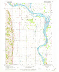
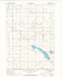
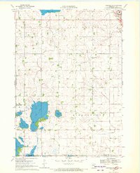
 1970 Okoboji1972 Print · USGSThe Iowa Great Lakes region is captured here in the early 1970s, showcasing the intricate balance of lakeside development and conservation. Genealogists and historians can locate specific settlements like Montgomery and Wahpeton, or trace the rail lines of the Chicago Rock Island and Pacific near Jemmerson Slough.2 unique versions available
 - 1970 Map of Missouri Valley, 1972 Print
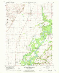
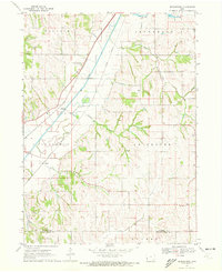
 1970 Missouri Valley1972 Print · USGSMissouri Valley and the surrounding Harrison County bottomlands are captured here during a period of significant infrastructure development in the 1970s. Researchers can trace the local landscape from the winding Willow Creek to the hilltop Mt Carmel Cem.
 - 1970 Map of Lakefield SE, 1972 Print
 1970 Lakefield SE1972 Print · USGSThe Minnesota-Iowa borderlands appear here in the early seventies, dominated by the drainage networks of the Des Moines River valley. Genealogists and local historians can trace the early layout of Jackson, locate the Vocational Sch, and find the rural Townhall in Middletown.
 - 1970 Map of Hartley, 1972 Print
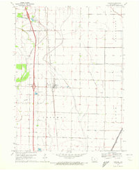
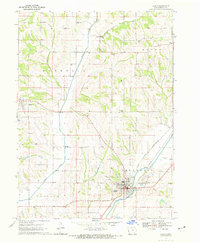
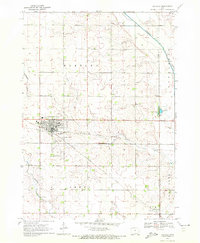 1970 Hartley1972 Print · USGSNorthwest Iowa's farm country is documented here during the early seventies, centered on the bustling rail junction at Hartley. Genealogists and local historians can trace the town's development through its High School, Pleasant View Cemetery, and the small southern settlement of Moneta.
 - 1970 Map of Mondamin, 1972 Print
 1970 Mondamin1972 Print · USGSThe Missouri River floodplain of western Iowa is captured here in the early seventies, showing a landscape of managed drainage and rail transit. Genealogists and researchers can trace the roads around Mondamin, find the Noyes Cem, and explore the marshes of Round Lake.
 - 1970 Map of Nichols, 1972 Print
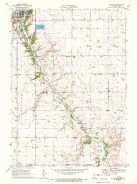
 1970 Nichols1972 Print · USGSThe river and rail networks of Muscatine and Louisa counties are meticulously detailed in the early 1970s. Trace family history through numerous burial sites like Lone Tree Cem and Brockway Cem, or follow the legacy of the Chicago Rock Island and Pacific railroad through Nichols.2 unique versions available
 - 1970 Map of Royal, 1972 Print
 1970 Royal1972 Print · USGSClay County's agricultural heartland is captured here in the early seventies, centered on the village of Royal. Local researchers can trace family landmarks and rural infrastructure across Lone Tree and Lincoln, including Maple Grove Ch and Tri Mello Cem.
 - 1970 Map of Modale, 1972 Print
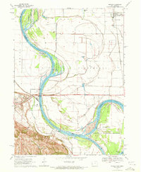 1970 Modale1972 Print · USGSThe Missouri River floodplain on the Iowa-Nebraska border comes alive in this early 1970s survey. Researchers can trace river changes at De Soto Lake and locate local landmarks like the Fort Calhoun Powerplant and Blair Cem.2 unique versions available
 - 1970 Map of Spirit Lake SE, 1972 Print
 1970 Spirit Lake SE1972 Print · USGSNorthwestern Iowa’s lake country is captured here during the 1970s, showing the intersection of recreation and rural industry. Genealogists and local historians can trace the lakeside developments of Arnolds Park or follow the Chicago and North Western rail line toward Little Muddy Creek.
 - 1970 Map of Beebeetown, 1972 Print
 1970 Beebeetown1972 Print · USGSHarrison County at the start of the 1970s shows a landscape of river-valley rail lines and upland farm settlements. Trace the paths of the Illinois Central railroad and locate rural landmarks like Beebeetown and Oak Grove Cem.
 - 1970 Map of Dunnell, 1972 Print
 1970 Dunnell1972 Print · USGSDunnell and the surrounding farmlands of Martin and Emmet counties are captured here in the early 1970s. Researchers can trace family ties through the Lake Fremont Cem, the Chicago and North Western rail corridor, and the grid of Judicial Ditch No 105.
 - 1970 Map of Brock, 1972 Print
 1970 Brock1972 Print · USGSThe Missouri-Iowa borderlands come into focus in the early 1970s, showing a rural landscape defined by the winding forks of the Wyaconda River. Genealogists can trace family heritage through numerous burial sites like Hubbard Cem, Trinity Cem, and the small settlement at Brock.
Showing maps 1-25
Top cities of Iowa
- Des Moines historical maps
- Cedar Rapids historical maps
- Davenport historical maps
- Sioux City historical maps
- Iowa City historical maps
- West Des Moines historical maps
See more
Top counties of Iowa
- Polk County historical maps
- Linn County historical maps
- Scott County historical maps
- Johnson County historical maps
- Black Hawk County historical maps
- Woodbury County historical maps
See more
Frequently asked questions
- What are the different types of historical maps available for Iowa?
- What is the oldest map of Iowa?
- Where can I purchase historical maps of Iowa for my home or office?
- Where can I download high-res historical maps of Iowa?
- Are there historical topographic maps available for Iowa?
- Is there historical aerial imagery available for Iowa?
- Where are historical maps of Iowa sourced from?