1980s Maps of Iowa
Explore 404 historic maps of Iowa from the 1980s. These maps offer a rare glimpse into what life looked like during the 1980s — showing old roads, neighborhoods, homes, and landmarks that have changed or disappeared over time.
Whether you're researching your family's past, planning a metal detecting trip, or studying how Iowa's landscape evolved across the 1980s, these high-resolution maps are a powerful tool for exploring the history of this region.
- Focus on a specific era: All maps on this page are from the 1980s, giving you a focused view of this time period.
- See what’s changed: Compare century-old streets, trails, and buildings to today's modern landscape using overlays and satellite layers.
- Research with precision: Use these maps for genealogy, historical research, land use analysis, or educational projects.
- View, download, or print: Maps are fully viewable online in high resolution, and can be downloaded or printed for your own records.
Start exploring Iowa's history through authentic maps from the 1980s. This is your window into the past.
Iowa maps
- 1980 Map of Omaha
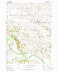
 1980 Omaha1980 Print · USGSThe Missouri-Iowa border comes into focus in the late 1970s, showing a rural landscape shaped by agriculture and coal. Researchers can trace family history through several burial sites like Mitchell Cem and Summers Cem or locate the Strip Mines near Omaha.
 - 1980 Map of Lytton
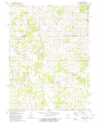
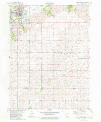
 1980 Lytton1980 Print · USGSThe border of Sac and Calhoun counties comes into focus in the 1970s, centered on the railroad town of Lytton. Genealogists and local historians can locate St John Cem, Garfield Cem, and the path of the Chicago Milwaukee St Paul and Pacific line.
 - 1980 Map of Union Mills
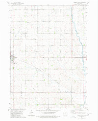
 1980 Union Mills1980 Print · USGSMahaska County, Iowa, is captured here in the late twentieth century as a landscape of steady agricultural tradition and quiet townships. Researchers can trace local lineage through several burial sites including Union Mills Cem, Mormon Point Cem, and Roberts Cem near the North Skunk River.
 - 1980 Map of Rockwell City
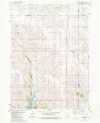
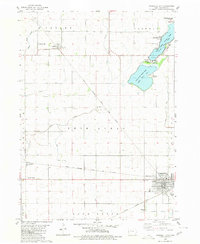 1980 Rockwell City1980 Print · USGSRockwell City and its surrounding lake country are captured here in the late 1970s, showcasing a landscape of prairie townships and rail-side grain stops. Researchers can trace family roots at Crown Hill Cem or locate community landmarks like the Drive-in Theater and Fairground.
 - 1980 Map of Leighton
 1980 Leighton1980 Print · USGSMahaska County as it appeared in the late 1970s shows a landscape of river bends and active industrial sites. Researchers can trace the rail line through Leighton or locate family plots at Butler Cem and Sand Ridge Cem.
 - 1980 Map of Corning South
 1980 Corning South1980 Print · USGSThe hill country south of Corning is captured here in the late seventies, showing a landscape defined by the Burlington Northern line and the East Nodaway River. Genealogists can locate Walnut Grove Cemetery and Oak Hill Cem, or trace the One Hundred and Two River through the southern townships.
 - 1980 Map of Odebolt East
 1980 Odebolt East1980 Print · USGSEastern Sac County was a thriving agricultural corridor in the late seventies and early eighties. Researchers can trace landownership patterns near the Boyer River and locate historic burial grounds like Salem Reform Cem and Odebolt Cem.
 - 1980 Map of Lone Rock
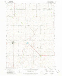
 1980 Lone Rock1980 Print · USGSKossuth County farming country is documented here in the late twentieth century, showing a landscape defined by prairie streams and drainage projects. Genealogy researchers can locate Lone Rock and rural landmarks like Immanuel Ch or the Township Cem.
 - 1980 Map of Newburg
 1980 Newburg1980 Print · USGSJasper and Marshall counties are captured in the 1980s as rural agricultural centers defined by the Chicago and North Western railroad. Researchers can trace local heritage through landmarks like Newburg, Hickory Grove Ch, and the recreation areas at Rock Creek State Park.
 - 1980 Map of Rolfe
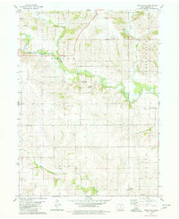
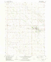 1980 Rolfe1980 Print · USGSIowa's prairie townships and the rail-oriented town of Rolfe are captured here in the 1980s. Genealogists can locate family sites at Powhatan Cem and Clinton-Garfield Cem, while tracing the CHICAGO AND NORTH WESTERN line.
 - 1980 Map of Sac City East
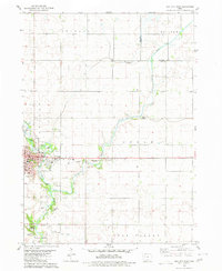 1980 Sac City East1980 Print · USGSSac City and the surrounding Iowa farmland are captured here in the early 1980s as the regional rail and river network remained vital. Genealogists and local historians can trace family locations near Oakland Cem, the Fairground, or along the Cedar Creek drainage.
 - 1980 Map of Montour
 1980 Montour1980 Print · USGSThe Mesquakie tribal lands and the Iowa River valley are documented here in the mid-seventies, showing the intersection of rail lines and rural townships. Genealogists can locate family landmarks like Maple Hill Cem and the Sac & Fox Day Sch near Montour.
 - 1980 Map of Glidden
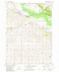
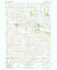
 1980 Glidden1980 Print · USGSAgricultural Carroll County comes to life in this late twentieth-century survey of the heartland's rail and river systems. Genealogists and local historians can trace the Chicago and North Western line through Glidden and locate family markers at Dickson Cem.
 - 1980 Map of Breda
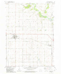
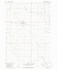
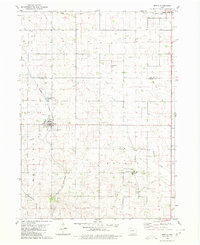 1980 Breda1980 Print · USGSIn the early 1980s, the rural border of Carroll and Sac Counties maintained a landscape of steady agricultural life and evolving rail lines. Genealogists and historians can trace family locations through St Bernards Cem, the community at Mount Carmel, and the Old Railroad Grade.
 - 1980 Map of Grant City
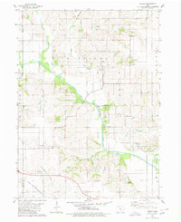
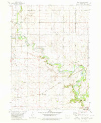 1980 Grant City1980 Print · USGSSoutheastern Sac County in the early eighties is defined by the winding North Raccoon River and its surrounding agricultural plateaus. Researchers can trace the rail history of Ulmer or locate family plots at Emanuel Cem and Oak Lawn Cem.
 - 1980 Map of Fenton
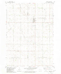 1980 Fenton1980 Print · USGSKossuth and Palo Alto counties are captured here in the late seventies, showing a landscape of productive Iowa prairie and evolving small towns. Trace rural community roots at St Johns Cem, St Lukes Ch, and the settlement of Fairville.
 - 1980 Map of Depew
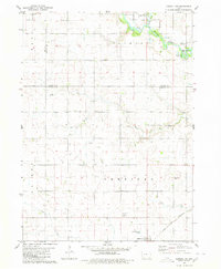
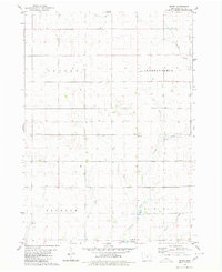 1980 Depew1980 Print · USGSPalo Alto County farmland during the late seventies shows a landscape of meticulously drained townships and quiet rural centers. Genealogists and local historians can locate several family burial grounds, including Township Cem and St Johns Cem, alongside the small settlement of Depew.
 - 1980 Map of Sully
 1980 Sully1980 Print · USGSCentral Iowa farmland meets the North Skunk River in the early eighties, centered on the growing communities of Sully and Lynnville. Researchers can locate numerous family burial grounds like Swans Cem and Dairy Grove Cem, along with local landmarks like the Municipal Landing Strip.
 - 1980 Map of Carroll NE
 1980 Carroll NE1980 Print · USGSMid-century Iowa farm country unfolds across Carroll, Calhoun, and Sac counties as the eighties began. Researchers can trace the Chicago and North Western line to Lidderdale, find family plots at Cottonwood Cem, or locate the Flowing Well near the river.
 - 1980 Map of Peoria
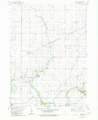
 1980 Peoria1980 Print · USGSMahaska County and Marion County farmlands are captured in the late seventies, showing the transition of rural Iowa townships. Genealogists and historians can trace family roots through landmarks like Appel Cem, the Christian Sch, and the South Skunk River.
 - 1980 Map of Eitzen
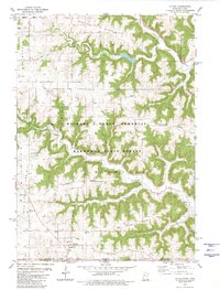 1980 Eitzen1980 Print · USGSThe Minnesota-Iowa border region near Eitzen comes alive in this 1980s record of the Driftless Area's ridges and valleys. Researchers can trace family sites like St Lukes Ch and Carsten Cem or explore the wooded draws of Winnebago Creek.
 - 1980 Map of Havelock
 1980 Havelock1980 Print · USGSPocahontas County at the start of the 1980s reveals a precision-mapped landscape of rail junctions and prairie drainage. Genealogists and rail historians can trace the paths of the Chicago and North Western and the town's local Cemetery and Park.
 - 1980 Map of Yetter
 1980 Yetter1980 Print · USGSWestern Calhoun County is shown here in the late seventies, a time when rail and river still dictated the local geography. Researchers can trace the path of the Illinois Central Gulf through Yetter or locate the historic Cottonwood Cem.
 - 1980 Map of Pella
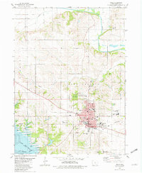 1980 Pella1980 Print · USGSPella and the surrounding Marion County farmlands are captured in the early eighties, showcasing a landscape shaped by Dutch heritage and river geography. Genealogists and historians can trace institutional roots at the Central Univ of Iowa, locate family plots at Oak Wood Cem, or follow the Chicago Rock Island and Pacific rail line.
 - 1980 Map of Early
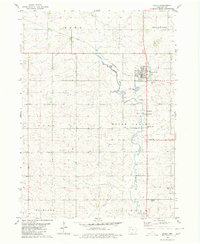 1980 Early1980 Print · USGSSac County farming life and rail transit converge in the late 1970s around the settlement of Early. Researchers can locate family sites near Early Union Cem, trace the path of the Chicago and North Western railroad, or find local landmarks like Reiff Park.
Showing maps 1-25
Top cities of Iowa
- Des Moines historical maps
- Cedar Rapids historical maps
- Davenport historical maps
- Sioux City historical maps
- Iowa City historical maps
- West Des Moines historical maps
See more
Top counties of Iowa
- Polk County historical maps
- Linn County historical maps
- Scott County historical maps
- Johnson County historical maps
- Black Hawk County historical maps
- Woodbury County historical maps
See more
Frequently asked questions
- What are the different types of historical maps available for Iowa?
- What is the oldest map of Iowa?
- Where can I purchase historical maps of Iowa for my home or office?
- Where can I download high-res historical maps of Iowa?
- Are there historical topographic maps available for Iowa?
- Is there historical aerial imagery available for Iowa?
- Where are historical maps of Iowa sourced from?