
Historical Maps of Guadalupe County, New Mexico
What stories do these 106 old maps tell about Guadalupe County's past? From 1890 to present day, these maps reveal the evolution of streets, neighborhoods, iconic landmarks, and natural features in stunning high-res detail. Whether you're a history enthusiast, genealogist, or professional in education, environmental work, or architecture, these maps are perfect for exploration, research, and discovery.
Discover Guadalupe County's history through maps:
- Trace Guadalupe County's growth: Explore earlier and latest maps and editions to uncover how the region changed over time.
- Examine technical details: Each map includes its creators, publishers, scale, dimensions, and full source information.
- Layer maps with modern tools & imagery: Compare historical maps to modern-day with high-resolution satellite imagery and detailed LiDAR layers.
- Sourced from trusted archives: Carefully preserved and digitized by institutions like the United Stated Geological Survey and the US Library of Congress.
- Access in any format: View and explore in high resolution, download for offline use, or order a museum-quality print for yourself or a loved one.
Begin your journey into Guadalupe County's history with these remarkable must-see maps.
Guadalupe County, NM maps
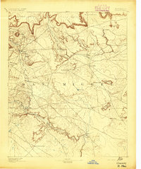
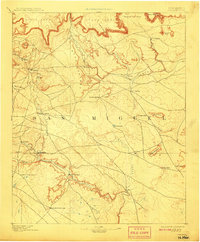
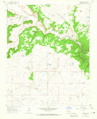
(106)- 1890 Map of Bernal, 1956 Print
 1890 Bernal1956 Print · USGSCovers Guadalupe County, including Upper Dilia, Serafina, and other nearby areas
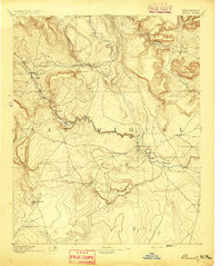
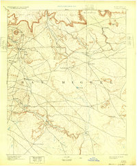
 - 1891 Map of Bernal
 1891 Bernal1891 Print · USGSCovers Guadalupe County, including Upper Dilia, Serafina, and other nearby areas
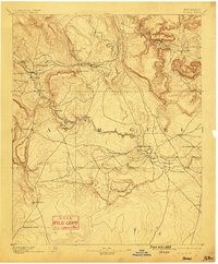
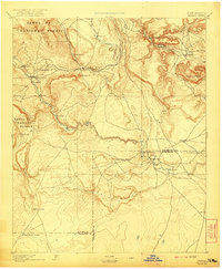
 - 1892 Map of Corazon
 1892 Corazon1892 Print · USGSCovers Guadalupe County, including Trementina, Salitre, and other nearby areas
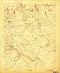
 - 1892 Map of Corazon, 1948 Print
 1892 Corazon1948 Print · USGSCovers Guadalupe County, including Trementina, Salitre, and other nearby areas
 - 1894 Map of Corazon
 1894 Corazon1894 Print · USGSCovers Guadalupe County, including Trementina, Salitre, and other nearby areas
 - 1894 Map of Bernal
 1894 Bernal1894 Print · USGSCovers Guadalupe County, including Upper Dilia, Serafina, and other nearby areas
 - 1894 Map of Bernal, 1899 Print
 1894 Bernal1899 Print · USGSCovers Guadalupe County, including Upper Dilia, Serafina, and other nearby areas
 - 1894 Map of Corazon, 1900 Print
 1894 Corazon1900 Print · USGSCovers Guadalupe County, including Trementina, Salitre, and other nearby areas
 - 1894 Map of Corazon, 1908 Print
 1894 Corazon1908 Print · USGSCovers Guadalupe County, including Trementina, Salitre, and other nearby areas
 - 1894 Map of Bernal, 1921 Print
 1894 Bernal1921 Print · USGSCovers Guadalupe County, including Upper Dilia, Serafina, and other nearby areas
 - 1894 Map of Corazon, 1932 Print
 1894 Corazon1932 Print · USGSCovers Guadalupe County, including Trementina, Salitre, and other nearby areas
 - 1894 Map of Bernal, 1946 Print
 1894 Bernal1946 Print · USGSCovers Guadalupe County, including Upper Dilia, Serafina, and other nearby areas
 - 1894 Map of Corazon, 1948 Print
 1894 Corazon1948 Print · USGSCovers Guadalupe County, including Trementina, Salitre, and other nearby areas
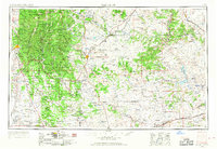
 - 1954 Map of Santa Fe, 1963 Print
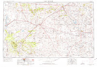
 1954 Santa Fe1963 Print · USGSCovers Guadalupe County, including Santa Fe, Las Vegas, and other nearby areas
 - 1954 Map of Fort Sumner, 1964 Print
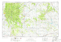
 1954 Fort Sumner1964 Print · USGSCovers Guadalupe County, including Santa Rosa, Estancia, and other nearby areas
 - 1954 Map of Santa Fe, 1968 Print
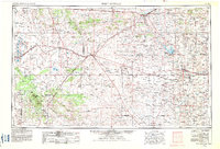
 1954 Santa Fe1968 Print · USGSCovers Guadalupe County, including Santa Fe, Las Vegas, and other nearby areas
 - 1954 Map of Fort Sumner, 1974 Print
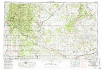
 1954 Fort Sumner1974 Print · USGSCovers Guadalupe County, including Santa Rosa, Estancia, and other nearby areas
 - 1954 Map of Santa Fe, 1976 Print
 1954 Santa Fe1976 Print · USGSCovers Guadalupe County, including Santa Fe, Las Vegas, and other nearby areas
 - 1954 Map of Fort Sumner, 1983 Print
 1954 Fort Sumner1983 Print · USGSCovers Guadalupe County, including Santa Rosa, Estancia, and other nearby areas
 - 1954 Map of Santa Fe, 1984 Print
 1954 Santa Fe1984 Print · USGSCovers Guadalupe County, including Santa Fe, Las Vegas, and other nearby areas
 - 1958 Map of Fort Sumner
 1958 Fort Sumner1958 Print · USGSCovers Guadalupe County, including Santa Rosa, Estancia, and other nearby areas
 - 1958 Map of Santa Fe
 1958 Santa Fe1958 Print · USGSCovers Guadalupe County, including Santa Fe, Las Vegas, and other nearby areas
 - 1963 Map of Colonias, 1965 Print
 1963 Colonias1965 Print · USGSCovers Guadalupe County, including Margarito Ulibarri Ranch, Colonias, and other nearby areas
 - 1963 Map of Santa Rosa, 1965 Print
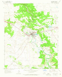 1963 Santa Rosa1965 Print · USGSCovers Guadalupe County, including Santa Rosa, United States, and other nearby areas
 - 1963 Map of Pedro Miguel Peak, 1965 Print
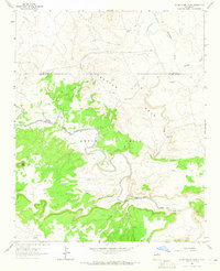 1963 Pedro Miguel Peak1965 Print · USGSCovers Guadalupe County, including San Miguel County, United States, and other nearby areas
Showing maps 1-25 of 106
Top cities in Guadalupe County
Frequently asked questions
- What are the different types of historical maps available for Guadalupe County?
- What is the oldest map of Guadalupe County?
- Where can I purchase historical maps of Guadalupe County for my home or office?
- Where can I download high-res historical maps of Guadalupe County?
- Are there historical topographic maps available for Guadalupe County?
- Is there historical aerial imagery available for Guadalupe County?
- Where are historical maps of Guadalupe County sourced from?