Loading...
Loading map...1961 Map of Chillicothe
USGS Topo · Published 1985About this map
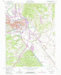
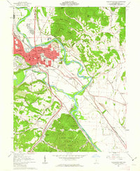
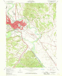
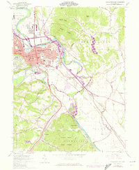
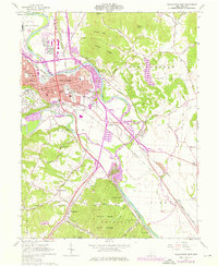
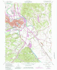
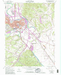
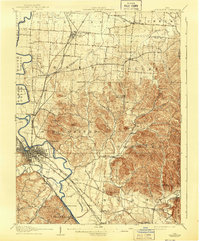
Chillicothe serves as the focal point of this 1961 survey, situated at the confluence where Paint Creek meets the Scioto River. The city’s urban grid is dense with institutional history, from the Chillicothe Correctional Institute and Sky Park Airport in the north to the Courthouse and numerous neighborhood schools like Flaget Sch and Tiffin Sch. The 1985 photorevisions highlight the evolving infrastructure, including the Sewage Disposal plant and expanded residential areas near Grandview Cem.
Find a feature on this map
82 named features on this map. Tap any name to fly to it.
Don’t see what you’re looking for? This feature index may not catch every label — zoom into the map to look around manually.
Map Details
Date Portrayed1961
Date Published1985
PublisherU.S. Geological Survey
Map TypeTopographic
Scale1:24,000
Physical Dimensions22.1 x 27 inches
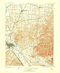
Editions of this 1961 Chillicothe Map
7 editions found
Historical Maps of Chillicothe Through Time
Featured Locations
Source Details
SourceU.S. Geological Survey
CopyrightPublic Domain