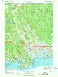
1968 Map of Guilford
USGS Topo · Published 1970This historical map portrays the area of Guilford in 1968, primarily covering New Haven County. Featuring a scale of 1:24000, this map provides a highly detailed snapshot of the terrain, roads, buildings, counties, and historical landmarks in the Guilford region at the time. Published in 1970, it is one of 5 known editions of this map due to revisions or reprints.
Find a feature on this map
168 named features on this map. Tap any name to fly to it.
Don’t see what you’re looking for? This feature index may not catch every label — zoom into the map to look around manually.
Map Details
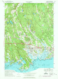
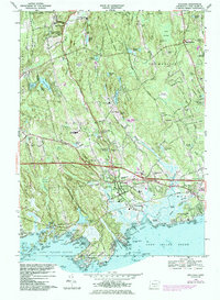
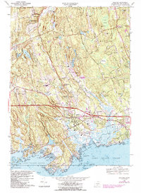
Editions of this 1968 Guilford Map
5 editions found
Historical Maps of South Central Connecticut Planning Region Through Time
24 maps found

1946 Southington
New Haven County, CT

1951 Milford
New Haven County, CT

1953 Southbury
New Haven County, CT

1954 Guilford
New Haven County, CT

1954 Mount Carmel
New Haven County, CT

1954 Wallingford
New Haven County, CT

1955 Southington
New Haven County, CT

1960 Milford
New Haven County, CT

1964 Southbury
New Haven County, CT

1967 Mount Carmel
New Haven County, CT

1967 Wallingford
New Haven County, CT

1968 Guilford
New Haven County, CT

1968 Southington
New Haven County, CT

1984 Milford
New Haven County, CT

2024 Branford
New Haven County, CT

2024 Branford OE S
New Haven County, CT

2024 Clinton OE S
New Haven County, CT

2024 Guilford
New Haven County, CT

2024 Guilford OE S
New Haven County, CT

2024 Milford
New Haven County, CT

2024 Mount Carmel
New Haven County, CT

2024 Southbury
New Haven County, CT

2024 Southington
New Haven County, CT

2024 Wallingford
New Haven County, CT