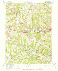
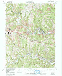
1960 Map of Lansing
USGS Topo · Published 1973About this map
The industrial and agricultural rhythms of Belmont County are preserved in this 1960 survey, dominated by the winding course of Wheeling Creek and the steel rails of the Baltimore and Ohio. This landscape is defined by the extensive footprint of the coal industry, with numerous Strip Mines and Strip Mine operations terracing the hillsides above settlements like Barton, Blaine, and Neffs. The map serves as a detailed record of mid-century infrastructure, featuring the transition between traditional routes like the National Road and the early interstate system.
Find a feature on this map
67 named features on this map. Tap any name to fly to it.
Don’t see what you’re looking for? This feature index may not catch every label — zoom into the map to look around manually.
Map Details
Editions of this 1960 Lansing Map
5 editions found
Other maps of this area

1902 · Wheeling
USGS Topo · 1:62,500

1904 · Cameron
USGS Topo · 1:62,500

1905 · Clarington
USGS Topo · 1:62,500

1905 · St. Clairsville
USGS Topo · 1:62,500

1935 · Cameron
USGS Topo · 1:62,500

1935 · Clarington
USGS Topo · 1:62,500

1935 · Wheeling
USGS Topo · 1:62,500

1940 · Clarington
USGS Topo · 1:62,500

1942 · Cameron
USGS Topo · 1:62,500

1942 · Wheeling
USGS Topo · 1:62,500