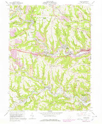
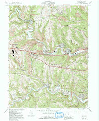
1960 Map of Lansing
USGS Topo · Published 1978About this map
Wheeling Creek carves a deep valley through this industrial landscape, where the Baltimore and Ohio railroad corridor links coal-patch settlements like Barton, Blaine, and Lansing. Extensive Strip Mines and visible Tailings across the ridges of Cole Rain and Richland townships speak to the region's intensive mineral extraction history in the late 1950s and 1960s.
Find a feature on this map
84 named features on this map. Tap any name to fly to it.
Don’t see what you’re looking for? This feature index may not catch every label — zoom into the map to look around manually.
Map Details
Editions of this 1960 Lansing Map
5 editions found
Other maps of this area

1902 · Wheeling
USGS Topo · 1:62,500

1904 · Cameron
USGS Topo · 1:62,500

1905 · Clarington
USGS Topo · 1:62,500

1905 · St. Clairsville
USGS Topo · 1:62,500

1935 · Cameron
USGS Topo · 1:62,500

1935 · Clarington
USGS Topo · 1:62,500

1935 · Wheeling
USGS Topo · 1:62,500

1940 · Clarington
USGS Topo · 1:62,500

1942 · Cameron
USGS Topo · 1:62,500

1942 · Wheeling
USGS Topo · 1:62,500