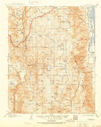
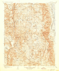
1907 Map of Olancha
USGS Topo · Published 1951About this map
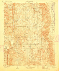
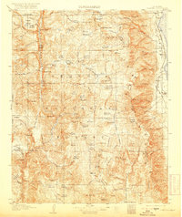
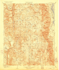
Sequoia National Park and the Inyo National Forest meet in this 1905 survey, documenting the High Sierra landscape before extensive modern infrastructure. The eastern edge is defined by the Southern Pacific System railroad skirting the shores of Owens Lake, connecting the settlements of Olancha and Cartago. High in the western backcountry, the Kern River flows through the deep Kern Canyon, where the Kern Canyon Ranger Station and geothermal features like Kern Hot Spring and Jordan Hot Sprs served early forest travelers. The map captures a transition from the arid Owens Valley floor to the alpine terrain of Whitney Meadow and the unique geological formation at Natural Bridge. The presence of a Big Trees grove near Lloyd Meadows indicates the botanical diversity that led to the area's early federal protection.
Find a feature on this map
160 named features on this map. Tap any name to fly to it.
Don’t see what you’re looking for? This feature index may not catch every label — zoom into the map to look around manually.
Map Details
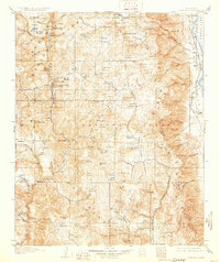
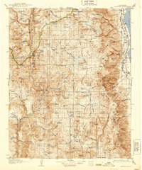
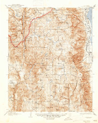
Editions of this 1907 Olancha Map
9 editions found
Other maps of this area

1903 · Tehipite
USGS Topo · 1:125,000

1904 · Kaweah
USGS Topo · 1:125,000

1905 · Tehipite
USGS Topo · 1:125,000

1905 · Olancha
USGS Topo · 1:125,000

1905 · Fairview
USGS Topo · 1:24,000

1906 · Kernville
USGS Topo · 1:125,000

1907 · Olancha
USGS Topo · 1:125,000

1907 · Mt. Whitney
USGS Topo · 1:125,000

1908 · Kernville
USGS Topo · 1:125,000

1908 · Ballarat
USGS Topo · 1:250,000