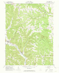
1961 Map of Rarden
USGS Topo · Published 1973About this map
The Norfolk And Western railroad winds through the narrow valley of Scioto Brush Creek in the early 1960s, serving as the industrial backbone for this corner of the Virginia Military District. In the village of Rarden, the rail line and state routes converge, providing a vital connection for the surrounding timber and farming communities. The landscape is defined by the steep ridges of the Brush Creek State Forest, where elevations rise sharply toward landmarks like the Lookout Tower and Camp Creek Ridge. Genealogists will find a significant concentration of small family and community burial grounds tucked into the hollows, including Old Hackworth Cem and Harmon-Salt Creek Cem. The settlement pattern follows the drainage of numerous runs, with small centers like Mt Joy and Duke established at key junctions.
Find a feature on this map
62 named features on this map. Tap any name to fly to it.
Don’t see what you’re looking for? This feature index may not catch every label — zoom into the map to look around manually.
Map Details
Editions of this 1961 Rarden Map
4 editions found
Other maps of this area

1915 · Bainbridge
USGS Topo · 1:48,000

1915 · Otway
USGS Topo · 1:62,500

1915 · Piketon
USGS Topo · 1:62,500

1916 · Peebles
USGS Topo · 1:62,500

1917 · Bainbridge
USGS Topo · 1:62,500

1917 · Piketon
USGS Topo · 1:62,500

1917 · Otway
USGS Topo · 1:62,500

1918 · Peebles
USGS Topo · 1:62,500

1944 · Piketon
USGS Topo · 1:62,500

1947 · Columbus
USGS Topo · 1:250,000