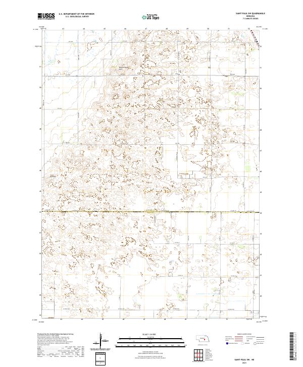
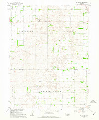
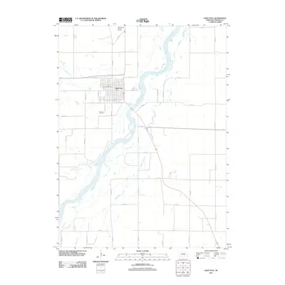
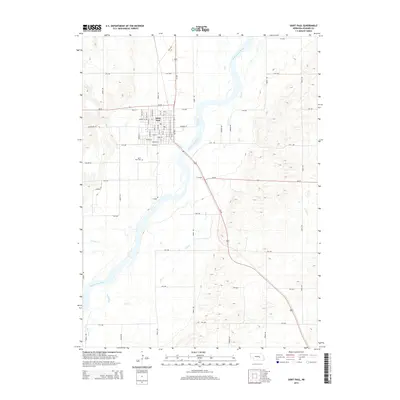
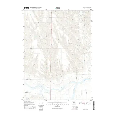
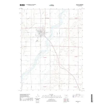
2021 Map of Saint Paul SW
USGS Topo · Published 2021About this map
The border of Howard Co Hall Co divides this landscape of central Nebraska, where the terrain is punctuated by distinctive rises such as Mumpumpey Hill and Pool Hill. The area follows a rigid section-line road grid typical of the Great Plains, defined by numbered thoroughfares like 6th Ave and 5th Ave, alongside rural connectors such as Jansen Rd and Friend Rd. This 2021 survey illustrates how modern drainage and land management interact with natural features like Lake Cr. The prominent Loup River Rd follows the county line, serving as a primary east-west artery through a region characterized by specialized irrigation patterns and localized depressions within the undulating plains.
Find a feature on this map
31 named features on this map. Tap any name to fly to it.
Don’t see what you’re looking for? This feature index may not catch every label — zoom into the map to look around manually.
Map Details
Editions of this 2021 Saint Paul SW Map
This is the sole edition of this map. No revisions or reprints were ever made.
Historical Maps of Hall County Through Time
28 maps found
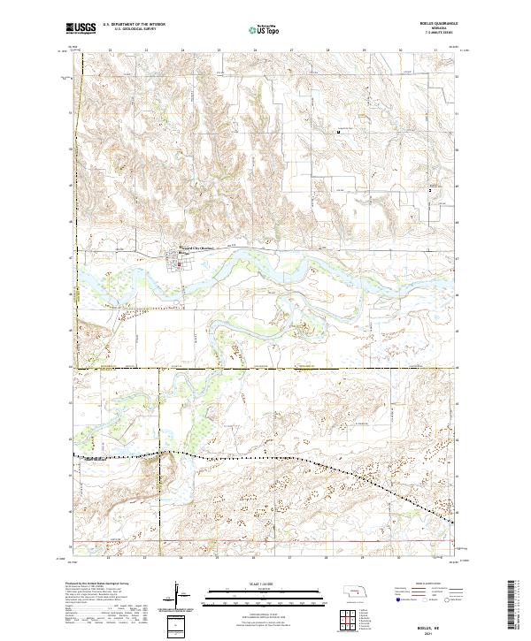
1953 Boelus
Howard County, NE
1953 Nysted
Howard County, NE
1955 Wolbach SW
Howard County, NE
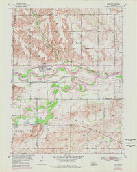
1961 St. Paul SW
Howard County, NE
2011 Boelus
Howard County, NE
2011 Nysted
Howard County, NE
2011 Saint Libory
Howard County, NE
2011 Saint Paul
Howard County, NE
2011 Saint Paul SW
Howard County, NE
2011 Wolbach SW
Howard County, NE
2014 Boelus
Howard County, NE
2014 Nysted
Howard County, NE
2014 Saint Libory
Howard County, NE
2014 Saint Paul
Howard County, NE
2014 Saint Paul SW
Howard County, NE
2014 Wolbach SW
Howard County, NE
2017 Boelus
Howard County, NE
2017 Nysted
Howard County, NE
2017 Saint Libory
Howard County, NE
2017 Saint Paul
Howard County, NE
2017 Saint Paul SW
Howard County, NE
2017 Wolbach SW
Howard County, NE
2021 Boelus
Howard County, NE
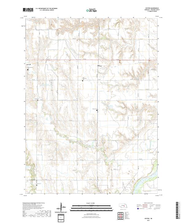
2021 Nysted
Howard County, NE
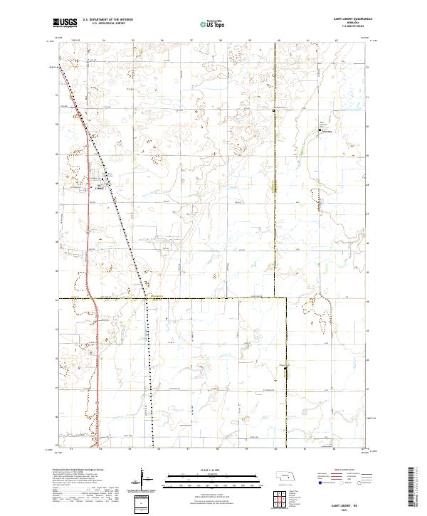
2021 Saint Libory
Howard County, NE
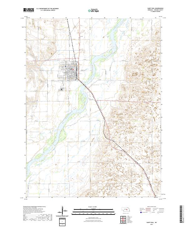
2021 Saint Paul
Howard County, NE
2021 Saint Paul SW
Howard County, NE
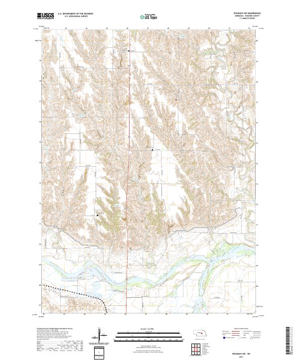
2021 Wolbach SW
Howard County, NE