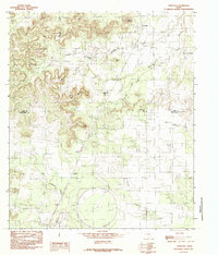
1984 Map of Tennyson
USGS Topo · Published 1984About this map
The small settlement of Tennyson anchor this mid-1980s landscape, situated where the high plateaus of the Edwards Plateau begin to drop into the drainage basins of West Texas. The terrain is defined by a series of prominent rises including Mount Margaret, Gobbler Hill, and Kiser Mountain, which overlook a network of seasonal watercourses such as Mule Creek and Crows Nest Creek. The map reveals a transition between rural ranching land and industrial activity, marked most notably by a large, circular Test Facility in the southern portion of the quadrangle.
Find a feature on this map
18 named features on this map. Tap any name to fly to it.
Don’t see what you’re looking for? This feature index may not catch every label — zoom into the map to look around manually.
Map Details
Editions of this 1984 Tennyson Map
This is the sole edition of this map. No revisions or reprints were ever made.
Other maps of this area

1891 · Hayrick
USGS Topo · 1:125,000

1894 · Hayrick
USGS Topo · 1:125,000

1921 · Baker Flat
USGS Topo · 1:31,680

1921 · Maverick
USGS Topo · 1:31,680

1921 · Mays School
USGS Topo · 1:31,680

1954 · San Angelo
USGS Topo · 1:250,000

1957 · Miles
USGS Topo · 1:62,500

1957 · Harriet
USGS Topo · 1:62,500
1957 · San Angelo North
USGS Topo · 1:24,000

1958 · San Angelo
USGS Topo · 1:250,000