1910s Maps of Montana
Explore 47 historic maps of Montana from the 1910s. These maps offer a rare glimpse into what life looked like during the 1910s — showing old roads, neighborhoods, homes, and landmarks that have changed or disappeared over time.
Whether you're researching your family's past, planning a metal detecting trip, or studying how Montana's landscape evolved across the 1910s, these high-resolution maps are a powerful tool for exploring the history of this region.
- Focus on a specific era: All maps on this page are from the 1910s, giving you a focused view of this time period.
- See what’s changed: Compare century-old streets, trails, and buildings to today's modern landscape using overlays and satellite layers.
- Research with precision: Use these maps for genealogy, historical research, land use analysis, or educational projects.
- View, download, or print: Maps are fully viewable online in high resolution, and can be downloaded or printed for your own records.
Start exploring Montana's history through authentic maps from the 1910s. This is your window into the past.
Montana maps
(47)- 1910 Map of Todd Lakes, 1975 Print
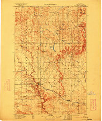
 1910 Todd Lakes1975 Print · USGSNortheastern Montana before the Great War is captured here as a sprawling expanse of the Fort Peck Indian Reservation. Trace the intricate drainage of Wolf Creek and locate the natural basins of Todd Lakes in this early ranching-era landscape.2 unique versions available
 - 1910 Map of Cuskers, 1975 Print
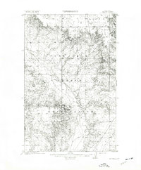
 1910 Cuskers1975 Print · USGSNortheastern Montana lands are documented here during the early years of the twentieth century, showing the topography of the Fort Peck Indian Reservation. Genealogists and historians can trace the Poplar River and identify the specific site of the Cuskers House.2 unique versions available
 - 1911 Map of Sheridan
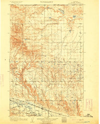
 1911 Sheridan1911 Print · USGSSheridan and the surrounding northern Wyoming ranchlands are captured here during a period of rapid railroad expansion. Researchers can trace the Chicago Burlington and Quincy RR through Dietz and Verona, or locate early homesteads like Wagoner Ranch.2 unique versions available
 - 1911 Map of Gallatin
 1911 Gallatin1911 Print · USGSYellowstone's thermal wonders and early military outposts are recorded in detail just after the turn of the century. Researchers can trace the early road and trail systems connecting landmark sites like Fort Yellowstone, the Norris Geyser Basin, and the Fountain Hotel.2 unique versions available
 - 1911 Map of Canyon
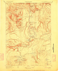
 1911 Canyon1911 Print · USGSYellowstone National Park is captured here in the early twentieth century as a fledgling wilderness preserve. Researchers can trace the early road system including the Cooke Road and find historic sites like Yanceys, the Canyon Hotel, and Fishing Bridge.6 unique versions available
 - 1911 Map of Blackfoot
 1911 Blackfoot1911 Print · USGSNorthwestern Montana at the start of the twentieth century was a territory of vast open spaces and burgeoning rail towns. Researchers can trace the early Great Northern railroad corridor through Blackfoot, find the Cutfinger School, and locate Cooks Ranch.2 unique versions available
 - 1911 Map of Cataldo
 1911 Cataldo1911 Print · USGSThe Idaho Panhandle's mining and timber country is documented here in the early twentieth century, showing the rail-linked settlements of the Coeur d'Alene River valley. Genealogists can trace family sites at Old Mission, Kellogg, and Magee Ranch.2 unique versions available
 - 1911 Map of Priest Lake, 1954 Print
 1911 Priest Lake1954 Print · USGSThe Idaho Panhandle during the early 1900s was a landscape of deep lakes and high-altitude mining operations connected by new rail lines. Genealogists and historians can trace pioneer settlements like Port Hill and Coolin, or locate remote industrial sites such as the Queen Mine and Mountain Chief Mine.
 - 1911 Map of Lolo, 1954 Print
 1911 Lolo1954 Print · USGSThe Bitterroot wilderness at the dawn of the Forest Service era is documented here through its early camps and trail networks. Researchers can locate remote outposts like Moose City, the Clearwater Gold and Copper Company, and the historic Indian Post Office landmark.
 - 1912 Map of Cut Bank
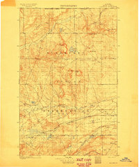
 1912 Cut Bank1912 Print · USGSNorthern Montana’s high plains and the Blackfeet Indian Reservation are captured here during the height of the homesteading era. Genealogists and historians can trace the early path of the Great Northern R R through Cut Bank and Simla.3 unique versions available
 - 1912 Map of Chelsea
 1912 Chelsea1912 Print · USGSNortheastern Montana at the start of the twentieth century shows the intersection of the Fort Peck Indian Reservation and the Great Plains rail economy. Trace early settlements like Chelsea and Nickwall along the Missouri River and the Great Northern tracks.2 unique versions available
 - 1912 Map of Hay Creek
 1912 Hay Creek1912 Print · USGSNortheastern Montana rangeland is captured here just before the Great War, during a period of early ranching and reservation administration. Genealogists and historians can locate Kerns Ranch and trace the original course of the Poplar River and Hay creek.2 unique versions available
 - 1912 Map of Poplar
 1912 Poplar1912 Print · USGSThe High Plains of northeastern Montana are captured here just before the first World War, centered on the confluence of two major waterways. Genealogists and historians can trace early railroad siding stops like Sprole and Arthur along the Great Northern line and through the Fort Peck Indian Reservation.
 - 1912 Map of Zurich
 1912 Zurich1912 Print · USGSNorthern Montana ranchlands and rail towns are captured here in the early twentieth century before the full development of modern irrigation. Genealogists and historians can locate early family-named sites like Corregan Ranch and Kerrs Coalmine along the Great Northern railroad line.
 - 1912 Map of Missoula
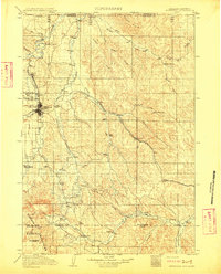
 1912 Missoula1912 Print · USGSWestern Montana at the end of the frontier era shows a landscape of growing rail hubs and remote mountain outposts. Researchers can trace early river crossings like Alberts Ferry, the grounds of Ft Missoula, and vanished schools such as Big Flat School.4 unique versions available
 - 1912 Map of Thibedeau Lake
 1912 Thibedeau Lake1912 Print · USGSNorthern Montana's ranching frontier and rail corridors are captured here just after the turn of the century. Genealogists and historians can trace the early foundations of Havre and Fort Assinniboine, alongside family landmarks like Lohman's Ranch and Connolly Ranch.
 - 1912 Map of Smoke Creek
 1912 Smoke Creek1912 Print · USGSThe eastern reaches of the Fort Peck Indian Reservation are captured here in the years following the turn of the century. Genealogists and researchers can trace the early livestock era at Wests Ranch or the natural hydrology of Smoke Creek and Manning Lake.
 - 1913 Map of Lolo
 1913 Lolo1913 Print · USGSThe Bitterroot wilderness of the early 1900s is documented here through a web of mining camps, ranger stations, and high mountain passes. Genealogists and researchers can locate remote sites like Moose City, Williams Ranch, and the Clearwater Gold and Copper Company.2 unique versions available
 - 1913 Map of Priest Lake
 1913 Priest Lake1913 Print · USGSThe Idaho Panhandle was a rugged network of rail sidings and mining camps in the years before the Great War. Genealogists and historians can trace old homesteads and depots from Sandpoint up to the Continental Mine and the remote border crossing at Addie.3 unique versions available
 - 1913 Map of Cherry Ridge
 1913 Cherry Ridge1913 Print · USGSNorthern Montana ranching and the Fort Belknap Indian Reservation are captured here during the early twentieth century. Genealogists and historians can locate early homesteads like Arbagasts Ranch and trace the path of the Great Northern railroad.3 unique versions available
 - 1913 Map of Marias Pass
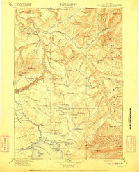
 1913 Marias Pass1913 Print · USGSThe Continental Divide and the Great Northern Railroad meet at the crest of the Rockies in the years just after Glacier's establishment. Local historians can trace early rail stations like Lubec, the Midvale settlement, and remote outposts such as Three Forks Rangers Cabin.3 unique versions available
 - 1913 Map of Stryker, 1960 Print
 1913 Stryker1960 Print · USGSNorthwest Montana at the start of the twentieth century was a landscape of remote rail outposts and high-country forestry along the Great Northern. Researchers can locate vanished infrastructure like the Meadow Creek School or trace early forest service history at Point of Rock Ranger Station.
 - 1914 Map of Brockton
 1914 Brockton1914 Print · USGSNortheastern Montana ranching and rail life are frozen in time just before the First World War. Trace the early layout of Brockton and find local landmarks like Armstrongs Ranch, Schoolhouse Coulee, and the path of the Great Northern R R.3 unique versions available
 - 1914 Map of Homestead
 1914 Homestead1914 Print · USGSNortheastern Montana ranching country comes into focus in this early twentieth-century survey of the Big Muddy Creek valley. Genealogists can trace the location of the Le Clair School and pioneer outposts like Scott Ranch and Walker's Ranch along the rail line.
 - 1914 Map of Nyack
 1914 Nyack1914 Print · USGSThe Middle Fork Flathead River corridor is captured here during the early days of Glacier National Park. Historians and researchers can trace the Great Northern rail line through remote stops at Nyack, Essex, and Java.3 unique versions available
Showing maps 1-25 of 47
Top cities of Montana
- Billings historical maps
- Missoula historical maps
- Great Falls historical maps
- Bozeman historical maps
- Butte historical maps
- Helena historical maps
See more
Top counties of Montana
- Yellowstone County historical maps
- Missoula County historical maps
- Gallatin County historical maps
- Flathead County historical maps
- Cascade County historical maps
- Lewis and Clark County historical maps
See more
Frequently asked questions
- What are the different types of historical maps available for Montana?
- What is the oldest map of Montana?
- Where can I purchase historical maps of Montana for my home or office?
- Where can I download high-res historical maps of Montana?
- Are there historical topographic maps available for Montana?
- Is there historical aerial imagery available for Montana?
- Where are historical maps of Montana sourced from?