1950s Maps of Montana
Explore 363 historic maps of Montana from the 1950s. These maps offer a rare glimpse into what life looked like during the 1950s — showing old roads, neighborhoods, homes, and landmarks that have changed or disappeared over time.
Whether you're researching your family's past, planning a metal detecting trip, or studying how Montana's landscape evolved across the 1950s, these high-resolution maps are a powerful tool for exploring the history of this region.
- Focus on a specific era: All maps on this page are from the 1950s, giving you a focused view of this time period.
- See what’s changed: Compare century-old streets, trails, and buildings to today's modern landscape using overlays and satellite layers.
- Research with precision: Use these maps for genealogy, historical research, land use analysis, or educational projects.
- View, download, or print: Maps are fully viewable online in high resolution, and can be downloaded or printed for your own records.
Start exploring Montana's history through authentic maps from the 1950s. This is your window into the past.
Montana maps
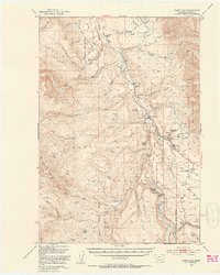
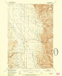
(363)- 1950 Map of Johnson Lake
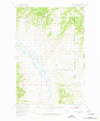
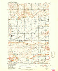
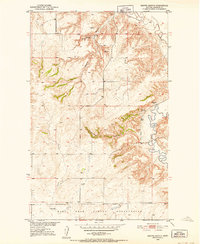
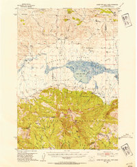
 1950 Johnson Lake1950 Print · USGSRoosevelt County at the mid-century shows a landscape of reservation lands and wildlife conservation areas. Researchers can trace the winding course of Muddy Creek and locate features like the Medicine Lake National Wildlife Refuge, Johnson Lake, and early Gravel Pits.
 - 1950 Map of Devils Fence
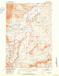
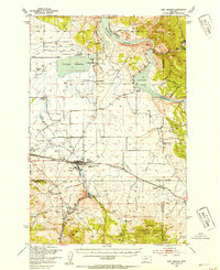
 1950 Devils Fence1950 Print · USGSJefferson County ranchlands and mining districts are meticulously detailed in this mid-century survey of the Boulder Valley region. Researchers can locate remote family landmarks such as the Quaintance Ranch, Boulder Valley Church, and the active Ida Mine.5 unique versions available
 - 1950 Map of Timber Coulee
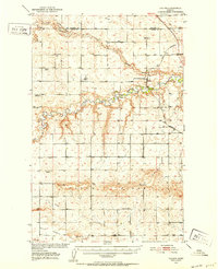
 1950 Timber Coulee1950 Print · USGSMontana's high prairie and river breaks are documented here in the mid-1940s, showing a landscape defined by the winding Teton River. Genealogists and local historians can trace the locations of the Knee Church, the Jensen Elevator, and early rural schools like Promised Land School.
 - 1950 Map of Dent Bridge
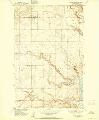
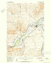
 1950 Dent Bridge1950 Print · USGSChouteau County was a landscape of remote prairie schools and river breaks in the years following the war. Researchers can trace rural genealogy and land use through landmarks like Promised Land School No 2, Dent Bridge, and the winding Teton River.3 unique versions available
 - 1950 Map of Jefferson City, 1952 Print
 1950 Jefferson City1952 Print · USGSMining districts in Jefferson and Lewis and Clark Counties are shown in high detail during the early fifties. Trace the history of the Northern Pacific rail line and dozens of old workings like the Grey Eagle Mine and Rimini.5 unique versions available
 - 1950 Map of Canyon Ferry, 1952 Print
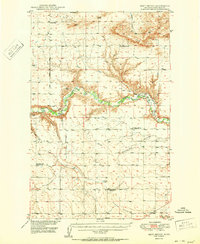
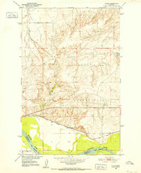
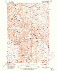
 1950 Canyon Ferry1952 Print · USGSBroadwater and Lewis and Clark counties are captured here in the mid-century as the Missouri River valley underwent massive change. Genealogists and historians can trace the transition from old settlements like York and Placer to the rising waters of Canyon Ferry Lake.3 unique versions available
 - 1950 Map of Fairfield, 1952 Print
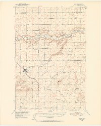
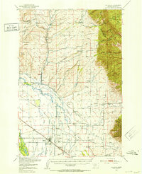
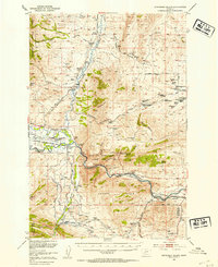
 1950 Fairfield1952 Print · USGSIn the early 1950s, the Teton County prairie was a landscape of irrigation canals and rail lines centered on Fairfield. Trace the development of the Missouri River Basin through features like the Greenfield Main Canal, Old Fort Shaw, and the Great Northern railroad.4 unique versions available
 - 1950 Map of Coyote Coulee, 1952 Print
 1950 Coyote Coulee1952 Print · USGSRoosevelt County ranching and reservation life are captured here in the early fifties during the Missouri River Basin development era. Genealogists and historians can trace the remote Schnitzler Ranch or the winding paths of Coyote Coulee and Smoke Creek.2 unique versions available
 - 1950 Map of Calais, 1952 Print
 1950 Calais1952 Print · USGSNortheastern Montana's river valley and high plains come into focus at mid-century, where the reservation meets the winding Missouri. Genealogists and historians can trace the Great Northern rail line through Calais or locate the Alton Mine and Bertino Res.2 unique versions available
 - 1950 Map of Dutton, 1952 Print
 1950 Dutton1952 Print · USGSDutton and the surrounding Teton County plains are shown in the early 1950s as a thriving rail-side agricultural community. Genealogists can trace a network of rural schoolhouses like Doheney School and Pleasant School, alongside the Great Northern railroad line.3 unique versions available
 - 1950 Map of Shippe Canyon, 1952 Print
 1950 Shippe Canyon1952 Print · USGSSheridan County's high plains and river breaks are captured here in the early fifties, showing the northern reaches of the Fort Peck Indian Reservation. Researchers can locate several Coal Mines (inactive) and follow the drainage of Big Muddy Creek and Richardson Coulee.2 unique versions available
 - 1950 Map of Clark, 1952 Print
 1950 Clark1952 Print · USGSNorthern Wyoming ranching and early petroleum development meet here at the start of the 1950s. Researchers can trace family homesteads like Johnson Ranch and locate local landmarks including Clark Sch and the Clark Cem.3 unique versions available
 - 1950 Map of Collins, 1952 Print
 1950 Collins1952 Print · USGSTeton County and Pondera County meet along the meanders of the Teton River at the height of the post-war ranching and rail era. Researchers can trace the rural school network including South Liberty Sch, or locate family landmarks like Beck Cem and the grain hub at Zim Elevator.2 unique versions available
 - 1950 Map of Townsend, 1953 Print
 1950 Townsend1953 Print · USGSBroadwater County is documented here in the mid-twentieth century just before the valley floor was reshaped by the Canyon Ferry Reservoir project. Trace family roots and local history through the Centerville Cemetery, the Whitehead Ranch, and mining sites like the East Pacific Mine.3 unique versions available
 - 1950 Map of Three Forks, 1953 Print
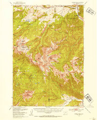
 1950 Three Forks1953 Print · USGSThree Forks and the surrounding Gallatin Valley are captured here just after the war, showing the historic meeting of the rivers that form the Missouri. Genealogists and historians can trace the foundations of this ranching community through the Jefferson Sch, Fairview Cem, and the Climbing Arrow Ranch.4 unique versions available
 - 1950 Map of Cliff Lake, 1953 Print
 1950 Cliff Lake1953 Print · USGSMadison County rangeland and the upper Madison River basin come into focus just after the war. Researchers can trace historic homesteads and sportsmen's retreats such as Snowball Inn, Wickadahl Ranch, and Miller Cow Camp.6 unique versions available
 - 1950 Map of Duck Creek Pass, 1953 Print
 1950 Duck Creek Pass1953 Print · USGSBroadwater County ranching and mining sites appear in detail during the early postwar era as the landscape shifted. Genealogists can locate family holdings like Merritt Ranch, several Gold Mines, and the Holy Cross Cem near the Missouri River.4 unique versions available
 - 1950 Map of Belgrade, 1953 Print
 1950 Belgrade1953 Print · USGSGallatin County ranching and rail infrastructure are captured here in the early fifties as the valley modernized. Researchers can locate family roots at the Dry Creek Cem, trace the old Menard Wye, or find the Mountain View School (Aband).6 unique versions available
 - 1950 Map of Hebgen Dam, 1954 Print
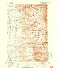
 1950 Hebgen Dam1954 Print · USGSThe Madison Range and the high country of the Montana-Idaho border come alive in this mid-century survey. You can trace the ranching and early tourism of the era through sites like Olifee Ranch, Campfire Lodge, and the remote Watkins Creek Ranch airstrip.7 unique versions available
 - 1950 Map of Cameron, 1954 Print
 1950 Cameron1954 Print · USGSMadison County ranching and mountain mining are captured here in the mid-twentieth century. Researchers can trace family ranch boundaries like Storey Ranch and Armitage Ranch or locate historical operations at Ruby Mine and Krauss Sawmill.5 unique versions available
 - 1950 Map of Spanish Peaks, 1954 Print
 1950 Spanish Peaks1954 Print · USGSThe Madison Range high country comes into focus in this early 1950s survey of the Gallatin and Beaverhead National Forests. Researchers can locate remote mountain landmarks and early ranch sites like 8K Ranch, Crall Ranch, and the Spanish Creek Ranger Station.4 unique versions available
 - 1950 Map of Sphinx Mountain, 1954 Print
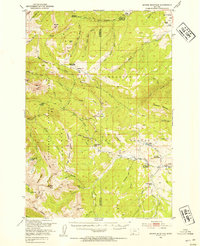 1950 Sphinx Mountain1954 Print · USGSThe high peaks of Madison County and Gallatin County are mapped here in the early postwar era, capturing a landscape of remote ranger stations and historic family ranches. Researchers can locate early forest outposts like Yellow Mule Ranger Sta or trace old backcountry routes such as the Wapiti Trail and Eldridge Trail.4 unique versions available
 - 1950 Map of Jefferson Island, 1954 Print
 1950 Jefferson Island1954 Print · USGSThe Jefferson River valley in the early 1950s reveals a landscape of industrial rail lines and established family ranchlands. Genealogists and local historians can locate early homesteads like Tribble Ranch, the Eureka School, and the South Boulder Cemetery.4 unique versions available
 - 1950 Map of Lower Red Rock Lake, 1954 Print
 1950 Lower Red Rock Lake1954 Print · USGSThe high Centennial Valley comes to life in the early fifties, where ranching and conservation meet along the Continental Divide. Genealogists and historians can trace family locations like the Goble Ranch, the Doyle School, and the remote Landon Camp.5 unique versions available
 - 1950 Map of East Helena, 1954 Print
 1950 East Helena1954 Print · USGSThe Missouri River valley near East Helena comes to life in the early fifties as a hub of rail transport and industrial mining. Genealogists and local historians can locate rural landmarks like Harmony School, St Anns Cem, and the Economy Mine.4 unique versions available
Showing maps 1-25 of 363
Top cities of Montana
- Billings historical maps
- Missoula historical maps
- Great Falls historical maps
- Bozeman historical maps
- Butte historical maps
- Helena historical maps
See more
Top counties of Montana
- Yellowstone County historical maps
- Missoula County historical maps
- Gallatin County historical maps
- Flathead County historical maps
- Cascade County historical maps
- Lewis and Clark County historical maps
See more
Frequently asked questions
- What are the different types of historical maps available for Montana?
- What is the oldest map of Montana?
- Where can I purchase historical maps of Montana for my home or office?
- Where can I download high-res historical maps of Montana?
- Are there historical topographic maps available for Montana?
- Is there historical aerial imagery available for Montana?
- Where are historical maps of Montana sourced from?