1940s Maps of Montana
Explore 70 historic maps of Montana from the 1940s. These maps offer a rare glimpse into what life looked like during the 1940s — showing old roads, neighborhoods, homes, and landmarks that have changed or disappeared over time.
Whether you're researching your family's past, planning a metal detecting trip, or studying how Montana's landscape evolved across the 1940s, these high-resolution maps are a powerful tool for exploring the history of this region.
- Focus on a specific era: All maps on this page are from the 1940s, giving you a focused view of this time period.
- See what’s changed: Compare century-old streets, trails, and buildings to today's modern landscape using overlays and satellite layers.
- Research with precision: Use these maps for genealogy, historical research, land use analysis, or educational projects.
- View, download, or print: Maps are fully viewable online in high resolution, and can be downloaded or printed for your own records.
Start exploring Montana's history through authentic maps from the 1940s. This is your window into the past.
Montana maps
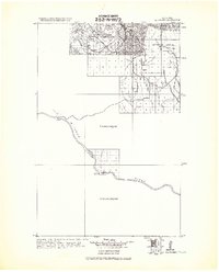
(70)- 1940 Map of Mt. Cowen, 1958 Print
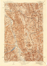
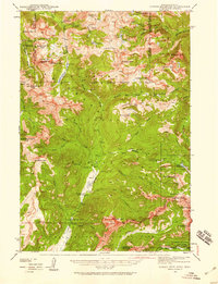
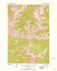 1940 Mt. Cowen1958 Print · USGSPark County's high mountain wilderness is captured here during the late Depression era, just before the war. Researchers can trace the early trail networks and backcountry landmarks like End Lookout, Beaver Meadows, and the peak of Mt Cowen.4 unique versions available
 - 1940 Map of Mt Wallace, 1963 Print
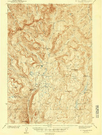
 1940 Mt Wallace1963 Print · USGSPark County high country is documented here at the start of the 1940s, where national forest and park lands converge. Researchers can trace remote routes like the Poacher Trail and find isolated outposts such as Bull Moose Cabin and Hellroaring Ranger Station.3 unique versions available
 - 1941 Map of Mt. Wood
 1941 Mt. Wood1941 Print · USGSStillwater County and the Custer National Forest are mapped here in the early 1940s, showing a landscape defined by mountain mining and river valley ranching. Researchers can locate the Nye Cem, the Benbow Mine, and high-country landmarks like Beartooth Ranch.
 - 1941 Map of Pendroy
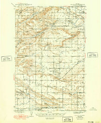
 1941 Pendroy1941 Print · USGSThe Montana high plains meet the Rocky Mountain Front in this pre-war survey of the Teton and Pondera county line. Local historians can trace the early ranching economy through landmarks like the Soberup Ranch and Hall Ranch, or locate coal operations at the Hubbard Mine.2 unique versions available
 - 1941 Map of Mt Douglas, 1958 Print
 1941 Mt Douglas1958 Print · USGSHigh-altitude Montana ranching and resource extraction are captured here at the start of the 1940s. Genealogists and historians can trace early land use at Clydehurst Ranch, the Gish Mine, and the Fourmile Guard Station.4 unique versions available
 - 1941 Map of Lewistown, 1959 Print
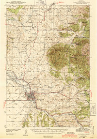
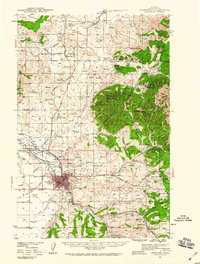 1941 Lewistown1959 Print · USGSFergus County's mining and ranching heart comes into focus during the early 1940s as the Judith Mountains overlook a bustling rail-fed valley. Trace the legacy of local industry through the Divide Coal Mine, the Heath Post Office, and the early footprint of the Lewistown Airport.3 unique versions available
 - 1941 Map of Judith Peak, 1959 Print
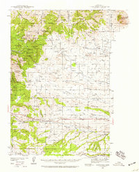 1941 Judith Peak1959 Print · USGSFergus County's high-altitude mining districts and military ruins are frozen in time just before the war. Trace the remnants of a gold boom at Maiden and Giltedge, or locate the Ruins of Fort Maginnis and several rural schoolhouses like Skaggs Sch.3 unique versions available
 - 1942 Map of Thompson Lakes
 1942 Thompson Lakes1942 Print · USGSNorthwest Montana during the early 1940s remained a landscape of timber and rail, where the Great Northern Railway hugged the banks of the Kootenai River. Researchers can trace the network of forest lookouts like Warland Pk Lookout and find early rural sites including Pleasant Valley Sch.2 unique versions available
 - 1942 Map of Silvertip
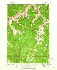
 1942 Silvertip1942 Print · USGSThe South Fork of the Flathead River backcountry is captured here in the late thirties, showing a wilderness managed by air and trail. Locate historic outposts like Big Prairie Ranger Sta, early airstrips, and remote cabins such as Limestone Cabin.2 unique versions available
 - 1942 Map of Gallup City, 1949 Print
 1942 Gallup City1949 Print · USGSThe Pondera and Teton County borderlands come to life in this pre-war survey, showing a landscape of high benches and deep coulees. Researchers can trace the rural school system at Porter Bench Sch and Erickson Sch, or locate family-named landmarks like Graham Ranch and Maucki.
 - 1942 Map of Cutoff Mtn, 1959 Print
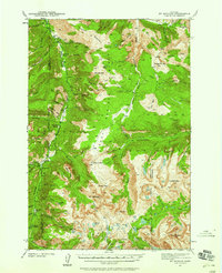
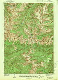
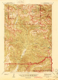
 1942 Cutoff Mtn1959 Print · USGSThe Absaroka-Beartooth wilderness along the Montana-Wyoming border is captured here in the early 1940s. Researchers can trace the high-country trails and sites like the Independence Mine, Silver Tip Ranch, and the Cooke Ranger Sta.4 unique versions available
 - 1943 Map of Gildford
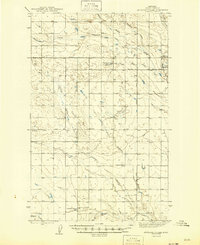
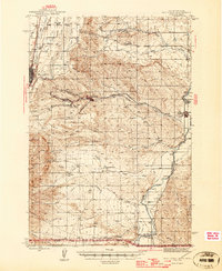
 1943 Gildford1943 Print · USGSSettlement and ranching define this Montana borderland during the early twentieth century, showing the rail-led growth of the northern plains. Researchers can trace the path of the Great Northern Railroad through Gildford or locate vanished sites like Lilacs and Fairchild.
 - 1943 Map of Kalispell
 1943 Kalispell1943 Print · USGSThe Flathead Valley's mid-century rail and river networks are preserved here as Kalispell expanded. Genealogists and historians can trace defunct river crossings like Therriaults Ferry, the old Demersville site, and the rail path of the Somers Kalispell Br.
 - 1943 Map of Mt Wallace
 1943 Mt Wallace1943 Print · USGSThe Absaroka wilderness at the edge of Yellowstone comes to life in the late 1930s, showing a remote landscape of high basins and ranger outposts. Trace the early trails and lookouts of the era, from Hellroaring Ranger Station to the Bull Moose Cabin and Poacher Trail.3 unique versions available
 - 1943 Map of Mt Douglas
 1943 Mt Douglas1943 Print · USGSHigh-altitude Montana ranching and forestry are documented here in the early 1940s, before modern road networks reached these alpine basins. Researchers can locate remote outposts like Clydehurst Ranch or trace the backcountry administrative boundaries near Fourmile Guard Station and Snowy Peak.2 unique versions available
 - 1943 Map of Landusky
 1943 Landusky1943 Print · USGSPhillips County during the early 1940s is shown here as a landscape of isolated mountain settlements and the wild Missouri Breaks. Researchers can trace the layout of Landusky, the mountain peaks of the Jefferson National Forest, and river landmarks such as Cow Island.
 - 1943 Map of Hogan
 1943 Hogan1943 Print · USGSCrossing the Continental Divide during the early twentieth century, this survey shows the high-country landscape between the Sun and Dearborn rivers. Researchers can trace early settlements like Stearns and Hogan, or find remote landmarks such as Silver Camp and the Dry Creek Reservoir Site.
 - 1943 Map of Glasgow
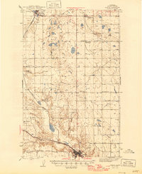
 1943 Glasgow1943 Print · USGSThe Milk River valley in northeastern Montana is captured here as it appeared during the early 1940s. Genealogists and local historians can trace the growth of rail-side towns like Glasgow, Vandalia, and Tampico while locating features like Griffiths Reservoir.
 - 1943 Map of Mt Cowen
 1943 Mt Cowen1943 Print · USGSPark County during the early 1940s is shown here as a landscape of high alpine peaks and remote water systems. Hikers and historians can trace the paths of the Boulder River and locate landmarks like Mt Cowen, Beaver Meadows, and Silver Pass.2 unique versions available
 - 1943 Map of Antelope Coulee, 1945 Print
 1943 Antelope Coulee1945 Print · USGSToole County ranching life is documented here during the mid-forties, showing a landscape shaped by drainage coulees and the grid of the Principal Meridian. Genealogists can locate family landmarks such as Frandsen Ranch, Bennett Ranch, and the Fairview Sch.2 unique versions available
 - 1943 Map of Shelby, 1946 Print
 1943 Shelby1946 Print · USGSToole County ranching and rail life are documented here during the 1940s as the regional economy transitioned between cattle and oil. Genealogists can trace family holdings like Roberts Ranch and Holstad Ranch or locate early rural school sites such as Aloe Sch.2 unique versions available
 - 1944 Map of Lewistown
 1944 Lewistown1944 Print · USGSFergus County at the height of the mid-century mining and rail era reveals a landscape shaped by resource extraction and high-plains settlement. Researchers can trace the legacy of local industry through the Divide Coal Mine, the Oil Refinery, and the State Fish Hatchery.2 unique versions available
 - 1944 Map of Cutoff Mtn
 1944 Cutoff Mtn1944 Print · USGSThe northern gateway to Yellowstone and the high Absaroka wilderness are documented in the early 1940s, just as the park’s modern boundaries were being refined. Trace the historic Northeast Entrance, the remote Silver Tip Ranch, and the high-altitude Independence Mine.2 unique versions available
 - 1944 Map of Judith Peak
 1944 Judith Peak1944 Print · USGSThe Judith Mountains mining districts are shown in high detail during the early 1940s, from high peaks to the prairie rail lines. Genealogists and historians can locate the Ruins of Fort Maginnis, the Fort Maginnis Cem, and numerous mines like the Old Glory Mine.2 unique versions available
 - 1944 Map of Red Lodge, 1946 Print
 1944 Red Lodge1946 Print · USGSCarbon County’s coal and ranching economy is captured here in the mid-1940s, from the railhead at Red Lodge to the banks of the Clarks Fork Yellowstone River. Genealogists and industrial historians can trace the operations of the Smith Mine, the Ohio Oil Co Camp, and the rural Clear Creek Sch.3 unique versions available
Showing maps 1-25 of 70
Top cities of Montana
- Billings historical maps
- Missoula historical maps
- Great Falls historical maps
- Bozeman historical maps
- Butte historical maps
- Helena historical maps
See more
Top counties of Montana
- Yellowstone County historical maps
- Missoula County historical maps
- Gallatin County historical maps
- Flathead County historical maps
- Cascade County historical maps
- Lewis and Clark County historical maps
See more
Frequently asked questions
- What are the different types of historical maps available for Montana?
- What is the oldest map of Montana?
- Where can I purchase historical maps of Montana for my home or office?
- Where can I download high-res historical maps of Montana?
- Are there historical topographic maps available for Montana?
- Is there historical aerial imagery available for Montana?
- Where are historical maps of Montana sourced from?