1960s Maps of Montana
Explore 2,032 historic maps of Montana from the 1960s. These maps offer a rare glimpse into what life looked like during the 1960s — showing old roads, neighborhoods, homes, and landmarks that have changed or disappeared over time.
Whether you're researching your family's past, planning a metal detecting trip, or studying how Montana's landscape evolved across the 1960s, these high-resolution maps are a powerful tool for exploring the history of this region.
- Focus on a specific era: All maps on this page are from the 1960s, giving you a focused view of this time period.
- See what’s changed: Compare century-old streets, trails, and buildings to today's modern landscape using overlays and satellite layers.
- Research with precision: Use these maps for genealogy, historical research, land use analysis, or educational projects.
- View, download, or print: Maps are fully viewable online in high resolution, and can be downloaded or printed for your own records.
Start exploring Montana's history through authentic maps from the 1960s. This is your window into the past.
Montana maps
- 1960 Map of Butte
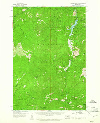
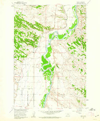
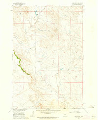
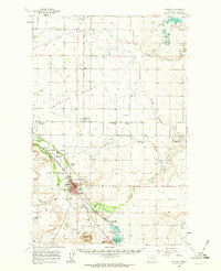
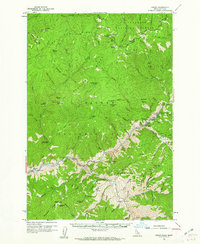
 1960 Butte1960 Print · USGSWestern Montana at the dawn of the sixties is defined by its industrial mining hubs and the railroads that connect them. Genealogists and historians can trace the routes of the Milwaukee Road through Butte or locate smaller settlements like Southern Cross and Bearmouth.
 - 1960 Map of Elk City
 1960 Elk City1960 Print · USGSThe Central Idaho wilderness and Bitterroot Range are captured here during the peak of mid-century industrial mining. Researchers can trace remote backcountry settlements like Burgdorf and Warren, alongside major mineral sites including the Blackbird Mine and Ima Mine.2 unique versions available
 - 1960 Map of Kalispell
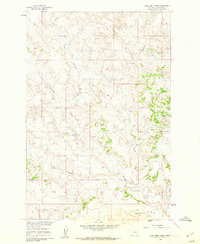
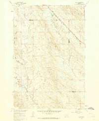
 1960 Kalispell1960 Print · USGSNorthwest Montana in the late fifties is defined by the mountain corridors of the Great Northern Railway and the vast reaches of Glacier National Park. Researchers can trace the legacy of timber and mining towns like Libby, Rexford, and Whitefish, or locate landmarks such as the Snowshoe Mine.
 - 1960 Map of Ashton
 1960 Ashton1960 Print · USGSThe Idaho-Montana-Wyoming borderlands at the dawn of the sixties show a landscape defined by the Continental Divide and early wilderness tourism. Genealogists and historians can trace rail-stop settlements like Trude Siding, old outposts like Warm River, and early lodging at Snowball Inn.
 - 1960 Map of Wallace
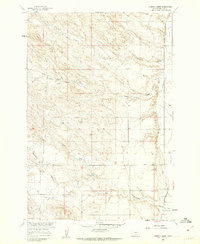
 1960 Wallace1960 Print · USGSNorthwestern Montana and the Idaho panhandle are captured in the late fifties, showing the vast Flathead Indian Reservation and the mining districts of the Bitterroot Range. Researchers can trace the rail lines of the Northern Pacific or locate early sites like the Morning Mine and the National Bison Range.
 - 1960 Map of Hamilton
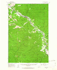
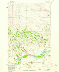
 1960 Hamilton1960 Print · USGSThe Bitterroot Valley and surrounding high country are captured here during the late fifties, showing the region's transition into a modern forest and rail corridor. Researchers can trace the path of the Northern Pacific through Missoula or locate landmarks like Fort Missoula and Lake Como.
 - 1960 Map of Painted Rocks Lake, 1961 Print
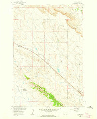
 1960 Painted Rocks Lake1961 Print · USGSThe Bitterroot mountains of western Montana are documented here in the early sixties, showing the remote canyon lands at the state border. Trace historic mountain routes like the Nez Perce Trail and locate the Copper Queen Mine or the settlement at Alta.3 unique versions available
 - 1960 Map of Bighorn, 1962 Print
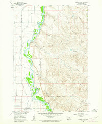
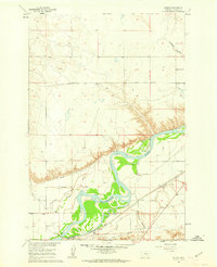
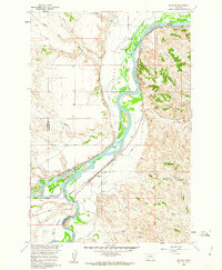 1960 Bighorn1962 Print · USGSThe confluence of the Yellowstone and Bighorn rivers in the early 1960s shows a landscape of vital irrigation ditches and rail lines. Researchers can trace the legacy of Pease Bottom through the Ft Pease (Site) and the tracks of the Northern Pacific railroad.5 unique versions available
 - 1960 Map of Bynum, 1962 Print
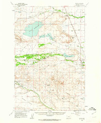 1960 Bynum1962 Print · USGSThe Bynum area during the early 1960s was a hub of irrigation and rail-side ranching. Genealogists and historians can trace family holdings like Perkins Ranch, find the Tetonview Sch, and locate the Miller Colony north of Koyl.2 unique versions available
 - 1960 Map of Hysham, 1962 Print
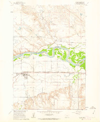 1960 Hysham1962 Print · USGSHysham and the surrounding Treasure County plains are documented here at the start of the 1960s, showing a landscape defined by river-driven irrigation. Local researchers can trace the Northern Pacific rail line and discover early landmarks like Memorial Vale Cem and Johnston.2 unique versions available
 - 1960 Map of Foster, 1962 Print
 1960 Foster1962 Print · USGSIn the Big Horn valley during the early sixties, the local economy relied on the river's waters and the heavy rail traffic through the plains. Genealogists and researchers can locate several rural schoolhouses, including Sorrel Horse Sch and Fairview Sch, along with the Two Leggins Canal and the siding at Foster.2 unique versions available
 - 1960 Map of Superior, 1962 Print
 1960 Superior1962 Print · USGSThe Clark Fork valley in the early sixties was a rugged industrial corridor defined by the Northern Pacific and Milwaukee Road rail lines. Genealogists and historians can trace the foundations of Superior or locate remote mining sites like the Iron Mountain Mine and Old Mountain Mines.2 unique versions available
 - 1960 Map of Steie Ranch, 1962 Print
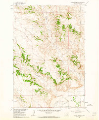
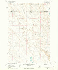 1960 Steie Ranch1962 Print · USGSBig sky ranching country along the Treasure and Rosebud county line is captured here just as the Missouri River Basin development program was underway. Researchers can locate the Steie Ranch and trace the drainage patterns of Froze to Death Creek and Geyser Spring Coulee.
 - 1960 Map of Simms, 1962 Print
 1960 Simms1962 Print · USGSWestern Montana's ranching and transit corridors are captured here during the mid-century, featuring the rugged volcanic mesas of the Sun River valley. Researchers can trace the legacy of the Mullan Road, the St Peter Mission, and the Eagle Rock Stage Station (Site).2 unique versions available
 - 1960 Map of Hagen Ranch, 1962 Print
 1960 Hagen Ranch1962 Print · USGSRosebud County ranching life is captured here in the early sixties, showing the isolated homesteads and water sources of the Montana plains. Genealogists and historians can locate family landmarks like Hagen Ranch, Mysse Ranch, and the winding Great Porcupine Creek.
 - 1960 Map of Vananda, 1962 Print
 1960 Vananda1962 Print · USGSRailroad operations and ranching life intersect in the high plains of Rosebud and Treasure Counties at the dawn of the sixties. Genealogists and rail historians can trace the Milwaukee Road through Vananda and identify old Prospects along Cedar Ridge.2 unique versions available
 - 1960 Map of Coal Bank Creek, 1962 Print
 1960 Coal Bank Creek1962 Print · USGSYellowstone County's high plains landscape is captured in the early sixties as part of the Missouri River Basin development. Researchers can trace the drainage patterns of Coal Bank Creek and the broad expanse of Sevenmile Flat across this ranching-era terrain.2 unique versions available
 - 1960 Map of Ninemile Point, 1962 Print
 1960 Ninemile Point1962 Print · USGSBig Horn County in the early sixties reveals a landscape of industrial agriculture and river-valley ranching. Genealogists and historians can trace family properties like Miller Ranch, locate the Nine Mile Sch, and study the rail-side Sugar Refinery at Whitman.2 unique versions available
 - 1960 Map of Choteau, 1962 Print
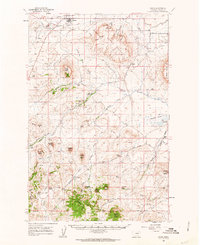
 1960 Choteau1962 Print · USGSMontana's Rocky Mountain Front is seen here in the early sixties, centered on the irrigation and rail networks around Choteau. Genealogists and local historians can trace rural school sites like East Farmington No 5 Sch or search for family roots at Trinity Cem and Agawam.2 unique versions available
 - 1960 Map of Custer, 1962 Print
 1960 Custer1962 Print · USGSThe Yellowstone River valley at the turn of the 1960s reveals a landscape of railroad engineering and irrigation efforts. Researchers can trace the path of the Northern Pacific, locate the Bighorn Tunnel, and explore the drainage network of Fivemile Hill.3 unique versions available
 - 1960 Map of Ahles, 1962 Print
 1960 Ahles1962 Print · USGSThe eastern Montana plains come into focus in the early sixties as the railroad era shapes the landscape. Trace the local geography along the Chicago Milwaukee St Paul and Pacific line near Ahles and the curiously named Starved to Death Creek.2 unique versions available
 - 1960 Map of Chimney Creek, 1962 Print
 1960 Chimney Creek1962 Print · USGSBig Horn County agriculture and natural drainages are captured here in the early sixties. Researchers can trace the irrigation path of Two Leggins Canal and family-named landmarks like Lone Tree Coulee and Chimney Creek.
 - 1960 Map of Shoup, 1962 Print
 1960 Shoup1962 Print · USGSThe Salmon River canyon and the Bitterroot Mountains come into focus in the early 1960s, showing a landscape defined by deep-vein mining and forest lookouts. Researchers can trace historic claims like the Kentucky Mine and Gold Hill Mine or locate the site of Reed Ranch.2 unique versions available
 - 1960 Map of Myers, 1962 Print
 1960 Myers1962 Print · USGSThe Yellowstone River valley of Treasure County comes alive in the early sixties, showing a landscape defined by irrigation and the railroad. Genealogists and local historians can locate the Rancher Ch and Rancher Sch, or trace the tracks of the Northern Pacific through Myers.2 unique versions available
 - 1960 Map of Rancher Cemetery, 1962 Print
 1960 Rancher Cemetery1962 Print · USGSTreasure County ranching country is captured here during the early sixties, showing the vast open spaces along the Yellowstone River valley. Genealogists and historians can locate Rancher Cemetery and trace the drainage patterns of Muggins Creek and Alkali Creek.2 unique versions available
Showing maps 1-25
Top cities of Montana
- Billings historical maps
- Missoula historical maps
- Great Falls historical maps
- Bozeman historical maps
- Butte historical maps
- Helena historical maps
See more
Top counties of Montana
- Yellowstone County historical maps
- Missoula County historical maps
- Gallatin County historical maps
- Flathead County historical maps
- Cascade County historical maps
- Lewis and Clark County historical maps
See more
Frequently asked questions
- What are the different types of historical maps available for Montana?
- What is the oldest map of Montana?
- Where can I purchase historical maps of Montana for my home or office?
- Where can I download high-res historical maps of Montana?
- Are there historical topographic maps available for Montana?
- Is there historical aerial imagery available for Montana?
- Where are historical maps of Montana sourced from?