1940s Maps of Oregon
Explore 122 historic maps of Oregon from the 1940s. These maps offer a rare glimpse into what life looked like during the 1940s — showing old roads, neighborhoods, homes, and landmarks that have changed or disappeared over time.
Whether you're researching your family's past, planning a metal detecting trip, or studying how Oregon's landscape evolved across the 1940s, these high-resolution maps are a powerful tool for exploring the history of this region.
- Focus on a specific era: All maps on this page are from the 1940s, giving you a focused view of this time period.
- See what’s changed: Compare century-old streets, trails, and buildings to today's modern landscape using overlays and satellite layers.
- Research with precision: Use these maps for genealogy, historical research, land use analysis, or educational projects.
- View, download, or print: Maps are fully viewable online in high resolution, and can be downloaded or printed for your own records.
Start exploring Oregon's history through authentic maps from the 1940s. This is your window into the past.
Oregon maps
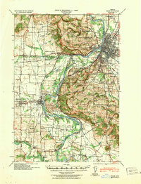
(122)- 1940 Map of McMinnville
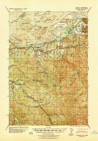
 1940 McMinnville1940 Print · USGSWillamette Valley life centered on river and rail transit in the 1940s, from the streets of McMinnville to the fertile bottomlands. Local historians can trace early school sites like Grub College and river crossings such as the Wheatland Ferry.3 unique versions available
 - 1940 Map of Svensen
 1940 Svensen1940 Print · USGSCoastal Clatsop County at the start of the 1940s reveals a complex network of river channels and small rail-side settlements. Genealogists and historians can locate old landmarks like Ivy Station, the CCC Camp, and several rural schoolhouses including Olney Sch.
 - 1940 Map of Mapleton
 1940 Mapleton1940 Print · USGSCoastal Oregon at the dawn of the 1940s reveals a river-driven economy of small schools and railroad stops. Genealogists can trace family landmarks like Lowney Ranch, identify rural schoolhouse locations including Minerva Sch, or follow the Southern Pacific line through Swisshome.
 - 1940 Map of Tualatin
 1940 Tualatin1940 Print · USGSThe Tualatin Valley comes into sharp focus during the late 1930s, showing the early footprints of Beaverton and Tigard amid a vast network of rail lines. Researchers can trace historic family schoolhouses like Witch Hazel School and locate the original path of Boones Ferry Road near Wilsonville.
 - 1940 Map of Hillsboro
 1940 Hillsboro1940 Print · USGSThe Tualatin Valley and the Columbia River confluence meet in this 1940 survey of the Hillsboro and North Portland region. Researchers can trace early twentieth-century rail lines like the Oregon Electric or locate historic rural landmarks such as Mountain View Cemetery and the Mason Hill School.
 - 1940 Map of Molalla
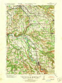
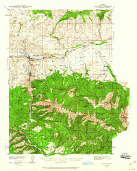
 1940 Molalla1940 Print · USGSClackamas and Marion counties are captured here just before the war, showing the fertile prairies and rising timbered foothills of the Willamette Valley. Researchers can trace ancestral property near Lone Elder, visit the Trinity Lutheran Church, or locate vanished logging landmarks like the Old Saw Mill.2 unique versions available
 - 1940 Map of Lebanon
 1940 Lebanon1940 Print · USGSLinn County agriculture and timber transit thrived on the eve of the 1940s, centered on the growing hub of Lebanon. Genealogists and historians can trace dozens of rural school districts and old burial grounds, including Jefferson Cemetery, Rollins Mill, and the Southern Pacific rail stops.
 - 1940 Map of Salem
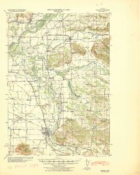
 1940 Salem1940 Print · USGSThe Willamette Valley thrives in the early days of the war, as Salem expands around its rail hubs and state institutions. Researchers can trace the legacy of the Southern Pacific line and find vanished local landmarks like the Poor Farm School for the Deaf or Oak Grove Church.
 - 1940 Map of Brookfield
 1940 Brookfield1940 Print · USGSPacific and Wahkiakum Counties are shown in detail during the early 1940s, highlighting the heavy industrial presence along the Columbia River shoreline. Researchers can locate salmon canneries, logging camps, and family holdings such as the Pillar Rock Cannery, Old Camp Brix Logging Co, and Maki Ranch.
 - 1940 Map of Cape Falcon
 1940 Cape Falcon1940 Print · USGSCoastal Clatsop County is captured just before the war, showing the development of Seaside and Cannon Beach along the Pacific. Researchers can trace early logging operations at the Markham Callow Logging Camp or locate the Ferndale Sch and Henderson Ranch.
 - 1940 Map of Mc Kenzie Bridge
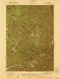
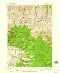
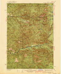 1940 Mc Kenzie Bridge1940 Print · USGSThe Oregon Cascades during the late 1930s reveal a landscape of mining claims and early forest service outposts. Trace the locations of historic mineral sites like the Lucky Boy Mine, family homesteads at Cooks Ranch, and mountain retreats at Belknap Springs.3 unique versions available
 - 1940 Map of Eugene
 1940 Eugene1940 Print · USGSThe Willamette Valley at the end of the Great Depression shows a landscape of growing towns and busy rail corridors. Genealogists can locate family-named landmarks like Gillespie Butte School and the I O O F Cemetery.2 unique versions available
 - 1940 Map of Boring
 1940 Boring1940 Print · USGSClackamas and Multnomah Counties are captured in the late thirties, documenting a landscape shaped by the Clackamas River and electric rail lines. Trace the route of the Cazadero Line or locate family roots at Mt Zion Cem and Lusted School.
 - 1940 Map of Mount Angel
 1940 Mount Angel1940 Print · USGSMarion County farming and institutional life are captured here just before the war, showing a valley crisscrossed by rail and river. Genealogists can locate family landmarks like St Benedict, the Pioneer Cemetery, and nearly twenty rural schoolhouses.
 - 1940 Map of Portland
 1940 Portland1940 Print · USGSThe Portland and Vancouver riverfronts are captured here just before the massive industrial shifts of the mid-century. Genealogists and historians can locate early landmarks like Vancouver Barracks, the University of Portland, and Mundays Ferry.4 unique versions available
 - 1940 Map of Vernonia, 1941 Print
 1940 Vernonia1941 Print · USGSNorthwestern Oregon’s timber country comes into focus in this 1940 survey, showing the river-valley settlements just before the Second World War. Researchers can trace early rural life through landmarks like Pleasant Hill School, the town of Vernonia, and the Catherwood Lookout.
 - 1940 Map of Mount Vernon, 1959 Print
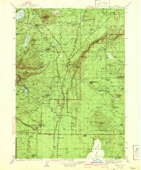
 1940 Mount Vernon1959 Print · USGSMount Vernon and the John Day River valley are shown here just before mid-century, capturing a landscape of remote ranches and forest lookouts. Genealogists can locate family landmarks like Fletcher Ranch, Belshaw Sch, and the Cinnabar Mine.2 unique versions available
 - 1940 Map of Aldrich Mtn., 1960 Print
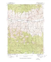
 1940 Aldrich Mtn.1960 Print · USGSGrant County ranching and timber management are captured here just before the mid-century, following the winding John Day River. You can trace early 20th-century family history through the Mountain View Sch and various homesteads like Clark Ranch and Weaver Cabin.2 unique versions available
 - 1940 Map of John Day, 1960 Print
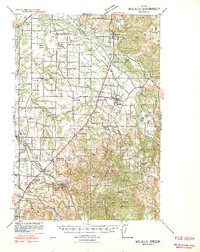
 1940 John Day1960 Print · USGSGrant County is captured here at the end of the 1930s as a region defined by high-desert ranching and the remnants of a gold-mining boom. Genealogists can trace early landmarks like Canyon City, the Joaquin Miller Resort, and several abandoned workings such as the Iron King Mine.2 unique versions available
 - 1941 Map of Keasey
 1941 Keasey1941 Print · USGSThe timber and rail economy of northwest Oregon is captured here just before the war. Trace the path of the Oregon American Lumber Co railroad and locate family landmarks like A W Nelsons Farm and the Winema Sch.
 - 1941 Map of Chemult
 1941 Chemult1941 Print · USGSUpper Klamath County in the mid-1930s is a landscape of high-altitude timber camps and critical rail junctions. Genealogy researchers can trace remote family holdings and logging outposts like Hoey Ranch, Beaver Marsh, and Lumber Camp 2 along the competing railroad lines.2 unique versions available
 - 1941 Map of Nestucca Bay
 1941 Nestucca Bay1941 Print · USGSThe Oregon coast at the start of the 1940s reveals a mix of timber industry and early seaside tourism. Trace the history of coastal work and recreation through labels like the Miles Lake CCC Camp, Hebo Alder Mill, and the many fire lookouts.
 - 1941 Map of St Helens
 1941 St Helens1941 Print · USGSThe Columbia River waterfront near St. Helens was a thriving industrial and agricultural corridor just before the war. Trace old rail stops at Honeymoon Sta, rural schoolhouses like Shilo Basin Sch, and the shifting river islands from Deer Island to Bachelor Island.
 - 1941 Map of Timber
 1941 Timber1941 Print · USGSCoastal Oregon at the start of the 1940s reveals a landscape defined by timber extraction and railroad expansion. Genealogists and historians can trace the remote logging life through Timber, Cochran, and numerous work sites like the Gonnacher Logging Camp.
 - 1941 Map of Enright
 1941 Enright1941 Print · USGSTimber and rail operations define the Tillamook backcountry in the early 1940s just after the Great Fire. Trace the Southern Pacific line past Enright and Belfort, or locate Lees Camp Ground and the Cedar Butte Lookout.
Showing maps 1-25 of 122
Top cities of Oregon
- Portland historical maps
- Eugene historical maps
- Salem historical maps
- Gresham historical maps
- Bend historical maps
- Hillsboro historical maps
See more
Top counties of Oregon
- Multnomah County historical maps
- Washington County historical maps
- Clackamas County historical maps
- Lane County historical maps
- Marion County historical maps
- Jackson County historical maps
See more
Frequently asked questions
- What are the different types of historical maps available for Oregon?
- What is the oldest map of Oregon?
- Where can I purchase historical maps of Oregon for my home or office?
- Where can I download high-res historical maps of Oregon?
- Are there historical topographic maps available for Oregon?
- Is there historical aerial imagery available for Oregon?
- Where are historical maps of Oregon sourced from?