1920s Maps of Oregon
Explore 38 historic maps of Oregon from the 1920s. These maps offer a rare glimpse into what life looked like during the 1920s — showing old roads, neighborhoods, homes, and landmarks that have changed or disappeared over time.
Whether you're researching your family's past, planning a metal detecting trip, or studying how Oregon's landscape evolved across the 1920s, these high-resolution maps are a powerful tool for exploring the history of this region.
- Focus on a specific era: All maps on this page are from the 1920s, giving you a focused view of this time period.
- See what’s changed: Compare century-old streets, trails, and buildings to today's modern landscape using overlays and satellite layers.
- Research with precision: Use these maps for genealogy, historical research, land use analysis, or educational projects.
- View, download, or print: Maps are fully viewable online in high resolution, and can be downloaded or printed for your own records.
Start exploring Oregon's history through authentic maps from the 1920s. This is your window into the past.
Oregon maps
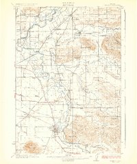
(38)- 1920 Map of Siltcoos Lake
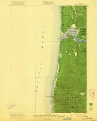
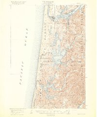 1920 Siltcoos Lake1920 Print · USGSThe Oregon coast at the end of the Great War reveals a landscape of river inlets and timber-driven rail lines. You can trace the Southern Pacific tracks past rural schoolhouses like Idlewild School and old stops at Cushman P.O. or Acme.3 unique versions available
 - 1920 Map of Seven Devils Mining District
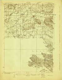
 1920 Seven Devils Mining District1920 Print · USGSThe Seven Devils Mining District was a bustling area of extraction and high-country ranching in the 1920s. Genealogists and historians can trace old homesteads and mining hubs like Cuprum, Landore, and Towsley Cabin, or locate the Landore School and Iron Springs Ranger Sta.
 - 1920 Map of Heceta Head
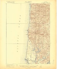 1920 Heceta Head1920 Print · USGSThe Oregon coast at the end of the First World War shows a rugged landscape of isolated schoolhouses and coastal outposts. Genealogists and historians can locate early landmarks like the Coast Guard Station, Mercer School, and the historic trail at The Portage.4 unique versions available
 - 1921 Map of Brownsville
 1921 Brownsville1921 Print · USGSLinn County agriculture and early rail travel define this landscape in the years following the Great War. Genealogists can trace the rural communities surrounding Brownsville through the locations of the Union Point School, Diamond Hill School, and the Southern Pacific line.4 unique versions available
 - 1921 Map of Lebanon
 1921 Lebanon1921 Print · USGSLinn County at the dawn of the 1920s reveals a landscape of thriving rural schools and expanding rail lines. Trace family roots and early farmstead locations near Lebanon, Tallman, and the South Santiam River.
 - 1921 Map of Cottage Grove
 1921 Cottage Grove1921 Print · USGSSouthern Lane County comes alive in this post-World War I survey, showing the valley floor before modern development. Genealogists can locate family homesteads near old schoolhouses like Green Door School or trace the early rail stops at Saginaw and Latham.3 unique versions available
 - 1921 Map of Corvallis
 1921 Corvallis1921 Print · USGSCorvallis and the surrounding Willamette Valley are captured in the early twentieth century as the region's agricultural and educational roots were deepening. Researchers can trace rural schoolhouse locations like Witham School and family-named landmarks such as Smith Hill or the Mt Union Cemetery.5 unique versions available
 - 1921 Map of Kalama
 1921 Kalama1921 Print · USGSThe Columbia River corridor is captured here in the early twenties, showing the vital rail and road networks connecting Washington and Oregon. Genealogists and historians can locate riverside settlements like Carrolls PO, industrial landmarks like the Ostrander Tunnel, and early routes like the Pacific Highway.
 - 1921 Map of Walla Walla
 1921 Walla Walla1921 Print · USGSSoutheastern Washington at the height of its rail-era agricultural expansion reveals a landscape of thriving wheat towns and mountain foothills. Genealogists can trace family footprints across dozens of rural landmarks, from the Whitman Monument to the Kellogg School and the early streets of Walla Walla.2 unique versions available
 - 1922 Map of He Devil
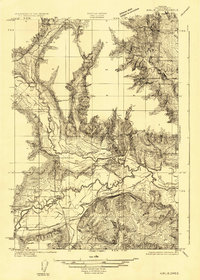
 1922 He Devil1922 Print · USGSThe Seven Devils Mountains of the early 1920s reveal a landscape of remote mining claims and high-elevation ranching camps. Researchers can locate historical sites like the Winchester Mine, Mc Gaffees Ranch, and Jacks Cabin.
 - 1922 Map of Monroe
 1922 Monroe1922 Print · USGSThe Willamette Valley’s southern reaches come to life in this survey from the decade after the Great War, showing the early infrastructure of Benton and Lane counties. Genealogists can trace family footprints across dozens of country schools like Winkle School and lost rail stops along the Southern Pacific line.4 unique versions available
 - 1922 Map of Preston Peak
 1922 Preston Peak1922 Print · USGSThe California-Oregon borderlands are mapped here just before the era of modern highway expansion, showing a network of remote river bars and mountain ranches. Trace the locations of early outposts like Gasquet Adams Sta, the Cleopatra Mine, and Terwer School.5 unique versions available
 - 1922 Map of St. Helens
 1922 St. Helens1922 Print · USGSThe Columbia River valley in the early twenties was a hub of logging and river commerce. Genealogists can trace family roots through old post offices like Yankton P.O. and Warren P.O. or locate historic industry at the Dupont Powder Co. site.
 - 1922 Map of Lebanon
 1922 Lebanon1922 Print · USGSLinn County during the early 1920s reveals a landscape of river-fed farms and burgeoning rail towns. Genealogists and historians can locate dozens of country schoolhouses like Cole School and family landmarks such as Ballins Mill and Miller Cemetery.
 - 1922 Map of Airlie
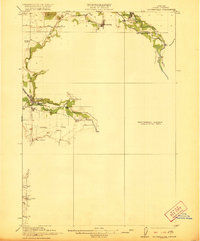
 1922 Airlie1922 Print · USGSPolk County at the conclusion of the First World War shows a landscape defined by the river valleys and emerging rail lines. Genealogists can trace family locations near Lewisville or identify local heritage at Antioch School and Simpson Siding.3 unique versions available
 - 1922 Map of Seiad
 1922 Seiad1922 Print · USGSSiskiyou County's rugged mining and timber country is captured here during the early twentieth century. Researchers can trace historic river crossings like Gordons Ferry, remote schools such as Nolton School, and active gold operations including the Siskiyou Mine.4 unique versions available
 - 1922 Map of Waldport
 1922 Waldport1922 Print · USGSCoastal Oregon at the end of the Great War era reveals a landscape of isolated bays and forest outposts. Genealogists and local historians can trace early settlements like Waldport and Sanlots, or locate the site of the rural Alder Grove School.2 unique versions available
 - 1922 Map of Elmira
 1922 Elmira1922 Print · USGSLane County's timber and rail landscape is caught in detail in the early 1920s, showcasing the development of rural communities and milling operations. Genealogists can locate family homesteads near numerous local institutions like Redonk School, Perkins Mill, and the many stations along the Oregon Electric line.3 unique versions available
 - 1923 Map of Reedsport
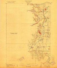
 1923 Reedsport1923 Print · USGSCoastal Oregon thrives in the 1920s as river commerce and rail lines connect the Umpqua estuary to the interior. Trace the old Southern Pacific line past Gardiner Sta or locate rural landmarks like Umpqua LH and Tenmile School.4 unique versions available
 - 1923 Map of Mount Angel
 1923 Mount Angel1923 Print · USGSMarion County in the early twenties is a landscape of thriving rail-towns and rural school districts connected by the Southern Pacific and Oregon Electric. Genealogists can trace early homesteads near Pioneers Cemetery or locate family roots at the US Indian School Chemawa and Belle Passi School.3 unique versions available
 - 1924 Map of Lebanon
 1924 Lebanon1924 Print · USGSLinn County agriculture and rail life are captured here in the early twenties as small communities flourished along the river forks. Researchers can trace the exact locations of many rural schoolhouses like Happy Home School and old mill sites such as Ballins Mill.3 unique versions available
 - 1924 Map of Mc Minnville
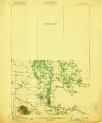
 1924 Mc Minnville1924 Print · USGSYamhill County in the mid-twenties shows a thriving landscape of rural schools and river-tied commerce. Researchers can locate family landmarks like Grub College, the Yamhill Locks, and old railroad stops at St Joseph or Whiteson.
 - 1924 Map of Mount Hood, 1955 Print
 1924 Mount Hood1955 Print · USGSMount Hood and its surrounding high-country settlements are captured here in the mid-twenties during the rise of mountain recreation. Trace early roads and landmarks like the Mt Hood Loop Highway, Government Camp, and the original Timberline Cabin.2 unique versions available
 - 1925 Map of Waldo Lake
 1925 Waldo Lake1925 Print · USGSThe High Cascades near the Lane and Klamath county line are shown here in the mid-1920s as a frontier of forestry and high-country ranching. Trace early landmarks like the State Fish Hatchery, the High Prairie School, and the remote Hills Ranch.4 unique versions available
 - 1925 Map of Stayton
 1925 Stayton1925 Print · USGSMarion County in the mid-1920s reveals a dense network of country schools and state institutions linked by the Southern Pacific railroad. Genealogists and historians can trace the foundations of local communities through landmarks like the State Training School, Victor Point School, and Willard Church.3 unique versions available
Showing maps 1-25 of 38
Top cities of Oregon
- Portland historical maps
- Eugene historical maps
- Salem historical maps
- Gresham historical maps
- Bend historical maps
- Hillsboro historical maps
See more
Top counties of Oregon
- Multnomah County historical maps
- Washington County historical maps
- Clackamas County historical maps
- Lane County historical maps
- Marion County historical maps
- Jackson County historical maps
See more
Frequently asked questions
- What are the different types of historical maps available for Oregon?
- What is the oldest map of Oregon?
- Where can I purchase historical maps of Oregon for my home or office?
- Where can I download high-res historical maps of Oregon?
- Are there historical topographic maps available for Oregon?
- Is there historical aerial imagery available for Oregon?
- Where are historical maps of Oregon sourced from?