1990s Maps of Oregon
Explore 907 historic maps of Oregon from the 1990s. These maps offer a rare glimpse into what life looked like during the 1990s — showing old roads, neighborhoods, homes, and landmarks that have changed or disappeared over time.
Whether you're researching your family's past, planning a metal detecting trip, or studying how Oregon's landscape evolved across the 1990s, these high-resolution maps are a powerful tool for exploring the history of this region.
- Focus on a specific era: All maps on this page are from the 1990s, giving you a focused view of this time period.
- See what’s changed: Compare century-old streets, trails, and buildings to today's modern landscape using overlays and satellite layers.
- Research with precision: Use these maps for genealogy, historical research, land use analysis, or educational projects.
- View, download, or print: Maps are fully viewable online in high resolution, and can be downloaded or printed for your own records.
Start exploring Oregon's history through authentic maps from the 1990s. This is your window into the past.
Oregon maps
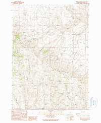
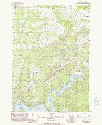
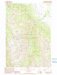
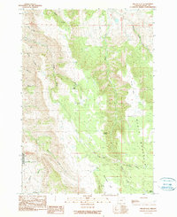
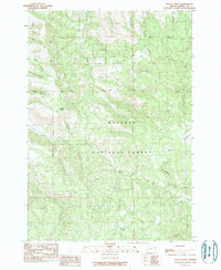
(907)- 1990 Map of Mormon Basin
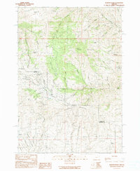 1990 Mormon Basin1990 Print · USGSThe Baker and Malheur county line runs through this rugged mining district as it appeared in the late twentieth century. Genealogists and historians can locate former settlements at Amelia and Miller, or trace old workings at the Sunday Hill Mine.
 - 1990 Map of Lostine
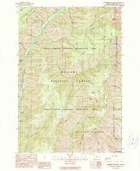
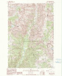
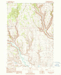
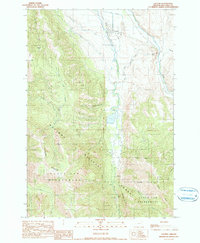 1990 Lostine1990 Print · USGSLostine and the Wallowa Valley in the late twentieth century show a landscape defined by the balance of mountain wilderness and valley irrigation. Genealogists and local historians can trace the paths of the Poley Allen Ditch, the riverside Gaging Station, and the Pole Bridge Picnic Area.
 - 1990 Map of Rabbit Mountain
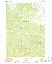
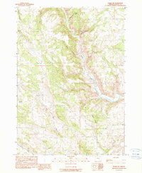
 1990 Rabbit Mountain1990 Print · USGSDouglas County’s rugged interior is documented here in the late twentieth century as timber and mining roads crisscross the ridges. Researchers can identify former habitation points like Cow Creek (Site) and Brandt (Site) or trace the winding course of the West Fork.
 - 1990 Map of Big Mowich Mountain
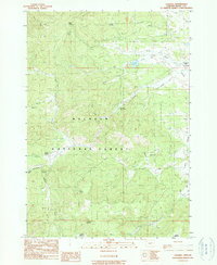
 1990 Big Mowich Mountain1990 Print · USGSHarney and Grant counties meet in this 1990 survey of the high forest country before modern digital mapping changed the look of the landscape. Researchers can trace family-named sites like Harris Ranch or Allison Ranch and locate remote landmarks such as the Allison Guard Sta and Stinking Spring.
 - 1990 Map of Donaldson Creek
 1990 Donaldson Creek1990 Print · USGSThe high country of Grant County is captured here in the late 1980s, centered on the wooded slopes of the Malheur National Forest. Researchers can locate the Pismire Camp (Site) and trace water sources from Sagebrush Spring to the headwaters of Donaldson Creek.
 - 1990 Map of Brady Creek
 1990 Brady Creek1990 Print · USGSMalheur County’s high country is captured here in the late twentieth century, showing a landscape of remote ranching and essential water sources. You can trace early land use through named features like Juniper Mtn Ranch, Homestead Spring, and the Upper Buckbrush Reservoir.
 - 1990 Map of Ninemile Slough
 1990 Ninemile Slough1990 Print · USGSThe high desert of eastern Oregon's basin country comes into focus in the early nineties, revealing a landscape of water management and cattle ranching. Researchers can trace the winding course of Ninemile Slough and locate dozens of infrastructure features like Check Dams and a prominent Spoil Bank.
 - 1990 Map of Puderbaugh Ridge
 1990 Puderbaugh Ridge1990 Print · USGSWallowa County's high forest and canyon country are captured here in the late twentieth century, showing a landscape shaped by the Imnaha River. Researchers can locate old backcountry landmarks like the Mc Graw Lookout, P O Saddle, and the Borrow Pit.
 - 1990 Map of Remote
 1990 Remote1990 Print · USGSCoos County as it appeared in the 1990s was a landscape defined by the winding Middle Fork Coquille River and its timbered ridges. Researchers can locate family landmarks like the Enchanted Prairie Cemetery or trace early roads near Remote and Plum Prairie.
 - 1990 Map of Eagle Rock
 1990 Eagle Rock1990 Print · USGSThe Crooked River valley and its surrounding high desert plateaus are captured here in the 1990s. Researchers can trace land use through the Prineville Reservoir State Park, the Boa Ramp, and family-named drainages like Sanford Creek.
 - 1990 Map of Krag Peak
 1990 Krag Peak1990 Print · USGSIn the high Wallowa Mountains during the late twentieth century, this survey tracks a wilderness landscape at the intersection of three counties. Hikers and historians can trace the Cliff Creek Trail and locate remote landmarks like the Bradley Creek Mine and Lookingglass Lake.2 unique versions available
 - 1990 Map of Logdell
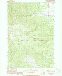
 1990 Logdell1990 Print · USGSGrant County's high forest country is captured here during the 1980s, centered on the ranching and forestry outposts of Bear Valley. Genealogists and historians can trace family-named landmarks like Sproul Ranch and isolated sites such as Logdell (Site).
 - 1990 Map of Monument
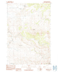
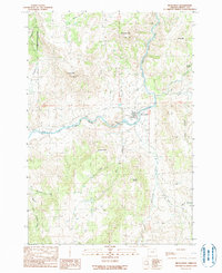 1990 Monument1990 Print · USGSMonument and the surrounding high-desert river valleys are captured here as they appeared in the 1990s. Researchers can trace the rural infrastructure of the North Fork John Day River and find landmarks like Hell Fire Flat and the Lookout Tower.
 - 1990 Map of Deadman Point
 1990 Deadman Point1990 Print · USGSThe high backcountry of Baker and Wallowa Counties is captured here in the early 1990s, where national forest boundaries and wilderness areas intersect. Researchers can trace alpine water routes like Buchanan Ditch and locate landmarks such as Imnaha Falls and Twin Lakes.
 - 1990 Map of Chief Joseph Mtn
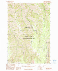
 1990 Chief Joseph Mtn1990 Print · USGSThe high Wallowa backcountry and its rugged mining history are preserved in this 1990 survey. Trace the trails to high-altitude sites like Legore Mine and Miners Basin, or locate the Hurricane Grange and Hurricane Creek Campground near the valley edge.3 unique versions available
 - 1990 Map of Poison Creek
 1990 Poison Creek1990 Print · USGSHarney County's high-desert ranching country is captured here during the late twentieth century, showing the intricate water systems and remote homesteads. Researchers can trace land use at Thousand Spring Ranch or locate the Poison Creek (Site) and Fivemile Dam.
 - 1990 Map of Calamity Butte
 1990 Calamity Butte1990 Print · USGSHarney County's high forest and ranching country is captured here in the late twentieth century. Genealogists and local historians can trace family-named sites and remote outposts such as Wade Ranch, Jackknife Flat, and Calamity Butte.
 - 1990 Map of Burns NW
 1990 Burns NW1990 Print · USGSHarney County's high desert ranching landscape is captured here in the late twentieth century. Researchers can trace vital water sources and land divisions along the Silvies River, Skull Creek Reservoir, and family-named landmarks like Boone Canyon.
 - 1990 Map of Miller Flat
 1990 Miller Flat1990 Print · USGSHigh-country ranching and geologic history meet in this 1990s survey of the Grant County highlands. Researchers can trace remote campsites and water sources like Saddle Camp, Burnt Corral Springs, and the protected borders of the John Day Fossil Beds National Monument.
 - 1990 Map of Lookout Mountain
 1990 Lookout Mountain1990 Print · USGSThe high Ochoco Mountains are documented here in the early nineties, showing a landscape defined by timber, water, and mineral extraction. Trace the locations of the Amity Mine and Independent Mine or locate high-country water sources like Kemp Spring and Lookout Spring.
 - 1990 Map of Tubb Spring
 1990 Tubb Spring1990 Print · USGSWheeler County during the late twentieth century was a landscape of high plateaus and vital water sources. Genealogists and local historians can trace family-named landmarks like George Iremonger Spring and prominent terrain features such as Table Mountain and Waterman Flat.
 - 1990 Map of Imnaha
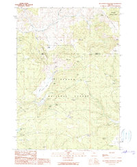
 1990 Imnaha1990 Print · USGSImnaha and the surrounding canyonlands appear in the late 1980s as a remote outpost of river-valley settlement and public forest land. Researchers can trace local landmarks like the Cem, the Gaging Station, and the winding route of Hat Point Road.
 - 1990 Map of Cedar Creek
 1990 Cedar Creek1990 Print · USGSThe Oregon Coast Range at the turn of the 1990s was a landscape of deep drainages and limited back-roads access. Researchers can trace the rugged intersection of the Williams River and Cedar Creek, or locate high points like Green Peak and the remote 4WD trails.
 - 1990 Map of Sleepy Ridge
 1990 Sleepy Ridge1990 Print · USGSWallowa County's high ridges and deep canyons are captured here as they appeared in the early 1990s. Researchers can locate the historic Haas Horse Troughs (Site) or trace the remote drainages of Windy Hell Canyon and Medicine Creek.
 - 1990 Map of Keeney Point
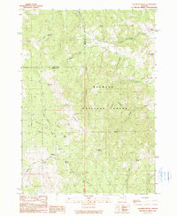
 1990 Keeney Point1990 Print · USGSGrant County, Oregon, in the late eighties and early nineties is captured here through its complex network of forest drainages and high ridges. Trace the routes between Keeney Camp Guard Station, Whisky Flat, and remote water sources like Federal Spring.
Showing maps 1-25 of 907
Top cities of Oregon
- Portland historical maps
- Eugene historical maps
- Salem historical maps
- Gresham historical maps
- Bend historical maps
- Hillsboro historical maps
See more
Top counties of Oregon
- Multnomah County historical maps
- Washington County historical maps
- Clackamas County historical maps
- Lane County historical maps
- Marion County historical maps
- Jackson County historical maps
See more
Frequently asked questions
- What are the different types of historical maps available for Oregon?
- What is the oldest map of Oregon?
- Where can I purchase historical maps of Oregon for my home or office?
- Where can I download high-res historical maps of Oregon?
- Are there historical topographic maps available for Oregon?
- Is there historical aerial imagery available for Oregon?
- Where are historical maps of Oregon sourced from?