1970s Maps of Oregon
Explore 321 historic maps of Oregon from the 1970s. These maps offer a rare glimpse into what life looked like during the 1970s — showing old roads, neighborhoods, homes, and landmarks that have changed or disappeared over time.
Whether you're researching your family's past, planning a metal detecting trip, or studying how Oregon's landscape evolved across the 1970s, these high-resolution maps are a powerful tool for exploring the history of this region.
- Focus on a specific era: All maps on this page are from the 1970s, giving you a focused view of this time period.
- See what’s changed: Compare century-old streets, trails, and buildings to today's modern landscape using overlays and satellite layers.
- Research with precision: Use these maps for genealogy, historical research, land use analysis, or educational projects.
- View, download, or print: Maps are fully viewable online in high resolution, and can be downloaded or printed for your own records.
Start exploring Oregon's history through authentic maps from the 1970s. This is your window into the past.
Oregon maps
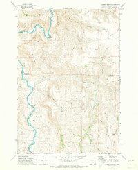
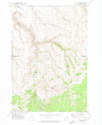
(321)- 1970 Map of Albany, 1972 Print
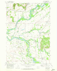
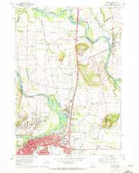 1970 Albany1972 Print · USGSThe Albany and Jefferson corridor in the early seventies shows a landscape defined by the WILLAMETTE RIVER and major rail lines. Genealogists can trace family roots through numerous sites like Waverly Cemetery, Dever School, and Hale Butte.3 unique versions available
 - 1970 Map of Monmouth, 1972 Print
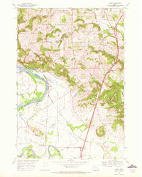
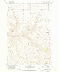
 1970 Monmouth1972 Print · USGSThe Willamette Valley comes alive in the early seventies, showing the established campus of Oregon College of Education and the riverfront at Independence. Genealogists and historians can trace the Southern Pacific tracks, local schools like Talmadge Jr High Sch, and riverside points including Wigrich Landing.2 unique versions available
 - 1970 Map of Alderdale, 1972 Print
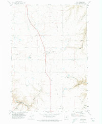
 1970 Alderdale1972 Print · USGSThe Columbia River corridor comes alive in the early seventies as a hub of rail activity and industrial transit. Trace the riverbank routes of the Union Pacific and Burlington Northern near Alderdale and Golgotha Butte.
 - 1970 Map of Lewisburg, 1972 Print
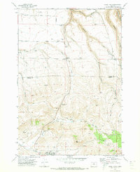
 1970 Lewisburg1972 Print · USGSBenton County's mid-century landscape is preserved here as it transitioned from a military center to a game management area. Genealogists can locate Gingles Cem and Locke Cem, or trace the tracks of the Southern Pacific and Oregon Electric railroads.3 unique versions available
 - 1970 Map of Crabtree, 1972 Print
 1970 Crabtree1972 Print · USGSThe Santiam River valley in the early seventies shows a landscape defined by its waterways and rail connections. Local researchers can trace old road networks like Old Sucker Road and find landmarks such as the Riverview Community Hall and several Covered Bridge crossings.2 unique versions available
 - 1970 Map of Sidney, 1972 Print
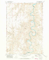
 1970 Sidney1972 Print · USGSMarion County south of Salem is shown here in the early seventies as a rich agricultural and riparian landscape. Genealogists can locate family names and burial sites at Rosedale Cem and Looney Cem or trace the old Oregon Electric rail line through Talbot and Sidney.3 unique versions available
 - 1970 Map of Devils Backbone, 1973 Print
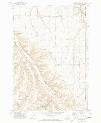
 1970 Devils Backbone1973 Print · USGSThe high canyon country of Gilliam County is captured here in the early 1970s, where the John Day River carves the county line. Genealogists and historians can trace old routes like Mikkalo Road to remote landmarks such as Potters Cem and the former site of Lewis.
 - 1970 Map of Bandon, 1973 Print
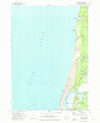
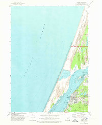
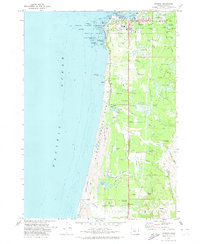 1970 Bandon1973 Print · USGSBandon and the Coos County coastline are captured here in the early seventies, a time when the local economy balanced maritime operations with extensive cranberry farming. Genealogists and local historians can locate the Knights of Pythias Cem, the Millard Sch, and family-named landmarks like Bradley Lake.2 unique versions available
 - 1970 Map of Wolf Hollow Falls, 1973 Print
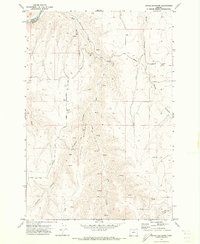
 1970 Wolf Hollow Falls1973 Print · USGSThe high desert of North Central Oregon is captured here in the early 1970s, showing a landscape defined by deep canyons and dryland farming. Researchers can locate the Earl Snell Birthplace Historical Monument, a remote Cem, and the namesake Wolf Hollow Falls.
 - 1970 Map of Bullards, 1973 Print
 1970 Bullards1973 Print · USGSThe Oregon coast at the start of the 1970s reveals a unique landscape where the Coquille River winds past Cranberry Bogs and the small community of Bullards. Researchers can trace local landmarks like Bullards Cem, the Bullards Bridge, and the shifting Sand Dunes near Whisky Run.
 - 1970 Map of Igo Butte, 1973 Print
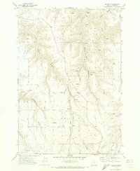 1970 Igo Butte1973 Print · USGSGilliam County ranchlands and high plateaus appear here as they were in the early 1970s. Researchers can locate the settlement of Alville, trace family history at Igo Cemetery, and follow canyon routes like Ferry Road.
 - 1970 Map of Schott Canyon, 1973 Print
 1970 Schott Canyon1973 Print · USGSGilliam County is captured in the early seventies, showcasing a high-desert landscape of wheat plateaus and deep canyons. Researchers can locate the Cameron School site and trace routes through landmarks like Shoestring Ridge and Thirtymile Creek.
 - 1970 Map of Chimney Springs, 1973 Print
 1970 Chimney Springs1973 Print · USGSThe high plateaus and canyons of the John Day country are captured here during the early seventies, when ranching life centered on remote outposts and spring-fed canyons. Researchers can trace land use at Buckhorn Ranch, locate the passage at Bills Pass, or find water sources like Duncan Spring.
 - 1970 Map of Flag Prairie, 1973 Print
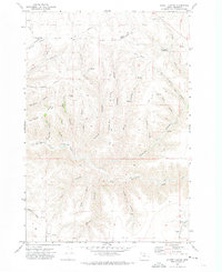
 1970 Flag Prairie1973 Print · USGSGrant and Harney County high country is shown here in the early seventies, a land of high-elevation meadows and national forest management. Researchers can trace forest history and livestock movements through sites like Crane Prairie Guard Station, North Fork Cow Camp, and Knox Meadow.
 - 1970 Map of Indian Cove, 1973 Print
 1970 Indian Cove1973 Print · USGSThe John Day River canyonlands along the Sherman and Gilliam county line are captured here in the early seventies. Researchers can trace the sinuous river curves through Indian Cove or locate remote water sources like Penny Spring and Hawkins Spring.
 - 1970 Map of Crescent, 1973 Print
 1970 Crescent1973 Print · USGSCentral Oregon in the early seventies reveals a landscape of volcanic peaks and timber outposts connected by the Southern Pacific rail line. Researchers can trace the layout of Christmas Valley, locate Cabin Lake Ranger Station, and explore the geological footprint of Newberry Crater.
 - 1970 Map of Condon, 1973 Print
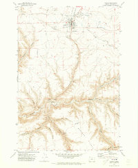 1970 Condon1973 Print · USGSThe high plateau of Gilliam County comes into focus in the early seventies, centered on the wheat-and-rail hub of Condon. Researchers can trace the Kinzua and Southern Railroad and locate significant local landmarks like Pictographs, the Masonic Cem, and Condon Airfield.2 unique versions available
 - 1970 Map of Salmon Fork, 1973 Print
 1970 Salmon Fork1973 Print · USGSThe Gilliam and Wheeler County borderlands are mapped here in the early 1970s, showcasing a landscape of timber and ranching history. Researchers can locate the Trail Fork School, identify family-named sites like Edwards, and trace the route of the Kinzua and Southern.
 - 1970 Map of Buckhorn Canyon, 1973 Print
 1970 Buckhorn Canyon1973 Print · USGSThe Gilliam and Wheeler County borderlands are captured here during the early 1970s, showcasing a landscape of isolated ranching outposts and deep canyons. Trace local heritage at the Cemetery or locate historic Pictographs and the northern Grain Elevator.
 - 1970 Map of Kent, 1973 Print
 1970 Kent1973 Print · USGSSherman County agriculture and transportation are captured here in the early 1970s, as the community centered around wheat storage and ranching. Genealogists and historians can trace the Old Railroad Grade past Kent and locate the IOOF Cem or the Decker Airstrip.
 - 1970 Map of Fossil North, 1973 Print
 1970 Fossil North1973 Print · USGSNorth of the Wheeler County seat in the early 1970s, the plateau gives way to the deep drainages of the John Day country. Researchers can locate the Mayville Cem, trace the winding Condon Kinzua & Southern railroad, and find local landmarks like Black Butte.
 - 1970 Map of Empire, 1973 Print
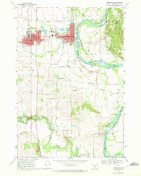
 1970 Empire1973 Print · USGSThe Coos Bay shoreline at the start of the 1970s reveals a landscape defined by industrial expansion and coastal preservation. Researchers can trace the layout of the Empire settlement, the campus of Southwestern Oregon Community College, and the sprawling North Spit.2 unique versions available
 - 1970 Map of Macken Canyon, 1973 Print
 1970 Macken Canyon1973 Print · USGSThe high desert plateaus along the Wasco and Sherman County line appear here in the early seventies, defined by deep canyons and seasonal springs. Researchers can trace the path of an Old Railroad Grade and locate agricultural landmarks like the lone Grain Elevator and Macken Springs.
 - 1970 Map of Shoestring Ridge, 1973 Print
 1970 Shoestring Ridge1973 Print · USGSThe high canyons and river breaks of north-central Oregon are documented here just as the 1970s began. Genealogists and local historians can trace the remote ranching landscape across Shoestring Ridge, identifying isolated landmarks like Schilling Spring and the Richmond Road.
 - 1970 Map of Rosebush, 1973 Print
 1970 Rosebush1973 Print · USGSSherman County wheat country is captured here during the early seventies, showing the small settlements and transport links of the plateau. Researchers can trace the Old Railroad Grade and locate local landmarks like the Bourbon Grain Elevator and Rutledge.
Showing maps 1-25 of 321
Top cities of Oregon
- Portland historical maps
- Eugene historical maps
- Salem historical maps
- Gresham historical maps
- Bend historical maps
- Hillsboro historical maps
See more
Top counties of Oregon
- Multnomah County historical maps
- Washington County historical maps
- Clackamas County historical maps
- Lane County historical maps
- Marion County historical maps
- Jackson County historical maps
See more
Frequently asked questions
- What are the different types of historical maps available for Oregon?
- What is the oldest map of Oregon?
- Where can I purchase historical maps of Oregon for my home or office?
- Where can I download high-res historical maps of Oregon?
- Are there historical topographic maps available for Oregon?
- Is there historical aerial imagery available for Oregon?
- Where are historical maps of Oregon sourced from?