1950s Maps of Oregon
Explore 319 historic maps of Oregon from the 1950s. These maps offer a rare glimpse into what life looked like during the 1950s — showing old roads, neighborhoods, homes, and landmarks that have changed or disappeared over time.
Whether you're researching your family's past, planning a metal detecting trip, or studying how Oregon's landscape evolved across the 1950s, these high-resolution maps are a powerful tool for exploring the history of this region.
- Focus on a specific era: All maps on this page are from the 1950s, giving you a focused view of this time period.
- See what’s changed: Compare century-old streets, trails, and buildings to today's modern landscape using overlays and satellite layers.
- Research with precision: Use these maps for genealogy, historical research, land use analysis, or educational projects.
- View, download, or print: Maps are fully viewable online in high resolution, and can be downloaded or printed for your own records.
Start exploring Oregon's history through authentic maps from the 1950s. This is your window into the past.
Oregon maps
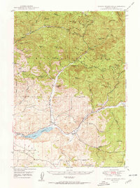
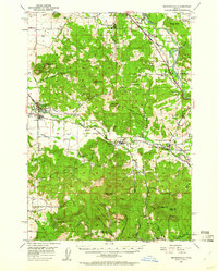
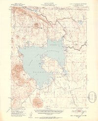
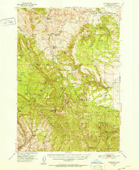
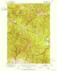
(319)- 1950 Map of Vancouver
 1950 Vancouver1950 Print · USGSCoastal Oregon and the lower Columbia River valley are captured in detail just after the war. Researchers can trace historic rail routes like the Southern Pacific or locate early settlements such as Vernonia, Gaston, and the Grand Ronde Indian Reservation.
 - 1950 Map of Weed
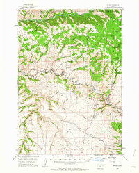
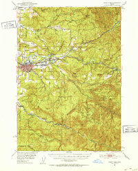
 1950 Weed1950 Print · USGSSiskiyou County and the surrounding Klamath mountains appear in the mid-century before extensive modern development. Genealogists and local historians can locate remote outposts like the Lee Brown Ranch and the specialized settlement of Darlingtonia.
 - 1950 Map of Ochoco Reservoir
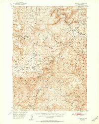
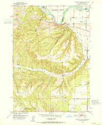
 1950 Ochoco Reservoir1950 Print · USGSCrook County at mid-century reveals a landscape of isolated forest lookouts and early ranching outposts within the Ochoco National Forest. Genealogists and local historians can trace legacy sites like the Keystone Ranch, Mill Cr Sch, and the distinctive Steins Pillar.4 unique versions available
 - 1950 Map of Vancouver, 1951 Print
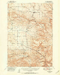
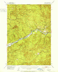
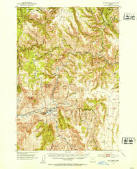
 1950 Vancouver1951 Print · USGSThe Pacific Northwest urban corridor meets the rugged coast in the years following the war, showing the expansion of Portland and Vancouver. Genealogists and historians can trace the reach of the Southern Pacific RR and locate coastal communities like Tillamook, Seaside, and Tolovana Park.
 - 1950 Map of Mt. Dome, 1952 Print
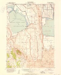 1950 Mt. Dome1952 Print · USGSUpper Klamath Basin life in the mid-century shows a landscape of reclamation and deep history at the Oregon-California border. Trace early ranching and water management at Chalk Bank Landing, the Winema Sch, and the Tulelake Tunnel.4 unique versions available
 - 1950 Map of Jamieson, 1952 Print
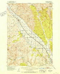 1950 Jamieson1952 Print · USGSEastern Oregon ranching and railroad life come into focus in the early fifties, following the path of the Union Pacific through Malheur County. Genealogists and historians can trace the irrigation networks of the Vale Main Canal and locate the Bully Creek School and Lancaster.3 unique versions available
 - 1950 Map of Marcola, 1955 Print
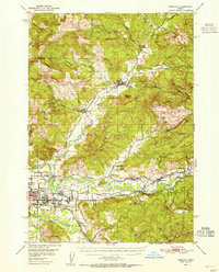 1950 Marcola1955 Print · USGSLane County in the early fifties shows a transition from timber-town economies to suburban growth near the McKenzie River. Researchers can locate family landmarks like the Camp Creek Cemetery, the Mohawk PO, and the rails of the Southern Pacific.2 unique versions available
 - 1950 Map of Brownsville, 1960 Print
 1950 Brownsville1960 Print · USGSLinn County agriculture and timber meet in the mid-1950s along the Calapooya River and South Santiam River. Genealogists and historians can trace the Oregon Electric line and locate sites like Union Point, Liberty Cem, and the Covered Bridge.3 unique versions available
 - 1950 Map of Ritter, 1964 Print
 1950 Ritter1964 Print · USGSThe river forks of Grant County are documented here mid-century, showing the isolated ranching and timber communities of the Blue Mountains. Genealogists and local historians can trace family-named landmarks like Ritter Cemetery, Threemile School, and the local Lumber Mill.2 unique versions available
 - 1951 Map of Copalis Beach
 1951 Copalis Beach1951 Print · USGSThe Olympic Peninsula's rugged coast and tribal lands are meticulously detailed in the early 1950s. Genealogists and historians can trace the foundations of coastal communities from Taholah to La Push or locate early markers like the James Island Lighthouse.
 - 1951 Map of Susanville
 1951 Susanville1951 Print · USGSThe Middle Fork of the John Day River corridor is shown here in the mid-twentieth century, at the meeting of two national forests. Genealogists and researchers can trace the roads and trails connecting Susanville, Galena, and the remote HiYu Guard Station.2 unique versions available
 - 1951 Map of Long Creek
 1951 Long Creek1951 Print · USGSMid-century Grant County is defined here by its high-altitude timber and mining operations within the Malheur National Forest. Researchers can locate early forest infrastructure like the Black Butte Lookout alongside local industry at the Fox Mill and Cohoe Mine.2 unique versions available
 - 1951 Map of Clear Lake Reservoir, 1952 Print
 1951 Clear Lake Reservoir1952 Print · USGSModoc County's high-desert basins and water systems are captured in the early fifties, just as the wildlife refuge and reservoir reached their modern configuration. Researchers can trace the historic Emigrant Trail or locate legacy ranching sites like McNeil Ranch and Chandler Ranch.5 unique versions available
 - 1951 Map of Sweet Home, 1952 Print
 1951 Sweet Home1952 Print · USGSLinn County’s timber and river corridors come alive in this early fifties survey of the Santiam valley. Genealogists and local historians can trace the Oregon Electric line and find old landmarks like the Berlin Cem, Sunnyside School, and the Hufford Bridge.4 unique versions available
 - 1951 Map of Moores Hollow, 1952 Print
 1951 Moores Hollow1952 Print · USGSThe high desert of Malheur County meets the winding Snake River in the early fifties, marking the border between Oregon and Idaho. Researchers can trace early irrigation networks like the Owyhee Canal and find family-named landmarks such as Jacobsen Gulch and McRea Island.4 unique versions available
 - 1951 Map of Leaburg, 1952 Print
 1951 Leaburg1952 Print · USGSThe McKenzie River corridor in the early fifties shows a landscape of hydroelectric progress and small riverside settlements. Genealogists and local historians can trace the foundations of Leaburg, Vida, and Deerhorn, or locate industrial landmarks like the Leaburg Power Plant and Leaburg Dam.4 unique versions available
 - 1951 Map of Malheur Butte, 1952 Print
 1951 Malheur Butte1952 Print · USGSEastern Oregon agriculture and infrastructure are captured here in the early fifties as irrigation transformed the high desert. Researchers can trace the development of rural social life and utility networks near Malheur Butte and the Ontario Heights Grange.4 unique versions available
 - 1951 Map of Courtrock, 1952 Print
 1951 Courtrock1952 Print · USGSSettlement and high-country ranching define this portion of central Oregon in the early fifties. Genealogists and historians can trace the foundations of the Hamilton community, locating the Courtrock school and landmarks like Courthouse Rock.3 unique versions available
 - 1951 Map of Moores Hollow, 1953 Print
 1951 Moores Hollow1953 Print · USGSThe Oregon-Idaho borderlands thrive on river-fed irrigation and rail transport in the early fifties. Genealogists can trace family footprints near Annex and Ontario Heights or locate the historic path of the Oregon Trail as it nears the Snake River.3 unique versions available
 - 1951 Map of Tulelake, 1953 Print
 1951 Tulelake1953 Print · USGSTule Lake and the Modoc plateau are captured in the early fifties during the height of the region's agricultural development. Genealogists and historians can trace the legacy of family ranching at Old Elliot Ranch or locate the historic Battle of Lands Ranch (Site) and Carr School.4 unique versions available
 - 1951 Map of Monument, 1953 Print
 1951 Monument1953 Print · USGSThe Grant and Morrow County borderlands in the early 1950s center on the vital confluence of the John Day River forks. Genealogists and historians can trace old homestead sites near the Top School (Aband) or explore the remote canyon reaches of Monument and Kimberly.3 unique versions available
 - 1951 Map of Lyons, 1953 Print
 1951 Lyons1953 Print · USGSThe North Santiam River valley and the cataracts of the Silver Creek watershed are captured here in the early 1950s. Genealogists and hikers can trace the original sites of Silver Falls City, the Fox Valley Cem, and the historic Couch Mansion.4 unique versions available
 - 1951 Map of Dale, 1953 Print
 1951 Dale1953 Print · USGSThe northern Blue Mountains come into focus in the 1950s, where the North Fork John Day River divides Grant and Umatilla counties. Researchers can trace the era's mining and forest service history through landmarks like the Keeney Mine, Dale Ranger Sta, and Peep Creek Camp.4 unique versions available
 - 1951 Map of Bates, 1953 Print
 1951 Bates1953 Print · USGSThe high country of Grant and Baker counties is captured here in the early fifties during a period of active mountain forestry and mining. Genealogists and historians can trace old claims like the Ben Harrison Mine and Standard Mine or locate the settlement at Bates.3 unique versions available
 - 1951 Map of Payette, 1953 Print
 1951 Payette1953 Print · USGSThe Snake River valley in the early fifties is captured here at the busy intersection of the Pacific Northwest's rail and river networks. Researchers can trace the Old Oregon Trail Highway or locate local landmarks like the Orchard Ave Grange Hall and Riverside Cemetery.3 unique versions available
Showing maps 1-25 of 319
Top cities of Oregon
- Portland historical maps
- Eugene historical maps
- Salem historical maps
- Gresham historical maps
- Bend historical maps
- Hillsboro historical maps
See more
Top counties of Oregon
- Multnomah County historical maps
- Washington County historical maps
- Clackamas County historical maps
- Lane County historical maps
- Marion County historical maps
- Jackson County historical maps
See more
Frequently asked questions
- What are the different types of historical maps available for Oregon?
- What is the oldest map of Oregon?
- Where can I purchase historical maps of Oregon for my home or office?
- Where can I download high-res historical maps of Oregon?
- Are there historical topographic maps available for Oregon?
- Is there historical aerial imagery available for Oregon?
- Where are historical maps of Oregon sourced from?