1980s Maps of Oregon
Explore 908 historic maps of Oregon from the 1980s. These maps offer a rare glimpse into what life looked like during the 1980s — showing old roads, neighborhoods, homes, and landmarks that have changed or disappeared over time.
Whether you're researching your family's past, planning a metal detecting trip, or studying how Oregon's landscape evolved across the 1980s, these high-resolution maps are a powerful tool for exploring the history of this region.
- Focus on a specific era: All maps on this page are from the 1980s, giving you a focused view of this time period.
- See what’s changed: Compare century-old streets, trails, and buildings to today's modern landscape using overlays and satellite layers.
- Research with precision: Use these maps for genealogy, historical research, land use analysis, or educational projects.
- View, download, or print: Maps are fully viewable online in high resolution, and can be downloaded or printed for your own records.
Start exploring Oregon's history through authentic maps from the 1980s. This is your window into the past.
Oregon maps
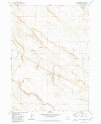
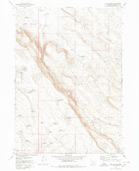
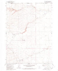
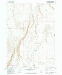
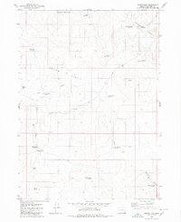
(908)- 1980 Map of Capehart Lake
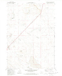 1980 Capehart Lake1980 Print · USGSHarney County's high desert is captured here in the early eighties, showcasing a remote landscape of volcanic buttes and seasonal basins. Trace the movement of early travelers and ranchers through Kellogg Waterhole, Lookout Butte, and the diagonal Jeep Trail.
 - 1980 Map of Brewster Reservoir
 1980 Brewster Reservoir1980 Print · USGSThe high-desert ranchlands along the Oregon-Idaho border are captured here in the 1970s, as the North Fork Owyhee River winds through deep canyons. Researchers can trace remote cattle operations like Brewster Ranch and Circle Bar Ranch or locate isolated water features like Mule Lake Reservoir.2 unique versions available
 - 1980 Map of Eugene
 1980 Eugene1980 Print · USGSThe southern Willamette Valley and Coast Range are captured in the early eighties as the urban centers of Eugene and Springfield expanded. Researchers can trace the legacy of family estates and regional infrastructure through landmarks like Mahlon Sweet Airport, Fern Ridge Lake, and Junction City.
 - 1980 Map of Odell Mountain
 1980 Odell Mountain1980 Print · USGSHumboldt County high country is documented here in the early eighties, showing the remote borderlands between Nevada and Oregon. Researchers can locate high-desert landmarks like the Quinn River Cabin, mountain Prospects, and essential water sources including Sheepherder Springs.
 - 1980 Map of Hughet Spring
 1980 Hughet Spring1980 Print · USGSHigh desert ranching and water management in Harney County are documented here in the late seventies. Researchers can trace the layout of essential water sources and landmarks like Buckaroo Flat, Stud Horse Reservoir, and Buzzard Canyon.
 - 1980 Map of Skull Creek
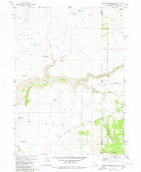
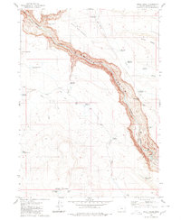 1980 Skull Creek1980 Print · USGSSoutheast Oregon’s high desert is defined by the deep incision of the river in the 1980s. Trace the path of the Owyhee River through Owyhee Canyon and locate family-named landmarks like Eiguren Reservoir and the Scotts Ditch irrigation line.
 - 1980 Map of Meadow Lake
 1980 Meadow Lake1980 Print · USGSHarney County's high desert rangeland is captured here in the early 1980s, showing a landscape shaped by the search for water. Trace the remote network of desert pools and seasonal catchments like Moon Lake, Alex Spring Reservoir, and the curiously named Deadmans Bedground.
 - 1980 Map of Three Forks
 1980 Three Forks1980 Print · USGSThe deep desert canyons of Malheur County are captured here at the start of the 1980s, centered on a major river confluence. Researchers can trace the rugged Military Grade and the Wes Hawkins Trail near the striking Three Forks Dome.2 unique versions available
 - 1980 Map of Twin Buttes
 1980 Twin Buttes1980 Print · USGSHarney County's high-desert ranching country is documented here in the early 1980s, revealing a landscape defined by critical water management. Trace named catchments like Long Canyon Reservoir and isolated outposts such as Mammoth Waterhole and Tooney Waterhole.
 - 1980 Map of Caviatta Ridge
 1980 Caviatta Ridge1980 Print · USGSHigh desert ranching and water management define this Malheur County landscape in the 1970s. Researchers can trace essential water sources and landmarks like Garlow Butte Spring, Mustang Water Hole, and Crows Nest Reservoir across the high ridges.
 - 1980 Map of Jackass Butte
 1980 Jackass Butte1980 Print · USGSIn the high desert of Malheur County during the late seventies, this survey shows a remote landscape defined by essential water sources and volcanic landmarks. Trace the distribution of water at Heber Ranch, Grafton Well, and the Bull Canyon Reservoir.
 - 1980 Map of Lunch Lake
 1980 Lunch Lake1980 Print · USGSHarney County's high-desert landscape is captured here in the early eighties, showing a network of canyons and seasonal basins. Researchers can locate the site of Ruins near the head of Buzzard Canyon and trace water features like Lunch Lake and Buckaroo Flat.
 - 1980 Map of Calico Butte
 1980 Calico Butte1980 Print · USGSThe Oregon-Nevada borderlands in the early eighties were defined by isolated ranching outposts and vital desert water sources. Researchers can trace the layout of Calico Ranch, locate the Caves, and follow the seasonal flows of Wild Bills Creek.2 unique versions available
 - 1980 Map of Squaw Butte
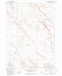
 1980 Squaw Butte1980 Print · USGSHigh-desert rangeland in Harney County is captured here during the 1980s, centered on federal research lands. Researchers and historians can trace water management and survey points across Squaw Butte, China Lake, and Papoose Lake.
 - 1980 Map of Wagontire Mtn West
 1980 Wagontire Mtn West1980 Print · USGSHigh desert ranching and observation stations define this 1980 survey of the Oregon interior at the border of Lake and Harney counties. Researchers can trace land use through remote water features like Peila Reservoir, Snookum Spring, and the high Lookout Tower on Wagontire Mtn.
 - 1980 Map of Juniper Point
 1980 Juniper Point1980 Print · USGSThe Oregon and Idaho borderlands are captured here in the 1980s, showcasing the intricate ranching infrastructure of this high desert region. Researchers can locate remote homesteads like Redmond Ranch and Dougal Ranch alongside named water features like Gartin Reservoir and Twin Lakes.
 - 1980 Map of Flybee Lake
 1980 Flybee Lake1980 Print · USGSHarney County's high desert landscape is captured here in the early eighties, showcasing a remote network of vital watering holes and canyons. Trace the path of a Jeep Trail as it connects Flybee Lake, Hole in Rocks, and Flynn Lake.
 - 1980 Map of Mahogany Spring
 1980 Mahogany Spring1980 Print · USGSThe high desert border between Nevada and Oregon is mapped here in the early eighties, showcasing the transition from the Calico Mountains to the southern Humboldt National Forest. Researchers can trace the drainage of the East Fork Quinn River and locate remote water sources like Owyhee Reservoir 3 and Mahogany Spring.
 - 1980 Map of Iron Mtn. Flat
 1980 Iron Mtn. Flat1980 Print · USGSHarney County's high desert landscape is captured here in the early 1980s, centered on the stark transition between volcanic uplands and seasonal alkali basins. Local historians can trace old livestock routes and water sources like Dead Bull Waterhole, Crane Spring, and the prominent Iron Mountain.
 - 1980 Map of Jackies Butte
 1980 Jackies Butte1980 Print · USGSSoutheast Oregon's high desert was a landscape of remote ranching and seasonal drainages during the 1970s. Trace the isolated water infrastructure and cattle territory of Beber Ranch while locating landmarks like Jackies Butte and the Bull Canyon Reservoir.
 - 1980 Map of Clover Flat
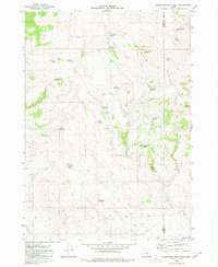
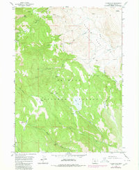 1980 Clover Flat1980 Print · USGSLake County, Oregon, is shown in the early eighties as a network of high-elevation meadows and vital water sources within the Fremont National Forest. Researchers can trace the drainages of Ben Young Creek and Bauers Creek or locate landmarks like O'Leary Reservoir and Moss Pass.
 - 1980 Map of Squaw Flat
 1980 Squaw Flat1980 Print · USGSHigh-desert grazing lands in eastern Oregon come into focus during the early 1980s, revealing a landscape shaped by ranching and water management. Researchers can trace remote livestock infrastructure like Coyote Wells, the Corral, and the Upper Horse Camp Res.
 - 1980 Map of Yamhill River
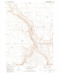
 1980 Yamhill River1980 Print · USGSThe Oregon Coast Range and the western Willamette Valley meet in this 1980 survey, showing the landscape from the Pacific shore to the valley floor. Genealogists and historians can trace old routes like the Salmon River Highway to find the Grand Ronde Agency, Cloverdale, and Perrydale.3 unique versions available
 - 1980 Map of Round Top Butte
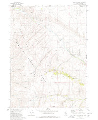
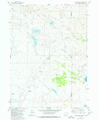
 1980 Round Top Butte1980 Print · USGSHigh-desert rangeland on the border of Lake and Harney Counties is captured in the late 1970s, showcasing a network of remote springs and reservoirs. Researchers can locate isolated homestead sites like Anderl Place and trace the drainage of Lost Creek toward the Sinks of Lost Creek.
 - 1980 Map of Alec Butte
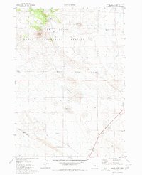
 1980 Alec Butte1980 Print · USGSHarney County's high-desert ranching country is captured here during the 1980s, showcasing a landscape defined by vital water resources and isolated outposts. Researchers can trace historic ranching infrastructure like the Old Peterson Ranch, Horseshoe Bar Reservoir, and Alec Butte.
Showing maps 1-25 of 908
Top cities of Oregon
- Portland historical maps
- Eugene historical maps
- Salem historical maps
- Gresham historical maps
- Bend historical maps
- Hillsboro historical maps
See more
Top counties of Oregon
- Multnomah County historical maps
- Washington County historical maps
- Clackamas County historical maps
- Lane County historical maps
- Marion County historical maps
- Jackson County historical maps
See more
Frequently asked questions
- What are the different types of historical maps available for Oregon?
- What is the oldest map of Oregon?
- Where can I purchase historical maps of Oregon for my home or office?
- Where can I download high-res historical maps of Oregon?
- Are there historical topographic maps available for Oregon?
- Is there historical aerial imagery available for Oregon?
- Where are historical maps of Oregon sourced from?