1960s Maps of Oregon
Explore 603 historic maps of Oregon from the 1960s. These maps offer a rare glimpse into what life looked like during the 1960s — showing old roads, neighborhoods, homes, and landmarks that have changed or disappeared over time.
Whether you're researching your family's past, planning a metal detecting trip, or studying how Oregon's landscape evolved across the 1960s, these high-resolution maps are a powerful tool for exploring the history of this region.
- Focus on a specific era: All maps on this page are from the 1960s, giving you a focused view of this time period.
- See what’s changed: Compare century-old streets, trails, and buildings to today's modern landscape using overlays and satellite layers.
- Research with precision: Use these maps for genealogy, historical research, land use analysis, or educational projects.
- View, download, or print: Maps are fully viewable online in high resolution, and can be downloaded or printed for your own records.
Start exploring Oregon's history through authentic maps from the 1960s. This is your window into the past.
Oregon maps
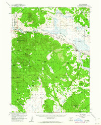
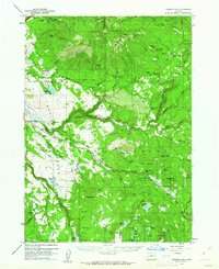
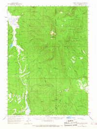
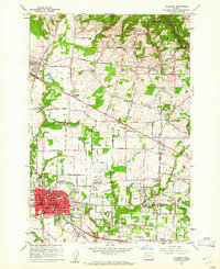
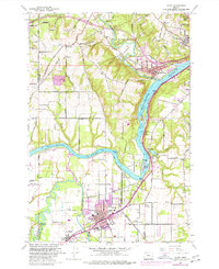
(603)- 1960 Map of Estacada
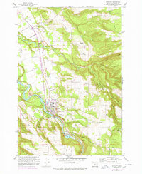 1960 Estacada1960 Print · USGSClackamas County communities and river-based industry thrive in the early 1960s along the Clackamas River. Genealogists and researchers can trace the Abandoned Railroad through Eagle Creek or locate the River Mill Powerhouse and Forrester Cem.
 - 1960 Map of Gerber Reservoir, 1961 Print
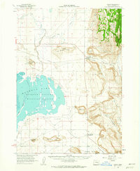
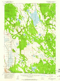 1960 Gerber Reservoir1961 Print · USGSKlamath County ranching and water management are at the forefront of this mid-century study of the high desert. Researchers can trace historic family holdings like the Noble Ranch and Antelope Ranch or follow the path of the Old Railroad Grade.2 unique versions available
 - 1960 Map of Riverbed Butte, 1961 Print
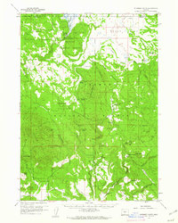 1960 Riverbed Butte1961 Print · USGSKlamath and Lake counties are shown here in the early sixties, highlighting a remote wilderness of high-desert forests and marshes. Researchers can trace historic family holdings and industrial traces such as McCartie Ranch, Obenchain Ranch, and an Old Logging Railroad.2 unique versions available
 - 1960 Map of Sycan Marsh, 1961 Print
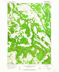
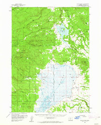 1960 Sycan Marsh1961 Print · USGSLake County ranching and timber lands are captured here during the early sixties, showing the vast Sycan Marsh before modern changes. Researchers can trace the Logging Railroad and locate established family holdings like Z X Ranch and Bratton Ranch.2 unique versions available
 - 1960 Map of Bly, 1961 Print
 1960 Bly1961 Print · USGSBly and the surrounding high-timber country of Klamath County are shown here at the start of the 1960s. Genealogists and historians can trace old homesteads like Vinson Ranch, find the Masekesket Cem, and follow the path of the Oregon California and Eastern Railroad.2 unique versions available
 - 1960 Map of Strawberry Butte, 1961 Print
 1960 Strawberry Butte1961 Print · USGSLake County ranching and forest service life are captured here at the start of the 1960s, spanning the border into California. Researchers can trace historic family-named outposts like Hunt Ranch and Reed Ranch, or locate forest infrastructure such as the Barnes Valley Guard Station and the Old Stage Road.2 unique versions available
 - 1960 Map of Beatty, 1961 Print
 1960 Beatty1961 Print · USGSKlamath County's high country and the Sprague River valley are documented here during a period of transition for the reservation and local rail industry. Researchers can trace historic sites like the Yainax Agency, Paiute Cem, and the Oregon California and Eastern Railroad line.3 unique versions available
 - 1960 Map of Fuego Mountain, 1962 Print
 1960 Fuego Mountain1962 Print · USGSUpper Klamath County is shown here in the early sixties, a landscape of high forests and sprawling meadows defined by the headwaters of the Sprague and Sycan rivers. Researchers can locate remote outposts like Yamsay Ranch and family-named landmarks such as Buckmaster Point and Teddy Powers Meadow.2 unique versions available
 - 1960 Map of Fishhole Mtn, 1962 Print
 1960 Fishhole Mtn1962 Print · USGSThe high timber and ranching country of southern Oregon is documented here during the early sixties, showing the transition from rail-based logging to forest management. Genealogists and researchers can find remote outposts like Swede Cabin, the Mitchell Monument, and ancient Indian Petroglyphs.2 unique versions available
 - 1960 Map of Crane, 1962 Print
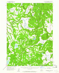
 1960 Crane1962 Print · USGSHarney County's high desert landscape comes alive in the early sixties, showing the vital relationship between the Union Pacific rail line and the vast Malheur Lake basin. Genealogists and historians can trace the foundations of Crane and New Princeton, while locating landmarks like Kruger Field and the Hot Springs.2 unique versions available
 - 1960 Map of Burns, 1962 Print
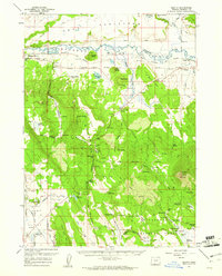
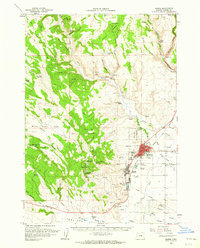 1960 Burns1962 Print · USGSHarney County's high desert hubs and surrounding cattle country are captured here just as the postwar era matured. Genealogists and local historians can locate family landmarks like the Peterson Ranch, trace the Northwestern Pacific rail line, or find early civic sites like the Union High Sch.
 - 1960 Map of Burns, 1962 Print
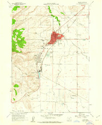 1960 Burns1962 Print · USGSThe Harney Basin communities of Burns and Hines are shown here in the early sixties at a peak of rail-driven and agricultural activity. Researchers can trace family history at the Burns Piute Cemetery or locate civic landmarks like the Grange Hall and the Experimental Station.2 unique versions available
 - 1960 Map of Salem, 1968 Print
 1960 Salem1968 Print · USGSThe Willamette Valley and the surrounding mountain ranges are shown here in the 1960s during a period of significant reservoir construction. Genealogists and historians can trace rail lines like the Oregon Electric and find communities from Lincoln City on the coast to Sweet Home and Mill City in the foothills.2 unique versions available
 - 1960 Map of Yamsay Mountain, 1968 Print
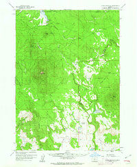
 1960 Yamsay Mountain1968 Print · USGSThe high timberlands of the Cascades transition into the Klamath Basin during the early 1960s. Researchers can locate remote legacy sites like Lamms Camp (Site) and trace early travel routes along the Old Indian Reservation Boundary Road.
 - 1961 Map of Newberg
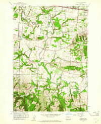
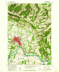 1961 Newberg1961 Print · USGSNewberg and the Willamette Valley are captured in the early sixties as agricultural roots met mid-century growth. Genealogists and historians can trace Ash Island, the Gearns Ferry (Site), and several pioneer-era cemeteries including Gibbs Cem.4 unique versions available
 - 1961 Map of Oregon City
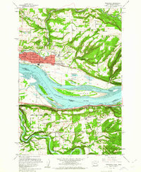
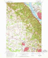
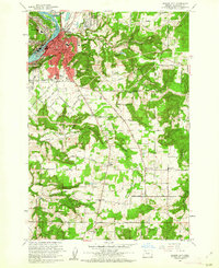 1961 Oregon City1961 Print · USGSOregon City and the Willamette River corridor are captured here in the early sixties as industrial rail networks and rural school districts still defined the local landscape. Genealogists can locate family landmarks from Mountain View Cemetery to Beaver Creek School and Fishers Corner.3 unique versions available
 - 1961 Map of Beaverton
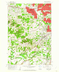 1961 Beaverton1961 Print · USGSBeaverton and Tigard are caught in a moment of post-war suburban expansion just as the rail-centered economy shifts toward the highway. Genealogists can locate family sites at Crescent Grove Cem or trace institutions like St Marys Boys Home and the Bernard Airport.5 unique versions available
 - 1961 Map of Hillsboro
 1961 Hillsboro1961 Print · USGSHillsboro and the Tualatin Valley are captured here in the early sixties as the rail-centered landscape began its suburban transformation. Genealogists and historians can trace family-named sites like the Joseph L Meek Land Claim, Tualatin Plains Cem, and the old community of Orenco.5 unique versions available
 - 1961 Map of Redland
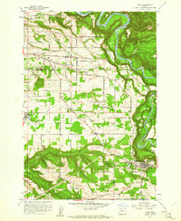
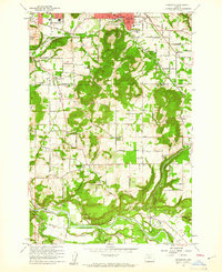
 1961 Redland1961 Print · USGSClackamas County was a patchwork of small farming communities and river landings in the early sixties. Genealogists can trace the rural school districts of Fir Grove Sch and Shubel Sch or locate the historic Fischers Mill and Feldheimer Ferry (Site).5 unique versions available
 - 1961 Map of Washougal
 1961 Washougal1961 Print · USGSThe Columbia River corridor in the early sixties serves as a busy junction for the rail-and-river economy between Washington and Oregon. Genealogists can trace family names at Sunnyside Cem or locate the Columbia Sch and Grange Hall near Corbett.4 unique versions available
 - 1961 Map of Sandy
 1961 Sandy1961 Print · USGSThe Clackamas and Multnomah County line during the early sixties shows a landscape of growing rural communities and deep river valleys. Genealogists and local historians can locate specific family-named roads and landmarks like Cottrell School, the Fish Hatchery, and the town of Boring.6 unique versions available
 - 1961 Map of Canby
 1961 Canby1961 Print · USGSThe riverfront communities south of Portland were thriving rail and water hubs in the early sixties. Researchers can trace family sites at the Robert Bird Cemetery or locate the historic Eccles Sch and New Era settlement along the Southern Pacific tracks.4 unique versions available
 - 1961 Map of Scholls
 1961 Scholls1961 Print · USGSWashington County agriculture and river-valley life are captured here in the early sixties, as the region maintained its rural character. Genealogists and historians can trace family-named sites like Mountainside Cem, Witch Hazel School, and the community of Scholls.5 unique versions available
 - 1961 Map of Damascus
 1961 Damascus1961 Print · USGSSoutheast of Portland in the early sixties, this area shows the suburban transition between Gresham and Boring. Genealogists and historians can locate the Sunnyside Church, trace the Portland Traction Co rail line, or find family-named landmarks like Walters Hill.4 unique versions available
 - 1961 Map of Linnton
 1961 Linnton1961 Print · USGSThe northern reaches of the Tualatin Valley and the Willamette riverfront meet here in the early sixties. Researchers can trace the expansion of suburban Cedar Mill and Aloha or locate historic sites like Union Cem and the St Johns Bridge.4 unique versions available
Showing maps 1-25 of 603
Top cities of Oregon
- Portland historical maps
- Eugene historical maps
- Salem historical maps
- Gresham historical maps
- Bend historical maps
- Hillsboro historical maps
See more
Top counties of Oregon
- Multnomah County historical maps
- Washington County historical maps
- Clackamas County historical maps
- Lane County historical maps
- Marion County historical maps
- Jackson County historical maps
See more
Frequently asked questions
- What are the different types of historical maps available for Oregon?
- What is the oldest map of Oregon?
- Where can I purchase historical maps of Oregon for my home or office?
- Where can I download high-res historical maps of Oregon?
- Are there historical topographic maps available for Oregon?
- Is there historical aerial imagery available for Oregon?
- Where are historical maps of Oregon sourced from?