1990s Maps of South Dakota
Explore 75 historic maps of South Dakota from the 1990s. These maps offer a rare glimpse into what life looked like during the 1990s — showing old roads, neighborhoods, homes, and landmarks that have changed or disappeared over time.
Whether you're researching your family's past, planning a metal detecting trip, or studying how South Dakota's landscape evolved across the 1990s, these high-resolution maps are a powerful tool for exploring the history of this region.
- Focus on a specific era: All maps on this page are from the 1990s, giving you a focused view of this time period.
- See what’s changed: Compare century-old streets, trails, and buildings to today's modern landscape using overlays and satellite layers.
- Research with precision: Use these maps for genealogy, historical research, land use analysis, or educational projects.
- View, download, or print: Maps are fully viewable online in high resolution, and can be downloaded or printed for your own records.
Start exploring South Dakota's history through authentic maps from the 1990s. This is your window into the past.
South Dakota maps
(75)- 1990 Map of Merriman NE
 1990 Merriman NE1990 Print · USGSThe Nebraska Sandhills come alive in this late twentieth-century record of the borderlands between Cherry County and South Dakota. Genealogists and local historians can trace legacy holdings like the Steve Moreland Ranch or the Quibble Ranch near Goose Lake.
 - 1990 Map of Merriman
 1990 Merriman1990 Print · USGSNorthern Nebraska's ranching country is documented here in the late twentieth century near the South Dakota border. Genealogists and historians can trace family landholdings like Sandoz Ranch and Gray Ranch or locate the Merriman town site.
 - 1990 Map of Irwin
 1990 Irwin1990 Print · USGSCherry County ranching country and the Nebraska-South Dakota border are captured here in the 1990s. Genealogists and historians can trace family-named outposts like Wiley Ranch and Irwin alongside hydrological landmarks such as Log Cabin Lake and Scott Meadow.
 - 1990 Map of Trumbull Lake
 1990 Trumbull Lake1990 Print · USGSThe ranching landscape of the Nebraska-South Dakota border is meticulously detailed in this late twentieth-century survey. Genealogists and historians can trace family-named homesteads such as Bear Creek Ranch and Skinner Ranch alongside water features like Trumbull Lake.
 - 1990 Map of Mitchell, 1991 Print
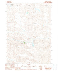
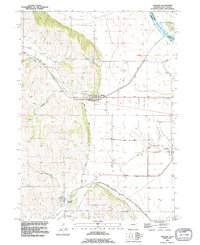
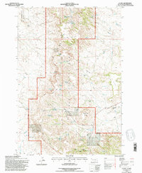
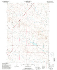
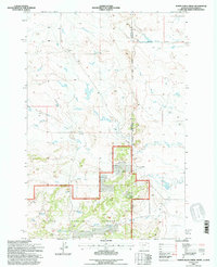
 1990 Mitchell1991 Print · USGSThe Missouri River and the surrounding South Dakota plains are captured here in the early nineties, showing a landscape shaped by water and wire. Genealogists and historians can trace the gridded townships from Mitchell to the Bijou Hills, locating sites like the Platte Colony and Academy.
 - 1993 Map of Hot Springs
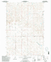
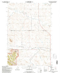
 1993 Hot Springs1993 Print · USGSThe southern Black Hills and Nebraska borderlands are captured here in the late twentieth century, showing a landscape of national forests and grasslands. You can trace the Black Hills Ordnance Depot near Igloo and follow the Burlington Northern rail lines through Edgemont.
 - 1993 Map of Sioux City South, 1995 Print
 1993 Sioux City South1995 Print · USGSThe Missouri River tri-state border region comes alive in the early nineties, showing the intersection of Iowa, Nebraska, and South Dakota. Trace community roots through St Michaels Cem, Salem Ch, and the streets of Dakota City.
 - 1993 Map of Bog Creek, 1995 Print
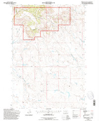
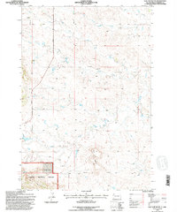
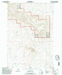
 1993 Bog Creek1995 Print · USGSHarding County in the early nineties shows a landscape of dramatic breaks and remote ranching infrastructure. Trace the rugged terrain of The Jumpoff or locate the headwaters of the South Fork Grand River and North Fork Moreau River.
 - 1993 Map of Jackson, 1995 Print
 1993 Jackson1995 Print · USGSDakota County, Nebraska, is captured here in the early nineties as the communities of Jackson and Hubbard thrived alongside the river bluffs. Researchers can trace family sites at St Johns Cem and St Marys Cem or locate old transit lines along the Old Grade and Knox Boulevard.
 - 1993 Map of Reva, 1996 Print
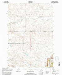
 1993 Reva1996 Print · USGSHarding County ranching country and the Slim Buttes region are captured here in the early nineties. Researchers can locate family landmarks like the Besler Ranch, the Reva Sch, and the historic site of the Battle of Slim Buttes.
 - 1993 Map of Ladner SE, 1996 Print
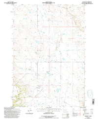
 1993 Ladner SE1996 Print · USGSHarding County ranchlands and forest reserves are captured here in the early nineties, showing a landscape defined by isolated homesteads and high plateaus. Researchers can locate family operations like the B Clarkson Ranch and trace water sources from Dry Creek Reservoir to Johnnys Pocket.
 - 1993 Map of Irish Butte, 1996 Print
 1993 Irish Butte1996 Print · USGSHarding County ranching life and the high ground of the Slim Buttes are preserved in this 1990s study. Researchers can trace the layout of the Guyer Sch, local ranch sites like Horton Ranch, and landmarks such as Adam and Eve Butte.
 - 1993 Map of Moreau Peak, 1996 Print
 1993 Moreau Peak1996 Print · USGSHarding County, South Dakota, is captured here in the early nineties, showing a landscape defined by the East Short Pine Hills. Researchers can trace old ranching boundaries and water sources like the Fox Ranch, Springs, and the lone Cem near the coulees.
 - 1993 Map of Ludlow, 1996 Print
 1993 Ludlow1996 Print · USGSHarding County ranching and forest lands are captured here during the 1990s as the regional landscape balanced conservation and resource use. Researchers can locate remote landmarks such as Ludlow Cave, the Rotten Burger Ranch, and numerous water sources like Picnic Spring.
 - 1993 Map of Hells Canyon, 1996 Print
 1993 Hells Canyon1996 Print · USGSHarding County ranching country and the breaks of the Moreau River are captured here in the early nineties. Researchers can trace land use and water rights through landmarks like the Dillon Ranch, the Ledger Dam, and the winding Cady Creek.
 - 1993 Map of J K Butte, 1996 Print
 1993 J K Butte1996 Print · USGSHarding County ranching and forest lands are captured in the early nineties as the region balanced conservation and local industry. Researchers can find homesteads like the Davis Ranch and trace the rugged elevations of the West Short Pine Hills and J K Butte.
 - 1993 Map of J B Hill, 1996 Print
 1993 J B Hill1996 Print · USGSHarding County ranching and the unique topography of the Slim Buttes are documented here during the early 1990s. Researchers can locate established homesteads like the G Wammen Ranch and trace the paths of Hoover Road and J B Pass Road.
 - 1993 Map of Flat Top Butte, 1996 Print
 1993 Flat Top Butte1996 Print · USGSHarding County ranching country is documented here in the early nineties, showing a landscape defined by the intersection of forest lands and high plains. Trace the geography of local holdings like Verhulst Ranch and landforms such as Flat Top Butte and Finger Butte.
 - 1993 Map of Ladner NE, 1996 Print
 1993 Ladner NE1996 Print · USGSThe North Dakota and South Dakota borderlands come alive in this early nineties survey of ranching country. Genealogists and historians can locate remote outposts like the Grand River Sch and Janvrin Ranch or trace old routes along Bullock Road.
 - 1993 Map of Harding, 1996 Print
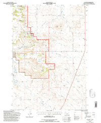
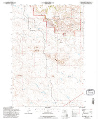
 1993 Harding1996 Print · USGSHarding and the northwestern plains of South Dakota appear here in the early nineties, just as the landscape was being revised via aerial study. You can trace the rural landmarks of the period, from the Brant School and Short Pine Cem to the terrain at The Jump Off.
 - 1993 Map of McKenzie Butte, 1996 Print
 1993 McKenzie Butte1996 Print · USGSHarding County rangelands are shown in the early nineties as a blend of federal forest land and private ranching interests. Researchers can trace remote homesteads like Butler Ranch, early extractive sites such as Hilton Mine, and natural landmarks like Penttila Butte.
 - 1993 Map of Sheep Mountain, 1996 Print
 1993 Sheep Mountain1996 Print · USGSHarding County ranching and forest lands are captured in the early nineties, revealing a landscape defined by vital water sources. Trace family-named landmarks and old routes like H Jensen, Marty Road, and the isolated Moonshine Spring.
 - 1993 Map of Hay Creek, 1996 Print
 1993 Hay Creek1996 Print · USGSHarding County ranching country is captured here during the 1990s, illustrating the essential relationship between the land and its seasonal waterways. Genealogists and researchers can trace the path of Harrison Road past the banks of Hay Creek and Jones Creek.
 - 1993 Map of Eagles Nest Butte, 1996 Print
 1993 Eagles Nest Butte1996 Print · USGSThe North Dakota and South Dakota borderlands come into focus in this late twentieth-century record of the high plains. Researchers can trace the ranching history of the area through landmarks like Feist Ranch, the Lone Tree Sch, and Eagles Nest Butte.
 - 1993 Map of North Slick Creek, 1996 Print
 1993 North Slick Creek1996 Print · USGSThe Montana and South Dakota borderlands meet in this late twentieth-century survey of the high plains. Genealogists and local historians can trace land use through the D Turbiville Ranch and water sources like Brown Jug Spring or the Section 21 Reservoir.
Showing maps 1-25 of 75
Top cities of South Dakota
- Sioux Falls historical maps
- Rapid City historical maps
- Aberdeen historical maps
- Watertown historical maps
- Brookings historical maps
- Mitchell historical maps
See more
Top counties of South Dakota
- Minnehaha County historical maps
- Pennington County historical maps
- Lincoln County historical maps
- Brown County historical maps
- Brookings County historical maps
- Codington County historical maps
See more
Frequently asked questions
- What are the different types of historical maps available for South Dakota?
- What is the oldest map of South Dakota?
- Where can I purchase historical maps of South Dakota for my home or office?
- Where can I download high-res historical maps of South Dakota?
- Are there historical topographic maps available for South Dakota?
- Is there historical aerial imagery available for South Dakota?
- Where are historical maps of South Dakota sourced from?