1960s Maps of South Dakota
Explore 370 historic maps of South Dakota from the 1960s. These maps offer a rare glimpse into what life looked like during the 1960s — showing old roads, neighborhoods, homes, and landmarks that have changed or disappeared over time.
Whether you're researching your family's past, planning a metal detecting trip, or studying how South Dakota's landscape evolved across the 1960s, these high-resolution maps are a powerful tool for exploring the history of this region.
- Focus on a specific era: All maps on this page are from the 1960s, giving you a focused view of this time period.
- See what’s changed: Compare century-old streets, trails, and buildings to today's modern landscape using overlays and satellite layers.
- Research with precision: Use these maps for genealogy, historical research, land use analysis, or educational projects.
- View, download, or print: Maps are fully viewable online in high resolution, and can be downloaded or printed for your own records.
Start exploring South Dakota's history through authentic maps from the 1960s. This is your window into the past.
South Dakota maps
(370)- 1960 Map of Conde SW, 1961 Print
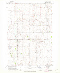
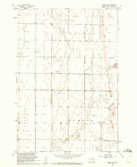 1960 Conde SW1961 Print · USGSSpink County’s rural townships are captured here in the early sixties as the Missouri River Basin development era shaped the plains. Researchers can locate the local Townhall, several Flowing Well sites, and the meandering path of Timber Creek.
 - 1960 Map of Aberdeen East, 1961 Print
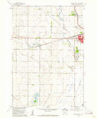
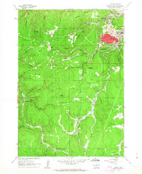
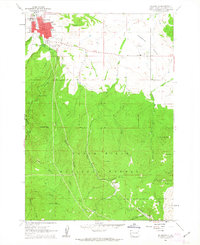
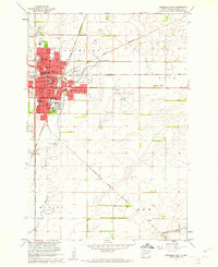 1960 Aberdeen East1961 Print · USGSAberdeen was a bustling South Dakota hub at the start of the sixties, where several major rail lines met the growing residential streets. Trace local genealogy and history at St Marys Cem, Presentation Heights College, and Northern State Teachers College.2 unique versions available
 - 1960 Map of Quinn Table NE, 1961 Print
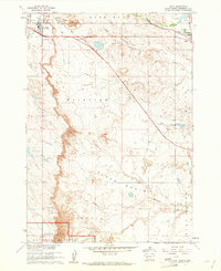
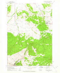
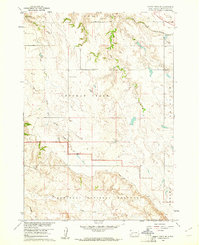 1960 Quinn Table NE1961 Print · USGSPennington County ranchlands meet the northern edge of the Badlands in the early sixties as the Missouri River Basin project progressed. Researchers can trace the path of the Chicago and North Western railroad or locate local landmarks like North Star Sch and the Microwave Tower.2 unique versions available
 - 1960 Map of Wall SE, 1961 Print
 1960 Wall SE1961 Print · USGSPennington and Jackson counties in the early sixties show a landscape defined by the sharp breaks of the Badlands. Researchers can locate community centers like Big Foot Sch and Big Foot Ch or trace the trails through Big Foot Pass.
 - 1960 Map of Brentford SE, 1961 Print
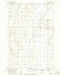
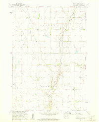 1960 Brentford SE1961 Print · USGSSpink County, South Dakota, is captured here in the early sixties as the Missouri River Basin development program shaped the rural landscape. Genealogists and local historians can trace family roots at Baldwin Cem, locate the local Townhall, and follow the winding path of Dry Run.
 - 1960 Map of Aberdeen West, 1961 Print
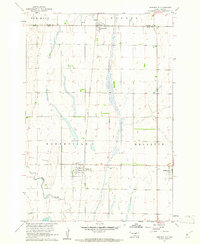
 1960 Aberdeen West1961 Print · USGSAberdeen in the early sixties was a bustling rail hub where major prairie lines converged near the growing city center. Researchers can trace local landmarks like Riverside Cemetery, find neighborhood schools such as Lincoln Sch, and locate the mid-century Drive-in Theater.3 unique versions available
 - 1960 Map of Wall, 1961 Print
 1960 Wall1961 Print · USGSPennington County at the start of the 1960s reveals a landscape shaped by the transition from the prairie into the northern reaches of the Badlands National Monument. Researchers can trace the rail corridor of the Chicago and North Western through Wall and Quinn.2 unique versions available
 - 1960 Map of Rudolph, 1961 Print
 1960 Rudolph1961 Print · USGSThe rural prairie of Brown County comes into focus in the early sixties, centered on the rail-side settlement of Rudolph. Genealogists can trace family landmarks and school districts like St John Sch, Sunshine Sch, and the Warner Cem.2 unique versions available
 - 1960 Map of Northville, 1961 Print
 1960 Northville1961 Print · USGSThe Spink County prairie in the early sixties was defined by rail-centered trade and vast section-line farmsteads. Researchers can trace the Chicago and North Western line through Northville and Mellette, or locate family sites near Fairview Cem.
 - 1960 Map of Turton, 1962 Print
 1960 Turton1962 Print · USGSThe Spink County prairie comes into focus during the early sixties, centered on the rail-side settlement of Turton. Genealogists and researchers can trace the old Chicago and North Western line and locate local landmarks like the Flowing Well.2 unique versions available
 - 1960 Map of Cottonwood SW, 1962 Print
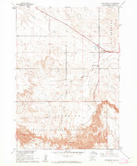 1960 Cottonwood SW1962 Print · USGSJackson County, South Dakota, is captured in the early sixties as the northern prairie descends into the dramatic erosion of Badlands National Monument. Researchers can locate Cactus Flats, the ridge of Big Foot Hill, and the remote Jeep Trail.2 unique versions available
 - 1960 Map of Quinn Table SE, 1962 Print
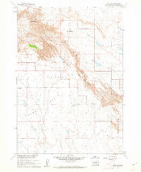
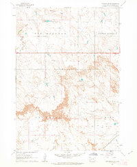
 1960 Quinn Table SE1962 Print · USGSPennington County during the early sixties shows the dramatic transition between the high tables and eroded basins of the Badlands National Monument. Researchers can trace the path of Sage Creek Pass and find the location of a solitary Grave and the settlement of Imlay.
 - 1960 Map of Wall SW, 1962 Print
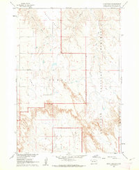
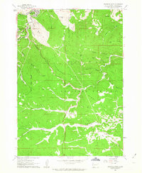
 1960 Wall SW1962 Print · USGSPennington County reveals its dramatic geography in the early sixties as the federal government managed these protected lands. Trace the descent through Dillon Pass and identify mid-century landmarks like Dillon Campground and The Pinnacles.2 unique versions available
 - 1960 Map of Athol, 1962 Print
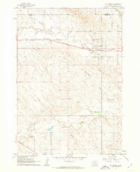
 1960 Athol1962 Print · USGSSpink County agriculture and rail life are centered here in the early sixties, as the prairie landscape borders the winding Snake Creek. Genealogists and local historians can trace the Chicago and North Western rail line and locate St Marys Cem and the settlement of Athol.
 - 1960 Map of Quinn Table SW, 1962 Print
 1960 Quinn Table SW1962 Print · USGSPennington County in the early sixties shows the striking contrast between high plateau ranching and the eroded breaks of the badlands. Researchers can locate the Jobgen Sch and trace the early boundaries of Badlands National Monument near Quinn Table.2 unique versions available
 - 1961 Map of Cottonwood
 1961 Cottonwood1961 Print · USGSCottonwood and the surrounding prairie are captured in the early sixties as the railroad still anchored the local economy. Genealogists and historians can trace family-named landmarks like Ackerman Hill or locate the Hi-Way Sch and Cottonwood Cem.2 unique versions available
 - 1961 Map of Maurice, 1962 Print
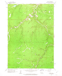
 1961 Maurice1962 Print · USGSThe Black Hills northwest of Spearfish were a rugged nexus of early transport and water management in the early sixties. Genealogists and historians can trace the routes of Tollgate Road and Sawmill Road or locate the settlement at Maurice near Bridal Veil Falls.5 unique versions available
 - 1961 Map of Cottonwood NE, 1963 Print
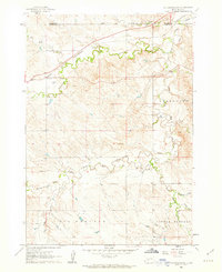 1961 Cottonwood NE1963 Print · USGSThe high prairie of Jackson County was a land of winding creek beds and remote rail sidings in the early sixties. You can trace the path of the CHICAGO AND NORTH WESTERN railroad and locate rural landmarks like Fairview Sch and the Landing Strip.2 unique versions available
 - 1961 Map of Wall NE, 1963 Print
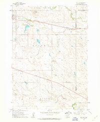 1961 Wall NE1963 Print · USGSThe town of Quinn and the surrounding ranchlands are documented here in the early 1960s at the intersection of three counties. Genealogists and local historians can trace landmarks like Mt Hope Cem, the Cottonwood Sch, and the Chicago and North Western railroad.2 unique versions available
 - 1961 Map of Lead, 1963 Print
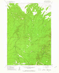
 1961 Lead1963 Print · USGSThe Black Hills mining district comes alive in the early 1960s as extraction operations and mountain settlements define the landscape. Researchers can trace the rail lines of the Burlington and Quincy through Terraville or locate family roots near Englewood Cemetery and Trojan.3 unique versions available
 - 1961 Map of Savoy, 1963 Print
 1961 Savoy1963 Print · USGSDeep in the Black Hills during the early sixties, this survey captures a landscape defined by dramatic waterfalls and high plateaus. Researchers can trace the layout of Savoy, find the Cemetery near Preston, or locate the Little Spearfish Guard Station.4 unique versions available
 - 1961 Map of Cottonwood SE, 1963 Print
 1961 Cottonwood SE1963 Print · USGSJackson County ranching and rail infrastructure are captured here in the early sixties as the landscape supported a hardy local economy. Researchers can trace the Milwaukee Road tracks and locate livestock water sources like Arke Dam and Martin Dam.2 unique versions available
 - 1961 Map of Deadwood South, 1963 Print
 1961 Deadwood South1963 Print · USGSThe Black Hills gold country comes into sharp focus during the early 1960s, showing the intersection of mining history and modern recreation. Trace family ties and land use near Deadwood, the Chicago Burlington and Quincy rails, and the mining camp at Galena.5 unique versions available
 - 1961 Map of Deadwood North, 1963 Print
 1961 Deadwood North1963 Print · USGSNorthern Lawrence County in the early sixties reveals a landscape shaped by mining and rail history. Trace the legacy of the Old West through Deadwood landmarks like the Seth Bullock Grave, Mt Moriah Cem, and the old Crook City site.4 unique versions available
 - 1961 Map of Spearfish, 1963 Print
 1961 Spearfish1963 Print · USGSSpearfish and the northern Black Hills are captured here in the early sixties, showing a landscape of college town growth and forested backcountry. Trace local history through the Black Hills Teachers College campus or find the Mount Theodore Roosevelt Monument and Maitland settlement.6 unique versions available
Showing maps 1-25 of 370
Top cities of South Dakota
- Sioux Falls historical maps
- Rapid City historical maps
- Aberdeen historical maps
- Watertown historical maps
- Brookings historical maps
- Mitchell historical maps
See more
Top counties of South Dakota
- Minnehaha County historical maps
- Pennington County historical maps
- Lincoln County historical maps
- Brown County historical maps
- Brookings County historical maps
- Codington County historical maps
See more
Frequently asked questions
- What are the different types of historical maps available for South Dakota?
- What is the oldest map of South Dakota?
- Where can I purchase historical maps of South Dakota for my home or office?
- Where can I download high-res historical maps of South Dakota?
- Are there historical topographic maps available for South Dakota?
- Is there historical aerial imagery available for South Dakota?
- Where are historical maps of South Dakota sourced from?