2000s (21st Century) Maps of Clallam County, Washington
Explore 60 historic maps of Clallam County from the 2000s (21st Century). These maps offer a rare glimpse into what life looked like during the 2000s — showing old roads, neighborhoods, homes, and landmarks that have changed or disappeared over time.
Whether you're researching your family's past, planning a metal detecting trip, or studying how Clallam County's landscape evolved across the 2000s, these high-resolution maps are a powerful tool for exploring the history of this region.
- Focus on a specific era: All maps on this page are from the 2000s, giving you a focused view of this time period.
- See what’s changed: Compare century-old streets, trails, and buildings to today's modern landscape using overlays and satellite layers.
- Research with precision: Use these maps for genealogy, historical research, land use analysis, or educational projects.
- View, download, or print: Maps are fully viewable online in high resolution, and can be downloaded or printed for your own records.
Start exploring Clallam County's history through authentic maps from the 2000s. This is your window into the past.
Clallam County, WA maps
(60)- 2002 Map of Hunger Mountain, 2006 Print
 2002 Hunger Mountain2006 Print · USGSThe Okanogan National Forest mountains and the Methow Valley are shown here in the early 2000s, reflecting decades of land management and surveying. Researchers can trace historic mineral extraction at various prospects or locate the Bear Creek Camp and Rest Area along the river corridor.
 - 2023 Map of Forks, 2023 Print
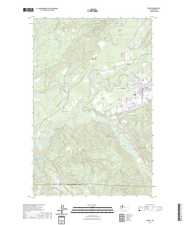 2023 Forks2023 Print · USGSThe Olympic Peninsula town of Forks is shown in 2023 at the confluence of several major rivers. Researchers can trace the layout of Forks Prairie, the Forks Airport, and high points like Grader Creek Hill.
 - 2023 Map of Mount Zion, 2023 Print
 2023 Mount Zion2023 Print · USGSThe Olympic Peninsula’s high country is captured here in the early twenty-first century, showing the protected Buckhorn Wilderness and surrounding forest. Trace old routes through Bon Jon Pass and along the Pacific Northwest National Scenic Trl over Dirty Face Ridge.
 - 2023 Map of Reade Hill, 2023 Print
 2023 Reade Hill2023 Print · USGSThe western Olympic Peninsula is captured here in the early twenty-first century, centered on the growing community of Forks and the surrounding river valleys. Researchers can trace the layout of Forks Prairie, the Forks Cem, and various forest routes like Sitkum Solduc Rd.
 - 2023 Map of Indian Pass, 2023 Print
 2023 Indian Pass2023 Print · USGSThe Olympic Peninsula wilderness comes into sharp focus in this recent survey of high-country river systems and protected lands. Trace the remote path of the Pacific Northwest National Scenic Trl through the Olympic Wilderness and along the Sitkum River.
 - 2023 Map of Mount Queets, 2023 Print
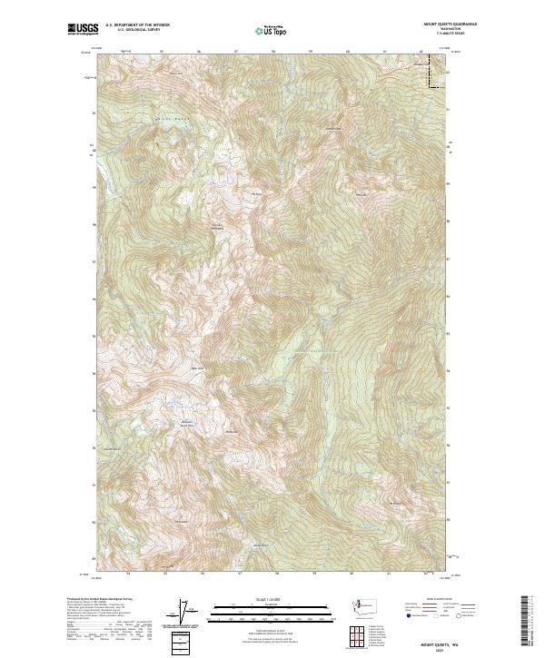 2023 Mount Queets2023 Print · USGSJefferson County's high wilderness is captured in this modern survey, showing the glacial headwaters and mountain ranges as they exist today. Researchers can trace remote routes like the Dodger Point Primitive Trl and locate landmarks such as Queets Glacier and Cream Lake.
 - 2023 Map of Hunger Mountain, 2023 Print
 2023 Hunger Mountain2023 Print · USGSThe high backcountry of the Olympic Peninsula is documented here in the early twenty-first century, showcasing a landscape of protected wilderness and deep river valleys. Trace the paths of the Pacific Northwest National Scenic Trl or find landmarks like Hunger Mtn and Rugged Ridge.
 - 2023 Map of Twin Rivers, 2023 Print
 2023 Twin Rivers2023 Print · USGSThe Clallam County coast and the northern Olympic Peninsula are captured in this 2023 survey. Trace the waterfront at Twin or follow the inland paths of the West Twin River and East Twin River into the Olympic National Forest.
 - 2023 Map of Hoko Falls, 2023 Print
 2023 Hoko Falls2023 Print · USGSThe timberlands of Clallam County are captured in this modern survey of the Olympic Peninsula's northwest corner. Trace the winding Hoko River through the foothills near Old Royal and across the slopes of Sekiu Mtn and Stolzenburg Mtn.
 - 2023 Map of Angeles Point, 2023 Print
 2023 Angeles Point2023 Print · USGSThe Olympic Peninsula coast comes into focus here, where the Elwha River reaches the Salish Sea. Researchers can trace the community layout of Lower Elwha, find family plots at Ocean View Cem, or locate the William R Fairchild International Airport.
 - 2023 Map of Gunderson Mountain, 2023 Print
 2023 Gunderson Mountain2023 Print · USGSThe Sol Duc Valley and the settlement of Shuwah are captured here in the early twenty-first century as the river winds through the Olympic foothills. Researchers can trace the local road network around Maxfield Prairie or locate landmarks like Dickey Lake and Gunderson Mtn.
 - 2023 Map of Sekiu River, 2023 Print
 2023 Sekiu River2023 Print · USGSThe rugged Olympic Peninsula coastline and the Sekiu River watershed are documented here in the early twenty-first century. Topography enthusiasts and researchers can trace the course of North Fork Sekiu River and locate coastal landmarks like Shipwreck Point and Chito Beach.
 - 2023 Map of Disque, 2023 Print
 2023 Disque2023 Print · USGSCoastal Clallam County meets the Salish Sea in this contemporary overview of the Olympic Peninsula shoreline. Researchers can trace the path of the Lyre River and locate the rural settlements of Disque and Shadow.
 - 2023 Map of Lake Sutherland, 2023 Print
 2023 Lake Sutherland2023 Print · USGSThe Olympic Peninsula shoreline and high interior peaks are detailed in this 2023 study. Trace the lakeside communities of Maple Grove and Snug Harbor or explore the wilderness trails leading to Mt Storm King and Happy Lake.
 - 2023 Map of Ediz Hook, 2023 Print
 2023 Ediz Hook2023 Print · USGSPort Angeles and its protected harbor are documented here in the early twenty-first century, featuring the prominent natural spit of Ediz Hook. Maritime researchers can trace the Port Angeles Ferry route and locate the Port Angeles Coast Guard Air Station.
 - 2023 Map of Lake Crescent, 2023 Print
 2023 Lake Crescent2023 Print · USGSThe glacial waters of the Olympic Peninsula appear here in high detail during the early twenty-first century. Researchers can trace the historic Spruce Railroad Trl and locate old lakeside landings at Piedmont, Ovington, and Barnes Point.
 - 2023 Map of Waadah Island, 2023 Print
 2023 Waadah Island2023 Print · USGSCoastal Washington at the edge of the strait is documented in this recent survey of the entrance to the bay. Researchers can trace the shoreline of Waadah Island and Waadah Point as they stand against the waters of the Salish Sea.
 - 2023 Map of Joyce, 2023 Print
 2023 Joyce2023 Print · USGSThe northern Olympic Peninsula coast comes to life in this recent study of the shoreline between Crescent Bay and Freshwater Bay. Researchers can locate the Port Crescent Pioneer Memorial Cem and trace rural routes through Joyce and Coville.
 - 2023 Map of Strait of Juan de Fuca (All Water), 2023 Print
 2023 Strait of Juan de Fuca (All Water)2023 Print · USGSThe northern waters of Clallam County are documented in this contemporary hydrographic survey. Researchers and maritime historians can trace the expanse of the Salish Sea off the Washington coast.
 - 2023 Map of Dungeness OE E, 2023 Print
 2023 Dungeness OE E2023 Print · USGSThe northern coast of the Olympic Peninsula comes into focus in this contemporary survey of the Clallam County shoreline. Researchers can trace coastal settlement patterns from Dungeness to Jamestown and locate local aviation landmarks like Rucilla's Roost Airport.
 - 2023 Map of Slip Point, 2023 Print
 2023 Slip Point2023 Print · USGSCoastal Clallam County meets the Salish Sea in this modern survey of the Olympic Peninsula's northern shore. Maritime researchers and local historians can trace the contemporary shoreline and the land boundaries of T32N R12W as they appear today.
 - 2023 Map of Dungeness, 2023 Print
 2023 Dungeness2023 Print · USGSCoastal Clallam County meets the Salish Sea in this recent survey of the Olympic Peninsula's northern edge. Local historians can trace the foundations of the area at Old Town, locate the Dungeness Cem, and explore the reaches of the Dungeness Spit.
 - 2023 Map of Port Angeles, 2023 Print
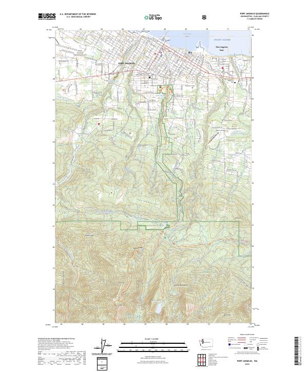 2023 Port Angeles2023 Print · USGSPort Angeles and its neighboring shoreline meet the foothills of the Olympic Mountains in this recent survey. Researchers can trace local landmarks from the Clallam County Courthouse to high-country features like Lake Angeles and Wildcat Mtn.
 - 2023 Map of Carlsborg, 2023 Print
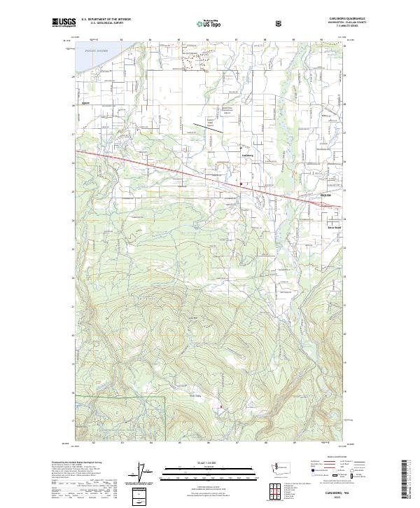 2023 Carlsborg2023 Print · USGSCoastal lowlands meet the northern Olympic foothills in this detailed recent survey of the Olympic Peninsula. Researchers can trace land use around Sequim, the winding course of the Dungeness River, and the ascent toward Lost Mtn.
 - 2023 Map of Sequim, 2023 Print
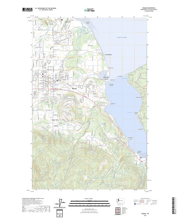 2023 Sequim2023 Print · USGSThe Sequim Prairie and the shores of Sequim Bay are captured in this recent survey, showcasing the area's mix of tribal lands and coastal settlements. Genealogists and historians can trace local sites like the S'Klallam Tribe Cem, Port Williams, and Saint Lukes Episcopal Church Columbarium.
Showing maps 1-25 of 60
Top cities of Clallam County
- Port Angeles historical maps
- Sequim historical maps
- Forks historical maps
- Neah Bay historical maps
- Clallam Bay historical maps
- Blyn historical maps
See more
Frequently asked questions
- What are the different types of historical maps available for Clallam County?
- What is the oldest map of Clallam County?
- Where can I purchase historical maps of Clallam County for my home or office?
- Where can I download high-res historical maps of Clallam County?
- Are there historical topographic maps available for Clallam County?
- Is there historical aerial imagery available for Clallam County?
- Where are historical maps of Clallam County sourced from?