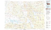
1990s Maps of Teton County, Wyoming
Explore 55 historic maps of Teton County from the 1990s. These maps offer a rare glimpse into what life looked like during the 1990s — showing old roads, neighborhoods, homes, and landmarks that have changed or disappeared over time.
Whether you're researching your family's past, planning a metal detecting trip, or studying how Teton County's landscape evolved across the 1990s, these high-resolution maps are a powerful tool for exploring the history of this region.
- Focus on a specific era: All maps on this page are from the 1990s, giving you a focused view of this time period.
- See what’s changed: Compare century-old streets, trails, and buildings to today's modern landscape using overlays and satellite layers.
- Research with precision: Use these maps for genealogy, historical research, land use analysis, or educational projects.
- View, download, or print: Maps are fully viewable online in high resolution, and can be downloaded or printed for your own records.
Start exploring Teton County's history through authentic maps from the 1990s. This is your window into the past.
Teton County, WY maps
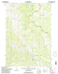
(55)- 1991 Map of Sylvan Lake, 1996 Print
 1991 Sylvan Lake1996 Print · USGSYellowstone's backcountry peaks and geothermal basins are mapped here in the early nineties as the park environment was being carefully documented. Hikers and historians can trace the Thorofare Trail along the Southeast Arm Yellowstone Lake or locate remote Thermal Areas near Brimstone Basin.2 unique versions available
 - 1991 Map of Sheridan Pass, 1997 Print
 1991 Sheridan Pass1997 Print · USGSThe high Wind River Range comes into focus during the early nineties, centered on the strategic Sheridan Pass. Researchers can trace the path of the Continental Divide and locate remote landmarks like the Hunting Camp and Buckskin Point.
 - 1991 Map of Lava Mountain, 1997 Print
 1991 Lava Mountain1997 Print · USGSThe Continental Divide serves as the backbone of this high-country survey in the early nineties, where the Teton and Shoshone forests meet. Researchers can trace historic access routes like the Sheridan Trail or locate remote landmarks like Brooks Lake Lodge and Lava Mountain.
 - 1991 Map of Togwotee Pass, 1997 Print
 1991 Togwotee Pass1997 Print · USGSHigh in the Wyoming Rockies during the early nineties, the Continental Divide splits the headwaters of the Wind River and the Buffalo Fork. Trace the old trails and backcountry routes through Togwotee Pass to the alpine shores of Brooks Lake and Upper Jade Lake.
 - 1993 Map of Hebgen Lake
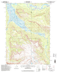
 1993 Hebgen Lake1993 Print · USGSThe high mountain passes and vast river basins of the Montana-Idaho border come into focus in the early nineties. Genealogists and historians can trace the remote settlement of Lakeview and the development of West Yellowstone near the Red Rock Lakes National Wildlife Refuge.2 unique versions available
 - 1996 Map of Whetstone Mountain, 1998 Print
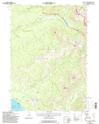
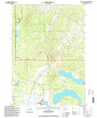
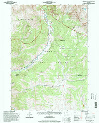
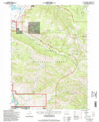
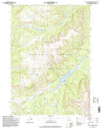
 1996 Whetstone Mountain1998 Print · USGSTeton County, Wyoming, is shown in the mid-1990s as a managed wilderness at the junction of two national parks and a national forest. Researchers can trace the boundaries of the National Buffalo Range or locate the Pacific Creek Ranger Station and early irrigation features like the Two Ocean Ditches.
 - 1996 Map of Snake Hot Springs, 1998 Print
 1996 Snake Hot Springs1998 Print · USGSThe southern reaches of Yellowstone and the Teton Wilderness are captured here in the mid-nineties, documenting the remote intersection of the park and national forest. Backcountry researchers can trace the routes around Heart Lake, the isolated Ranger Station, and the geothermal waters of Snake Hot Springs.
 - 1996 Map of Two Ocean Lake, 1998 Print
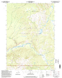
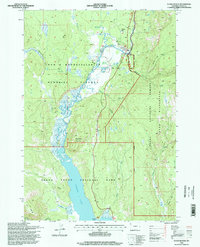
 1996 Two Ocean Lake1998 Print · USGSJackson Lake and its surrounding wilderness are captured in the late 1990s as the area's tourism and conservation infrastructure matured. Hikers and historians can trace the established routes of the Two Ocean Lake Trail and locate landmarks like Jackson Lake Lodge and Pilgrim Mountain.
 - 1996 Map of Granite Falls, 1998 Print
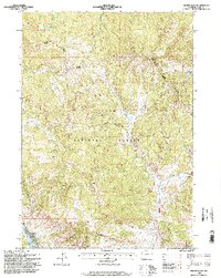
 1996 Granite Falls1998 Print · USGSTeton and Sublette counties are captured here in the mid-1990s, showcasing a wild landscape managed for both recreation and resource extraction. Researchers can locate Granite Hot Springs, the remote Oil Well, and back-country Corrals along the water.
 - 1996 Map of Palisades Peak, 1998 Print
 1996 Palisades Peak1998 Print · USGSThe high peaks of the Idaho and Wyoming border are documented here in the mid-1990s, showcasing the management and topography of the Targhee National Forest. Researchers can trace remote trails and landmarks like the Ice Cave, Mosquito Pass, and the shoreline of Upper Palisades Lake.
 - 1996 Map of Mount Leidy, 1998 Print
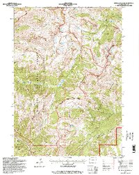
 1996 Mount Leidy1998 Print · USGSThe Teton National Forest backcountry comes into focus in the mid-nineties, showing a landscape managed for wilderness and seasonal use. Researchers can trace remote infrastructure like the Landing Strip and Hunting Camp alongside landmarks like Mount Leidy and the Gros Ventre River.
 - 1996 Map of Rendezvous Peak, 1998 Print
 1996 Rendezvous Peak1998 Print · USGSThe Teton high country is captured here in the mid-nineties, showing the intersection of park, forest, and wilderness protections. Hikers and historians can trace the Teton Crest Trail past Rendezvous Peak or locate the Patrol Cabin and Ski Lake.2 unique versions available
 - 1996 Map of Upper Slide Lake, 1998 Print
 1996 Upper Slide Lake1998 Print · USGSTeton County during the mid-nineties shows a landscape of high wilderness and mountain drainage. Researchers can trace the rugged topography around Goose Lake and the path of Lightning Creek through the forest.
 - 1996 Map of Cache Creek, 1998 Print
 1996 Cache Creek1998 Print · USGSTeton County was a landscape of high-mountain wilderness and conservation at the close of the twentieth century. Researchers can trace the development of Jackson and locate historic mining sites such as the Jackson Mine and Noker Mine near the peaks of the Gros Ventre Range.
 - 1996 Map of Jackson, 1998 Print
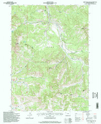
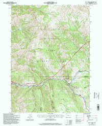
 1996 Jackson1998 Print · USGSJackson and the Snake River valley appear here in the mid-1990s as the region's ranching roots met modern growth. Researchers can trace land use from Elk Refuge and Wilson to local landmarks like Aspen Hill Cemetery and the Melody Ranch.
 - 1996 Map of Camp Davis, 1998 Print
 1996 Camp Davis1998 Print · USGSThe confluence of the Snake and Hoback Rivers comes alive in the mid-nineties, showing the intersection of forest life and canyon ranching. Genealogists and historians can trace family-named sites like Broken Arrow Ranch, Lafayette Station, and Camp Davis.
 - 1996 Map of Turquoise Lake, 1998 Print
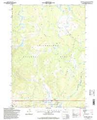
 1996 Turquoise Lake1998 Print · USGSThe Gros Ventre Range in the late nineties is a landscape of high summits and seasonal camps. Outdoor historians can trace the Highline trail past Turquoise Lake and locate remote outposts like the Ski Cabin and Hunting Camp near Blackrock Creek.2 unique versions available
 - 1996 Map of Two Ocean Pass, 1998 Print
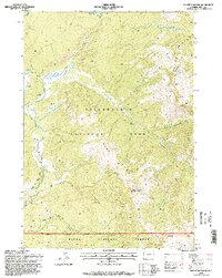
 1996 Two Ocean Pass1998 Print · USGSThe Teton backcountry in the mid-1990s remains a wilderness of divided waters where the Continental Divide crosses the high Two Ocean Plateau. Researchers can trace remote alpine trails and water routes through Two Ocean Pass, including Atlantic-Pacific Creek and the headwaters of the Snake River.
 - 1996 Map of Green Mountain, 1998 Print
 1996 Green Mountain1998 Print · USGSTeton National Forest remains a managed wilderness in the late nineties, defined by high peaks and remote ranger districts. Researchers can trace the minimal human footprint through seasonal sites like Cow Camp and the Corral, or locate secluded water bodies such as Hidden Lake.
 - 1996 Map of Crooked Creek, 1998 Print
 1996 Crooked Creek1998 Print · USGSYellowstone's southern boundary and the Teton high country are mapped here in the mid-1990s. Researchers can trace the Continental Divide and find remote landmarks like the Fox Creek Patrol Cabin and the Two Ocean Plateau Trail.
 - 1996 Map of Mount Hancock, 1998 Print
 1996 Mount Hancock1998 Print · USGSThe Teton Wilderness and the southern reaches of Yellowstone are captured in the late nineties, documenting a landscape defined by the Continental Divide. Backcountry researchers can trace the Heart Lake Trail to the Harebell Patrol Cabin or the geothermal activity near Heart Lake.
 - 1996 Map of Flagg Ranch, 1998 Print
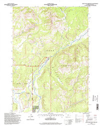
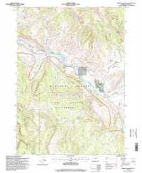
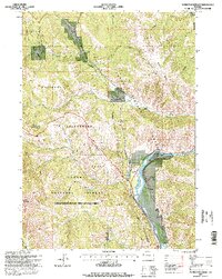
 1996 Flagg Ranch1998 Print · USGSThe northern gateway to the Tetons is captured here in the mid-1990s as the Snake River corridor hummed with seasonal activity. Researchers can trace the development of Flagg Ranch, locate Huckleberry Hot Springs, and study the shoreline of Jackson Lake.
 - 1996 Map of Bull Creek, 1998 Print
 1996 Bull Creek1998 Print · USGSThe Teton backcountry in the late twentieth century reveals a landscape of high peaks and protected wilderness near the Teton-Sublette county line. Researchers can trace the river corridor and mountain access points through Camp Davis, the Hoback Shield Trail, and Battle Mountain.
 - 1996 Map of Yellowstone Point, 1998 Print
 1996 Yellowstone Point1998 Print · USGSThe Teton backcountry in the mid-1990s is captured here, showing the remote high country before modern shifts in wilderness management. Researchers can trace the Thorofare Trail past the Hawks Rest Patrol Cabin and down the Yellowstone River.
 - 1996 Map of Munger Mountain, 1998 Print
 1996 Munger Mountain1998 Print · USGSThe Snake River corridor and the Teton and Lincoln county lines are captured here in the late nineties. Researchers can locate Astoria Mineral Hot Springs, the settlement of Hoback, and remote landmarks like the Rock Quarry or Red Top Meadows.
Showing maps 1-25 of 55
Top cities of Teton County
Frequently asked questions
- What are the different types of historical maps available for Teton County?
- What is the oldest map of Teton County?
- Where can I purchase historical maps of Teton County for my home or office?
- Where can I download high-res historical maps of Teton County?
- Are there historical topographic maps available for Teton County?
- Is there historical aerial imagery available for Teton County?
- Where are historical maps of Teton County sourced from?