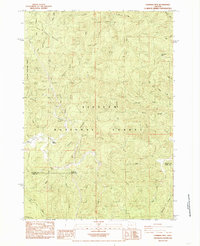
1984 Map of Cannibal Mtn
USGS Topo · Published 1985About this map
The Yachats River basin winds through the heart of the Siuslaw National Forest in this mid-1980s coastal range survey. This region is defined by its network of steep ridges and drainages, including Burnt Timber Mountain, Cannibal Mtn, and Seits Ridge, which separate various forks of the river system. Local heritage markers are concentrated along the river corridor, such as the River Covered Bridge and the Yachats Grange. The map documents a landscape focused on conservation and natural resource management, indicated by the presence of a Fish Ladder near Upper Yachats and the Keller Creek Picnic Ground. The boundary between Lincoln and Lane Counties cuts across the southern portion of the quadrangle, illustrating the rugged jurisdictional divide that follows the terrain of Cape Ridge and Malcom Ridge.
Find a feature on this map
41 named features on this map. Tap any name to fly to it.
Don’t see what you’re looking for? This feature index may not catch every label — zoom into the map to look around manually.
Map Details
Editions of this 1984 Cannibal Mtn Map
This is the sole edition of this map. No revisions or reprints were ever made.
Other maps of this area

1918 · Mapleton
USGS Topo · 1:48,000

1920 · Heceta Head
USGS Topo · 1:62,500

1922 · Waldport
USGS Topo · 1:62,500

1940 · Mapleton
USGS Topo · 1:62,500

1942 · Waldport
USGS Topo · 1:62,500

1942 · Heceta Head
USGS Topo · 1:62,500

1942 · Tidewater
USGS Topo · 1:62,500

1945 · Mapleton
USGS Topo · 1:62,500

1953 · Salem
USGS Topo · 1:250,000

1954 · Salem
USGS Topo · 1:250,000