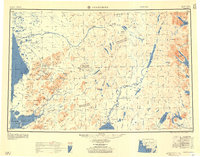
1951 Map of Goodnews
USGS Topo · Published 1958About this map
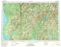
Kuskokwim Bay and the interconnected waters of Southwest Alaska define this mid-century survey, which reveals the complex hydrography of the Tikchik Lakes and Wood River Mountains before extensive modern development. The mapping shows established coastal settlements such as Quinhagak and Togiak Village alongside the more interior Kashiagamiut, reflecting the traditional reliance on riverine and maritime access in the region.
Find a feature on this map
90 named features on this map. Tap any name to fly to it.
Don’t see what you’re looking for? This feature index may not catch every label — zoom into the map to look around manually.
Map Details
Editions of this 1951 Goodnews Map
6 editions found

Other maps of this area

1945 · Nushagak Bay
USGS Topo · 1:250,000

1947 · Hagemeister Island D-2
USGS Topo · 1:63,360

1948 · Hagemeister Island D-3
USGS Topo · 1:63,360

1948 · Nushagak Bay D-4
USGS Topo · 1:63,360

1948 · Nushagak Bay D-3
USGS Topo · 1:63,360

1949 · Nushagak Bay
USGS Topo · 1:250,000

1950 · Bethel
USGS Topo · 1:250,000

1950 · Nushagak Bay D-5
USGS Topo · 1:63,360

1950 · Nushagak Bay D-6
USGS Topo · 1:63,360

1950 · Hagemeister Island D-6
USGS Topo · 1:63,360