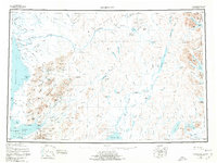
1951 Map of Goodnews
USGS Topo · Published 1974About this map
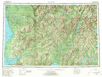
The Kanektok River and Kukaktlik River define the intricate drainage of this southwestern Alaska region during the mid-20th century. Established settlements such as Quinhagak and Goodnews sit along the coast of the Kuskokwim and Goodnews Bays, serving as hubs for the local fishing and subsistence economy. Further south, the mining town of Platinum marks a point of industrial activity near Puyulik Mtn.
Find a feature on this map
107 named features on this map. Tap any name to fly to it.
Don’t see what you’re looking for? This feature index may not catch every label — zoom into the map to look around manually.
Map Details
Editions of this 1951 Goodnews Map
6 editions found

Other maps of this area

1945 · Nushagak Bay
USGS Topo · 1:250,000

1947 · Hagemeister Island D-2
USGS Topo · 1:63,360

1948 · Hagemeister Island D-3
USGS Topo · 1:63,360

1948 · Nushagak Bay D-4
USGS Topo · 1:63,360

1948 · Nushagak Bay D-3
USGS Topo · 1:63,360

1949 · Nushagak Bay
USGS Topo · 1:250,000

1950 · Bethel
USGS Topo · 1:250,000

1950 · Nushagak Bay D-5
USGS Topo · 1:63,360

1950 · Nushagak Bay D-6
USGS Topo · 1:63,360

1950 · Hagemeister Island D-6
USGS Topo · 1:63,360