
2023 Map of Lyons
USGS Topo · Published 2023About this map
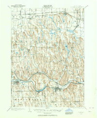
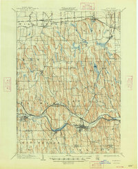
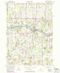
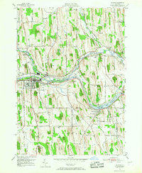
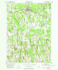
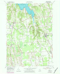
Lyons serves as a focal point for the historic transport infrastructure of Wayne County, where the Canandaigua Outlet meets the Clyde River. The presence of the Erie Canal winding eastward through the landscape illustrates the area's long-standing reliance on waterway commerce, linking settlements like Lock Berlin and Clyde. This modern survey highlights a region defined by agricultural heritage and local industry, with aviation landmarks such as D'Amico Airport and Pine View Airport situated among the drumlins and wetlands. For genealogists, the sheet is dense with resting places including Saint Johns Cem, Elmwood Cem, Rural Cem, and South Lyons Cem. The transition across county lines is marked near Thompson, where the boundary between Wayne County and Ontario County meets Ontario and Seneca counties, anchoring several small hamlets in the rural landscape.
Find a feature on this map
122 named features on this map. Tap any name to fly to it.
Don’t see what you’re looking for? This feature index may not catch every label — zoom into the map to look around manually.
Map Details
Editions of this 2023 Lyons Map
This is the sole edition of this map. No revisions or reprints were ever made.
Historical Maps of Alloway Through Time
36 maps found
1899 Palmyra
Wayne County, NY
1902 Palmyra
Wayne County, NY
1902 Sodus Bay
Wayne County, NY

1942 Ontario
Wayne County, NY

1943 Lyons
Wayne County, NY

1943 North Wolcott
Wayne County, NY

1943 Palmyra
Wayne County, NY

1943 Rose
Wayne County, NY

1943 Savannah
Wayne County, NY

1943 Sodus
Wayne County, NY

1943 Williamson
Wayne County, NY

1943 Wolcott
Wayne County, NY
1951 Macedon
Wayne County, NY
1952 Furnaceville
Wayne County, NY
1952 Ontario
Wayne County, NY
1952 Palmyra
Wayne County, NY
1952 Salmon Creek
Wayne County, NY
1952 Sodus
Wayne County, NY
1952 Williamson
Wayne County, NY
1953 Lyons
Wayne County, NY
1953 North Wolcott
Wayne County, NY
1953 Rose
Wayne County, NY
1953 Savannah
Wayne County, NY
1953 Wolcott
Wayne County, NY

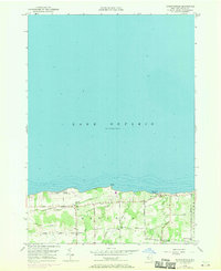
2023 Furnaceville
Wayne County, NY
2023 Lyons
Wayne County, NY

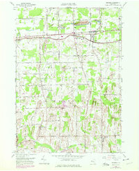
2023 Macedon
Wayne County, NY

2023 North Wolcott
Wayne County, NY

2023 Ontario
Wayne County, NY

2023 Palmyra
Wayne County, NY

2023 Rose
Wayne County, NY

2023 Salmon Creek
Wayne County, NY

2023 Savannah
Wayne County, NY

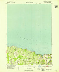
2023 Sodus
Wayne County, NY

2023 Williamson
Wayne County, NY

2023 Wolcott
Wayne County, NY