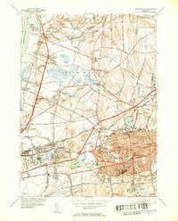
1952 Map of Manchester
USGS Topo · Published 1954About this map
Manchester is shown here in the early 1950s as a bustling hub of industry and civic life, characterized by a dense network of educational and religious institutions. The landscape is defined by the Hockanum River and numerous water features like Union Pond and Hilliards Pond, which historically powered the region's growth. Educational infrastructure is prominent, with the Nathan Hale Sch and Manchester High Sch anchoring the residential core.
Find a feature on this map
102 named features on this map. Tap any name to fly to it.
Don’t see what you’re looking for? This feature index may not catch every label — zoom into the map to look around manually.
Map Details
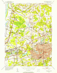
Editions of this 1952 Manchester Map
3 editions found
Historical Maps of Buckland Through Time
30 maps found

1892 Granby
Hartford County, CT

1906 Farmington
Hartford County, CT

1928 Glastonbury
Hartford County, CT

1928 Manchester
Hartford County, CT

1928 Mittineague
Hartford County, CT

1928 Windsor
Hartford County, CT

1928 Windsor Locks
Hartford County, CT

1944 Hartford South
Hartford County, CT

1944 Manchester
Hartford County, CT

1945 Hartford North
Hartford County, CT

1946 Glastonbury
Hartford County, CT

1946 Windsor Locks
Hartford County, CT

1951 Avon
Hartford County, CT

1952 Hartford North
Hartford County, CT

1952 Hartford South
Hartford County, CT

1952 Manchester
Hartford County, CT

1953 Glastonbury
Hartford County, CT

1953 Windsor Locks
Hartford County, CT

1957 Avon
Hartford County, CT

1963 Manchester
Hartford County, CT

1964 Glastonbury
Hartford County, CT

1964 Hartford North
Hartford County, CT

1964 Hartford South
Hartford County, CT

1964 Windsor Locks
Hartford County, CT

2024 Avon
Hartford County, CT

2024 Glastonbury
Hartford County, CT

2024 Hartford North
Hartford County, CT

2024 Hartford South
Hartford County, CT

2024 Manchester
Hartford County, CT

2024 Windsor Locks
Hartford County, CT