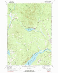
1968 Map of Miles Pond
USGS Topo · Published 1983About this map
The Connecticut River forms a major geographic boundary in this Northeast Kingdom landscape, marking the border between Vermont and New Hampshire. The map reveals the impact of the Moore Reservoir, which dominates the southern edge of the quadrangle. Inland, the Maine Central railroad tracks follow the valley of the Moose River, connecting the small settlements of North Concord and Miles Pond.
Find a feature on this map
44 named features on this map. Tap any name to fly to it.
Don’t see what you’re looking for? This feature index may not catch every label — zoom into the map to look around manually.
Map Details
Editions of this 1968 Miles Pond Map
This is the sole edition of this map. No revisions or reprints were ever made.
Other maps of this area

1900 · Whitefield
USGS Topo · 1:62,500

1920 · Guildhall
USGS Topo · 1:62,500

1931 · Guildhall
USGS Topo · 1:48,000

1931 · Littleton
USGS Topo · 1:62,500

1932 · Littleton
USGS Topo · 1:48,000

1933 · Guildhall
USGS Topo · 1:48,000

1935 · Littleton
USGS Topo · 1:62,500

1935 · Whitefield
USGS Topo · 1:48,000

1937 · Guildhall
USGS Topo · 1:62,500

1938 · Whitefield
USGS Topo · 1:62,500