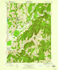
1944 Map of Shushan
USGS Topo · Published 1958About this map
The Batten Kill winds through the heart of this mid-century landscape, anchoring the valley settlements of Shushan and Eagleville. The terrain is defined by a dense network of ridges and hollows, where the New York-Vermont border cuts through the heights of Dugway Mountain and Buck Hill. Local life in the 1940s is traced through a system of rural district schools, such as School No 9 and School No 11, which served the scattered farming communities of The Plains and Ash Grove. Transport is dominated by the Delaware and Hudson corridor, which follows the lowlands near the Owl Kill. Notable landmarks include the distinctive Eldridge Swamp and family burial sites like Binninger Cem, providing deep genealogical texture to this pocket of Washington County. The transition from the fertile Batten Kill valley to the heights of Snake Ridge illustrates the historic relationship between the region's topography and its early settlement patterns.
Find a feature on this map
43 named features on this map. Tap any name to fly to it.
Don’t see what you’re looking for? This feature index may not catch every label — zoom into the map to look around manually.
Map Details
Editions of this 1944 Shushan Map
3 editions found
Other maps of this area

1894 · Equinox
USGS Topo · 1:62,500

1895 · Cambridge
USGS Topo · 1:62,500

1896 · Equinox
USGS Topo · 1:62,500

1897 · Hoosick
USGS Topo · 1:62,500

1898 · Cambridge
USGS Topo · 1:62,500

1898 · Bennington
USGS Topo · 1:62,500

1900 · Taconic
USGS Topo · 1:125,000

1900 · Equinox
USGS Topo · 1:62,500

1901 · Cambridge
USGS Topo · 1:62,500

1903 · Mettawee
USGS Topo · 1:125,000