1930s Maps of Mississippi
Explore 87 historic maps of Mississippi from the 1930s. These maps offer a rare glimpse into what life looked like during the 1930s — showing old roads, neighborhoods, homes, and landmarks that have changed or disappeared over time.
Whether you're researching your family's past, planning a metal detecting trip, or studying how Mississippi's landscape evolved across the 1930s, these high-resolution maps are a powerful tool for exploring the history of this region.
- Focus on a specific era: All maps on this page are from the 1930s, giving you a focused view of this time period.
- See what’s changed: Compare century-old streets, trails, and buildings to today's modern landscape using overlays and satellite layers.
- Research with precision: Use these maps for genealogy, historical research, land use analysis, or educational projects.
- View, download, or print: Maps are fully viewable online in high resolution, and can be downloaded or printed for your own records.
Start exploring Mississippi's history through authentic maps from the 1930s. This is your window into the past.
Mississippi maps
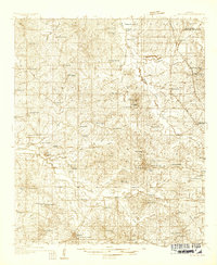
(87)- 1930 Map of Mellwood
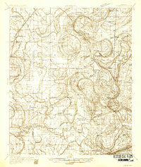
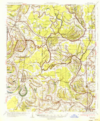
 1930 Mellwood1930 Print · USGSThe Mississippi Delta's shifting banks and rail-tied settlements are frozen in time just before the great mid-century levee expansions. Trace the history of the 1910s floods via the Ferguson Crevasse and locate river-dependent towns like Mellwood and Deeson.
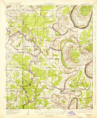
 - 1931 Map of Horseshoe Lake
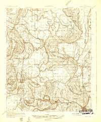
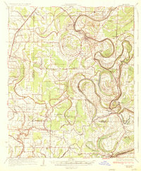
 1931 Horseshoe Lake1931 Print · USGSThe Mississippi Delta's shifting landscape is captured here in the early thirties, centered on the great oxbow of Horseshoe Lake. Genealogists and historians can trace family-named tracts like the Tucker Plantation and Seyppel Plantation, alongside rural landmarks like the Y M C A Camp and Robinsonville.
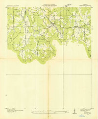
 - 1931 Map of Schlater
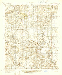
 1931 Schlater1931 Print · USGSThe Mississippi Delta's complex network of bayous and winding river bends is captured in the early 1930s. Genealogists can trace hundreds of family and community landmarks, from the Rosenwald Sch to small congregations like Thankful Ch and Harts Chapel.
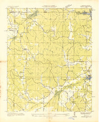
 - 1931 Map of Sumner
 1931 Sumner1931 Print · USGSTallahatchie County in the early thirties is captured here as a landscape of cotton fields and bayous connected by the Yazoo and Mississippi Valley Railroad. Researchers can locate community centers like Glendora and Sumner, or trace family ties to the Brooks-Rosenwald Sch and Indian Mounds.4 unique versions available
 - 1931 Map of Drew
 1931 Drew1931 Print · USGSSunflower County's agricultural and social landscape is meticulously detailed in the early 1930s, centering on the communities of Mound Bayou and Drew. Researchers can trace the layout of the State Penitentiary Reservation and numerous country churches like Beautiful Star Ch and Shady Grove Ch.
 - 1932 Map of Horn Lake
 1932 Horn Lake1932 Print · USGSNorthwest Mississippi and the river border come alive in the 1930s as the rail lines and river landings shaped local life. Genealogists can trace family footprints at Howards Store, Bynums Chapel, and Sunrise Sch and Ch near the banks of Horn Lake.3 unique versions available
 - 1932 Map of Sledge
 1932 Sledge1932 Print · USGSThe Mississippi Delta's complex water and rail networks are preserved here as they existed in the early thirties. Genealogists and local historians can trace family locations near the Yazoo and Mississippi Valley RR, Porters Ferry Sch, and Sanfords Chapel.2 unique versions available
 - 1932 Map of Philipp
 1932 Philipp1932 Print · USGSTallahatchie and Grenada counties in the early 1930s show a landscape shaped by river bends and the expansion of the rail network. Genealogists can trace family roots through numerous country schools and churches like Cowart Sch, Rosenwald Sch, and Jorden Hill Cem.4 unique versions available
 - 1932 Map of Tutwiler
 1932 Tutwiler1932 Print · USGSTallahatchie County was a landscape of winding oxbows and rail-linked settlements in the early 1930s. Genealogists and historians can trace numerous rural congregations like Whitfield Ch and New Bethlehem Ch, alongside industry at Fitches Gin.
 - 1932 Map of Marks
 1932 Marks1932 Print · USGSThe Mississippi Delta in the early 1930s is a landscape of complex bayous and tight-knit rural communities. Genealogists can trace family roots through numerous local landmarks like Swan Lake Normal College, Robinson Chapel, and the Yazoo and Mississippi Valley Railroad.2 unique versions available
 - 1932 Map of Crenshaw, 1964 Print
 1932 Crenshaw1964 Print · USGSNorthwest Mississippi in the early thirties reveals a complex network of Delta bayous and hill-country settlements. Genealogists can trace family roots through dozens of rural landmarks, from Cottonville Store to Brooks Chapel and the Longtown Sch.
 - 1933 Map of Lamont
 1933 Lamont1933 Print · USGSThe Mississippi River delta in the early 1930s is captured here just after the historic floods of the previous decade. Genealogists and historians can trace the foundations of Arkansas City, locate rural sites like Eutaw Store, and follow the tracks of the Mo Pac RR.
 - 1934 Map of Raymond
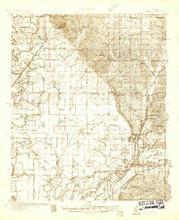
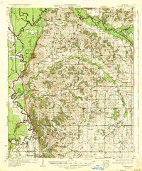
 1934 Raymond1934 Print · USGSHinds County during the mid-thirties was a landscape of thriving rural communities and significant educational centers. Genealogists can trace family roots through numerous local landmarks like Gaddis Chapel, McRaven Sta, and Rosenwald County Line Sch.
 - 1934 Map of Cleveland
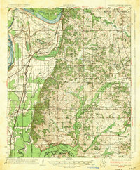
 1934 Cleveland1934 Print · USGSThe Mississippi Delta in the early thirties was a bustling landscape of rail-connected plantation towns and rural schools. Genealogists can trace family roots through numerous sites like Boyer Cem, the Doddsville Industrial Institute, and the historic Dockery community.2 unique versions available
 - 1934 Map of Schlater
 1934 Schlater1934 Print · USGSThe Mississippi Delta's winding bayous and rail towns are captured here in the early 1930s, showing a landscape of intense riverfront settlement. Genealogists can trace family-named sites across the floodplains, from Schlater and Sunnyside to the Rosenwald Sch and Rock of Ages Ch.2 unique versions available
 - 1935 Map of Slidell
 1935 Slidell1935 Print · USGSCoastal Louisiana in the mid-thirties reveals a landscape of growing rail towns and bayou settlements tied to the Gulf and the Pearl River systems. Genealogists and local historians can trace family roots through the Welch Cem, the Peace Grove Sch, and vanished hubs like McClure City.3 unique versions available
 - 1935 Map of Clarksdale
 1935 Clarksdale1935 Print · USGSThe Mississippi Delta's cotton country is captured here in the mid-1930s as the rail-and-river economy flourished. Genealogists can locate numerous rural landmarks like the Rosenwald Sch, Stoverville, and old church sites such as Beautiful Zion Ch.2 unique versions available
 - 1935 Map of English Lookout
 1935 English Lookout1935 Print · USGSThe coastal marshlands at the Louisiana-Mississippi line are captured in the mid-1930s as the rail line bridges the delta. Trace the historic route of the Louisville and Nashville railroad through English Lookout and across the waters of Little Lake.
 - 1935 Map of Holcut
 1935 Holcut1935 Print · USGSNortheast Mississippi was undergoing significant federal study in the mid-1930s as the railroad and river systems defined local life. Researchers can locate the community centers of the day, from the town of Holcut to rural landmarks like Lebanon Ch and Liberty Sch.
 - 1935 Map of Crowder
 1935 Crowder1935 Print · USGSThe Mississippi Delta's intricate river systems and rural communities are captured here in the mid-1930s. Researchers can locate vanished landmarks like Dry Bayou Plantation, the Quitman Co Hunting Club, and numerous schools such as Pharsalia Sch.3 unique versions available
 - 1935 Map of Doskie
 1935 Doskie1935 Print · USGSTishomingo County and the Tennessee borderlands are captured here in the mid-1930s just as the Tennessee Valley Authority began reshaping the local geography. Researchers can trace the rural communities of Doskie and Cross Roads or find family history at Pleasant Hill Ch and Mulberry Sch.
 - 1935 Map of Marks
 1935 Marks1935 Print · USGSThe Mississippi Delta landscape of the 1930s is captured here in rich detail, showcasing a network of bayous and rail towns. Genealogists can locate family landmarks like Swan Lake College, Macedonia Chapel, and the Posey Mound near Jonestown.2 unique versions available
 - 1935 Map of Sumner
 1935 Sumner1935 Print · USGSThe Mississippi Delta's intricate river bends and rail towns are captured here in the mid-1930s. Family historians can trace numerous rural sites like Brooks Rosenwald Sch, the State Reservation at Parchman, and the town of Glendora.2 unique versions available
 - 1935 Map of Crenshaw
 1935 Crenshaw1935 Print · USGSNorthwest Mississippi in the mid-thirties was a landscape of intricate bayous and thriving rural communities tied to the rail and river. Genealogists can trace family roots through numerous local landmarks like Cottonville Store, New Salem Ch, and Spring Hill Sch.2 unique versions available
 - 1935 Map of Horn Lake
 1935 Horn Lake1935 Print · USGSThe Mississippi Delta and Tennessee borderlands meet here in the mid-1930s, showing a landscape of bluff-top farms and river-bottom bayous. Genealogists can trace family roots through dozens of local landmarks like Morning Star Ch, Eudora, and Sunrise Sch.2 unique versions available
Showing maps 1-25 of 87
Top cities of Mississippi
- Jackson historical maps
- Gulfport historical maps
- Biloxi historical maps
- Hattiesburg historical maps
- Southaven historical maps
- Meridian historical maps
See more
Top counties of Mississippi
- Hinds County historical maps
- Harrison County historical maps
- DeSoto County historical maps
- Rankin County historical maps
- Jackson County historical maps
- Madison County historical maps
See more
Frequently asked questions
- What are the different types of historical maps available for Mississippi?
- What is the oldest map of Mississippi?
- Where can I purchase historical maps of Mississippi for my home or office?
- Where can I download high-res historical maps of Mississippi?
- Are there historical topographic maps available for Mississippi?
- Is there historical aerial imagery available for Mississippi?
- Where are historical maps of Mississippi sourced from?