1970s Maps of Mississippi
Explore 258 historic maps of Mississippi from the 1970s. These maps offer a rare glimpse into what life looked like during the 1970s — showing old roads, neighborhoods, homes, and landmarks that have changed or disappeared over time.
Whether you're researching your family's past, planning a metal detecting trip, or studying how Mississippi's landscape evolved across the 1970s, these high-resolution maps are a powerful tool for exploring the history of this region.
- Focus on a specific era: All maps on this page are from the 1970s, giving you a focused view of this time period.
- See what’s changed: Compare century-old streets, trails, and buildings to today's modern landscape using overlays and satellite layers.
- Research with precision: Use these maps for genealogy, historical research, land use analysis, or educational projects.
- View, download, or print: Maps are fully viewable online in high resolution, and can be downloaded or printed for your own records.
Start exploring Mississippi's history through authentic maps from the 1970s. This is your window into the past.
Mississippi maps
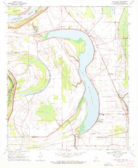
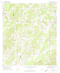
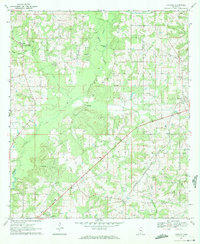
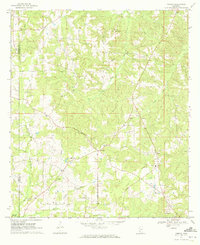
(258)- 1970 Map of Marks
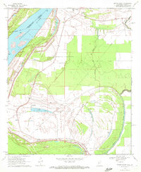
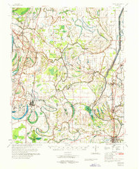 1970 Marks1970 Print · USGSThe Mississippi Delta in the early 1970s reveals a landscape of tight-knit agricultural communities and winding waterways. Genealogists and historians can trace family roots through numerous sites like the Lula-Rich Academy, Posey Mound Cem, and Dickerson Chapel.
 - 1970 Map of Pace
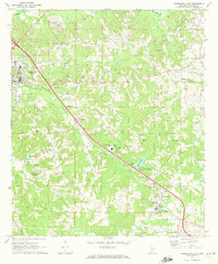
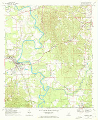
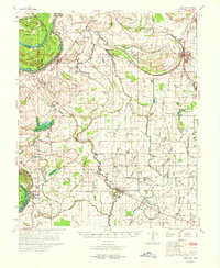 1970 Pace1970 Print · USGSThe Mississippi Delta's rail-and-river landscape comes alive in this 1970s survey of Bolivar County. Researchers can trace family history through dozens of rural landmarks like Peters Rock Ch, the Gunnison Cem, and the tracks of the Illinois Central Railroad.
 - 1970 Map of Henrico
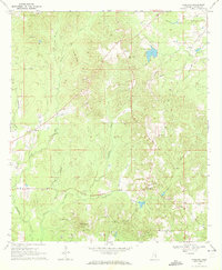
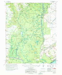 1970 Henrico1970 Print · USGSThe Arkansas Delta comes into focus during the late sixties, where the meandering White River meets the heavy timber of the White River National Wildlife Refuge. Genealogists and researchers can trace family-named sites like Nichols Cem, the community of Snow Lake, and 24 New Canaan Ch.
 - 1970 Map of Luna, 1971 Print
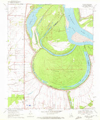
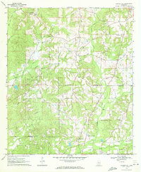
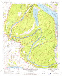 1970 Luna1971 Print · USGSThe Arkansas-Mississippi border country along the great river bends comes to life in the early 1970s. Trace the history of river commerce and flood control through local sites like Gaines Landing, the Panther Forest Crevasse, and Luna Landing.2 unique versions available
 - 1970 Map of Glen Allan, 1972 Print
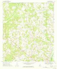
 1970 Glen Allan1972 Print · USGSThe Mississippi Delta in the early seventies reveals a landscape defined by massive oxbow lakes and river bends. Genealogists and local historians can trace family roots through sites like Glen Allan, Magnolia Ch Cem, and the ancient Indian Mounds near the wildlife refuge.
 - 1970 Map of Hopewell, 1972 Print
 1970 Hopewell1972 Print · USGSThe Pearl River valley at the start of the seventies serves as a preserved record of rural life along the Copiah-Simpson county line. Genealogists and local historians can trace the foundations of communities like Gatesville and Reno or locate family sites at Zion Hill Cem and Brushy Creek Ch.2 unique versions available
 - 1970 Map of Columbia South, 1972 Print
 1970 Columbia South1972 Print · USGSMarion County's river-bottom landscape comes alive in the early seventies, centered on the winding Pearl River south of Columbia. Genealogists and local historians can locate early settlements like Foxworth and Pickwick, or trace the grounds of St Paul Ch and Sunflower Ch Cem.2 unique versions available
 - 1970 Map of Lake Providence, 1972 Print
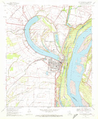 1970 Lake Providence1972 Print · USGSThe Louisiana-Mississippi borderlands around the 1970s show a river economy in transition, where the great oxbow of Lake Providence shelters the parish seat. Local historians can trace family roots through numerous landmarks like China Grove Ch Cem, Briarfield Academy, and Stack Island.
 - 1970 Map of Prentiss West, 1972 Print
 1970 Prentiss West1972 Print · USGSJefferson Davis County at the start of the 1970s shows a landscape of small settlements and rural industries. Trace the rail-and-river economy through the Illinois Central corridor, locating Williams Sch, Silver Creek, and Bethany Ch.
 - 1970 Map of Greenville, 1972 Print
 1970 Greenville1972 Print · USGSGreenville and the Mississippi River frontline are captured here in the early seventies, showing a landscape shaped by massive river cutoffs. Genealogists can locate family landmarks like Old Mt Tabor Cem, Macedonia Ch, and Winterville.2 unique versions available
 - 1970 Map of Sandy Hook NW, 1972 Print
 1970 Sandy Hook NW1972 Print · USGSThe rural borderlands of Marion and Walthall Counties are captured here in the early seventies, centered on the community of Foxworth. Genealogists and historians can trace local landmarks like Kokomo Sch, Terrys Chapel, and the Fernwood Columbia and Gulf railroad.3 unique versions available
 - 1970 Map of Tylertown SE, 1972 Print
 1970 Tylertown SE1972 Print · USGSThe Mississippi-Louisiana border comes into focus in the early seventies, capturing a rural landscape of creek-side settlements and family cemeteries. Genealogists can trace local roots through landmarks like Ard Cem, New Zion Ch, and the small community of Flowers.2 unique versions available
 - 1970 Map of Kokomo, 1972 Print
 1970 Kokomo1972 Print · USGSThe rural border of Marion and Walthall counties is captured here in the early 1970s, showing a landscape of timber-land settlements and rising energy infrastructure. Researchers can trace family roots through Magees Creek Ch, Boyd Cem, and the community at Kokomo.
 - 1970 Map of Mendenhall East, 1972 Print
 1970 Mendenhall East1972 Print · USGSIn the early 1970s, the area around Mendenhall remained a landscape of rural communities and railroad stops along the Illinois Central. Trace family history through landmarks like State Sanatorium, Zion Hill Ch, and Finley Cem.
 - 1970 Map of Millikin, 1972 Print
 1970 Millikin1972 Print · USGSThe Louisiana-Mississippi borderlands come into focus during the early 1970s, as the river carves through the alluvial plains of East Carroll Parish. Genealogists and local historians can trace the foundations of Millikin and find rural landmarks like Jerusalem Cem and Rose Hill Ch.2 unique versions available
 - 1970 Map of Mesa, 1972 Print
 1970 Mesa1972 Print · USGSWalthall County life in the early seventies is centered here on the rural rail corridor and the small settlements of the Piney Woods. Genealogists can trace family landmarks like Bridges Cem, St Paul Ch, and the rural community at Dinan.
 - 1970 Map of Topeka, 1972 Print
 1970 Topeka1972 Print · USGSLawrence County and the Lawrence-Lincoln border appear here in the early seventies, capturing a rural landscape of ridges and creek bottoms. Genealogists can trace family connections through landmarks like Ballards Chapel, Topeka-Tilton Sch, and the many gravel pits near Topeka.
 - 1970 Map of Monticello, 1972 Print
 1970 Monticello1972 Print · USGSMonticello and the surrounding Lawrence County countryside thrive along the Pearl River in the late sixties. Researchers can trace the rail lines of the Gulf Mobile and Ohio or locate family landmarks like Armstrong Cem and Canaan Ch.
 - 1970 Map of Paulding, 1972 Print
 1970 Paulding1972 Print · USGSJasper County in the early seventies shows a landscape of small rural settlements and an emerging energy industry. Researchers can trace family sites at Little Rocky Mount Ch or locate historical petroleum operations at several Oil Wells and a Pumping Sta.2 unique versions available
 - 1970 Map of Bunker Hill, 1972 Print
 1970 Bunker Hill1972 Print · USGSJefferson Davis and Marion counties appear here during the transition into the 1970s, a period of quiet rural industry and established community life. Genealogists can trace family roots through several local burial grounds and churches, including Old Bassfield Cem, Thompson Chapel Cem, and Shorts Chapel.2 unique versions available
 - 1970 Map of Whiting Bayou, 1972 Print
 1970 Whiting Bayou1972 Print · USGSThe Mississippi Delta bottomlands come alive in this early 1970s survey of Issaquena County. Researchers can trace the levee-side community of Tallula, the path of an Old Railroad Grade, and several historic black churches including Mt Sinai Ch and Christian Home Ch.
 - 1970 Map of Harrisville, 1972 Print
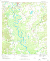
 1970 Harrisville1972 Print · USGSSimpson County rural life in the late sixties is centered around the village of Harrisville and the winding Strong River. Researchers can trace the path of the Old Railroad Grade and locate historic landmarks like Mt Olive Ch and the Lookout Tower.
 - 1970 Map of Darbun, 1972 Print
 1970 Darbun1972 Print · USGSSouth Mississippi’s rural crossroads come into focus during the early seventies, where the borders of three counties meet. Researchers can trace family history through a concentration of country churches and burial grounds like Sartinville Ch, Darbun Ch, and Sauls Valley Cem.
 - 1970 Map of Wayside, 1972 Print
 1970 Wayside1972 Print · USGSThe Mississippi Delta riverfront south of Greenville appears here in the early seventies, defined by oxbows and rural church communities. Genealogists and historians can trace family locations near Lakeview Gardens Cem, Wayside, and The Old Evening Star Ch.
 - 1970 Map of Sondheimer, 1972 Print
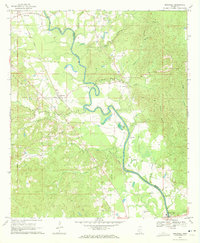
 1970 Sondheimer1972 Print · USGSThe Mississippi River delta in the early 1970s shows a landscape of rail-side settlements and parish-line farming. Researchers can locate local landmarks like Henderson Sch, Seventh Star Ch, and the Fish Farm near Omega.
Showing maps 1-25 of 258
Top cities of Mississippi
- Jackson historical maps
- Gulfport historical maps
- Biloxi historical maps
- Hattiesburg historical maps
- Southaven historical maps
- Meridian historical maps
See more
Top counties of Mississippi
- Hinds County historical maps
- Harrison County historical maps
- DeSoto County historical maps
- Rankin County historical maps
- Jackson County historical maps
- Madison County historical maps
See more
Frequently asked questions
- What are the different types of historical maps available for Mississippi?
- What is the oldest map of Mississippi?
- Where can I purchase historical maps of Mississippi for my home or office?
- Where can I download high-res historical maps of Mississippi?
- Are there historical topographic maps available for Mississippi?
- Is there historical aerial imagery available for Mississippi?
- Where are historical maps of Mississippi sourced from?