Old Maps of Mississippi for Academic Research
Study the evolution of Mississippi with 5,791 high-resolution historic maps. Whether you're teaching, researching, or modeling changes in land use, these maps provide essential visual documentation of urban, environmental, and geographic change.
- Analyze long-term change: Track patterns in development, transportation, and natural features.
- Ideal for environmental or urban studies: Support academic projects with primary historical map data.
- Use in the classroom or lab: Educators and researchers rely on these maps to bring historical context to life.
These maps are a powerful tool for teaching, research, and visualizing how Mississippi has changed over the decades.
Mississippi maps
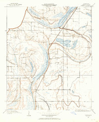
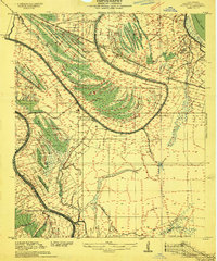
(5,791)- 1893 Map of Cat Island
 1893 Cat Island1893 Print · USGSThe Louisiana-Mississippi coastal border appears here in the late nineteenth century, charting the vital islands and channels of the Gulf. Researchers can trace the early maritime landscape of Cat Island, the position of Cat Island Light, and the reaches of Isle A Pitre.4 unique versions available
 - 1893 Map of Rigolets
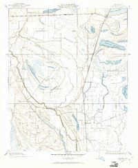
 1893 Rigolets1893 Print · USGSCoastal Louisiana and Mississippi meet at the turn of the century along a labyrinth of marshlands and railroad trestles. Researchers can trace the early path of the Louisville and Nashville Railroad past Ft. Pike and through the Little Lake region.5 unique versions available
 - 1893 Map of Toulme
 1893 Toulme1893 Print · USGSThe coastal marshlands of Hancock County are captured in the late 1890s, where the rail line meets the sound. Genealogists and maritime historians can trace the lonely locations of the St. Joseph Island Light, the settlement at Toulme, and the intricate reaches of Heron Bay.4 unique versions available
 - 1903 Map of Jackson
 1903 Jackson1903 Print · USGSCentral Mississippi at the dawn of the new century shows a landscape transformed by expanding rail lines and river commerce. Genealogists and researchers can trace family roots through early settlements like Pocahontas, Ridgeland, and Clinton or locate the historic Asylum grounds.
 - 1905 Map of Jackson
 1905 Jackson1905 Print · USGSJackson and its surrounding counties are shown at the height of the railroad era, as five major lines converge on the state capital. Genealogists can trace early rural life through Tougaloo University, family landmarks like Horns Mill, and churches such as Liberty Grove Church.3 unique versions available
 - 1906 Map of Bayou Sara
 1906 Bayou Sara1906 Print · USGSThe Feliciana parishes and the Mississippi River bottomlands come to life in this early twentieth-century survey. Genealogists can trace family footprints through river-town settlements like St Francisville or find early rail stops such as Gayden Sta (Gurley P.O.) and Slaughter.3 unique versions available
 - 1906 Map of Florence, 1965 Print
 1906 Florence1965 Print · USGSThe rural landscapes of Rankin and Hinds Counties are captured here at the start of the century, centered on the growing rail hub of Florence. Genealogists can trace old family locales through numerous landmarks like Hickory Ridge School, Ebenezer Church, and the winding Pearl River.
 - 1908 Map of Jackson
 1908 Jackson1908 Print · USGSCentral Mississippi thrives as a railroad and institutional hub at the beginning of the twentieth century. Genealogists can trace the early footprints of Jackson and Tougaloo University, or locate family landmarks like Beadmans Mill and Madison Station.2 unique versions available
 - 1908 Map of Florence
 1908 Florence1908 Print · USGSCentral Mississippi at the dawn of the twentieth century shows a landscape of rail-dependent villages and rural schoolhouses. Genealogists can trace family roots through sites like Monterey, Poplar Springs Church, and Steepbank School.2 unique versions available
 - 1908 Map of Lula, 1957 Print
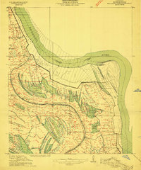
 1908 Lula1957 Print · USGSThe Mississippi Delta at the start of the twentieth century is defined here by the meeting of rail and river near Lula. Genealogists and historians can trace the early layout of settlements like Rich, Mascot, and Birdie along the various branches of the Yazoo and Mississippi Valley R. R.
 - 1908 Map of Dundee, 1957 Print
 1908 Dundee1957 Print · USGSMississippi Delta life in the early 1900s centered on the rail lines and fertile lowlands of Tunica County. Researchers can trace the layout of small settlements like Dundee and Maud or locate landmarks such as Oakgrove Church and Cockes Store along the Bayou.2 unique versions available
 - 1908 Map of Hollywood, 1961 Print
 1908 Hollywood1961 Print · USGSTunica County at the dawn of the twentieth century was a land of intricate bayous and rural sanctuaries. Genealogists and researchers can trace early congregation sites like Corinth Church and Moon Chapel alongside the winding Minton Bayou.
 - 1908 Map of Coahoma, 1961 Print
 1908 Coahoma1961 Print · USGSDuring the early years of the twentieth century, the Mississippi Delta was a landscape of rail sidings and massive river estates. Genealogists can trace family holdings at Elkhorn Place and King & Anderson's or locate old rail stops like Rudyard and Armistead.
 - 1908 Map of Moon Lake, 1961 Print
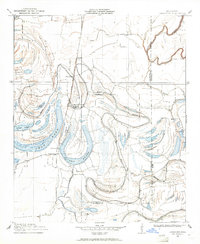
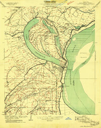
 1908 Moon Lake1961 Print · USGSThe Mississippi Delta's oxbows and bayous are meticulously detailed here in the early 1900s, showing a river-driven landscape. Trace the old rail lines of the Yazoo and Mississippi Valley R R or locate local centers like Delta Gerald P O and Powell.
 - 1908 Map of Jonestown, 1961 Print
 1908 Jonestown1961 Print · USGSThe Mississippi Delta's intricate river systems and early rail settlements are preserved here as they appeared in the first decade of the 1900s. Trace the path of the Yazoo and Mississippi Valley railroad through Jonestown and find historic landmarks like Hopewell Church and Eagles Nest.
 - 1908 Map of Walnut Lake, 1961 Print
 1908 Walnut Lake1961 Print · USGSThe Mississippi Delta's shifting waters and early settlements are captured here in the decade before the First World War. Genealogists and researchers can trace the locations of Walnut Lake School, Gerbach Mill, and local hubs like Dubbs.
 - 1908 Map of Lake Cormorant, 1961 Print
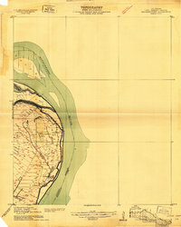
 1908 Lake Cormorant1961 Print · USGSThe Mississippi Delta's shifting landscape is captured here in the early twentieth century, showing a world of river landings and new rail lines. Genealogists and historians can trace the foundations of Lake Cormorant, Glover, and the Morning Star Church.
 - 1909 Map of Sycamore Landing
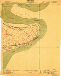
 1909 Sycamore Landing1909 Print · USGSThe riverfront of Concordia Parish comes alive in the early twentieth century as plantations and rail lines intersect along the Mississippi. Genealogists and historians can trace family roots at Lucerna Plantation or locate community centers like Rufus Baptist Church and Morville.
 - 1909 Map of Lake Bruen
 1909 Lake Bruen1909 Print · USGSTensas Parish life in the early 1900s centered on the massive Mississippi oxbow and the fertile soils of the delta. Researchers can trace historic family holdings like Bellevue and Panola or locate local landmarks including Zion Baptist Church and the St Joseph Station.
 - 1909 Map of Vidalia
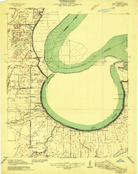
 1909 Vidalia1909 Print · USGSConcordia Parish sits at a tight bend of the Mississippi River in the early 1900s, where plantation life and rail commerce intersect. Genealogists and local historians can trace the foundations of Vidalia or locate family-named sites like Taconey Plantation and Minorca Church.
 - 1909 Map of Millikens Bend
 1909 Millikens Bend1909 Print · USGSMadison Parish and the Mississippi River front are captured during the peak of the plantation era. Researchers can trace historic family lands like Sparta and Huon Plantation, or locate rural landmarks such as Paradise Church and Hews Store.3 unique versions available
 - 1909 Map of Lake Providence
 1909 Lake Providence1909 Print · USGSEast Carroll Parish at the turn of the century shows a landscape of expansive plantations and river commerce centered on the great oxbow. Genealogists and historians can locate family estates like Way Way Plantation or trace community roots at Good Hope Church and Watersheta School.2 unique versions available
 - 1909 Map of Wilsons Point
 1909 Wilsons Point1909 Print · USGSEast Carroll Parish at the height of the river trade era reveals a landscape of alluvial points and levee-protected settlements. Genealogists and researchers can trace land tracts near Wilsons Point, the Morning Star Church, and the riverfront at Cottonwood.2 unique versions available
 - 1909 Map of Millikin
 1909 Millikin1909 Print · USGSEast Carroll Parish at the turn of the century reveals a landscape of large riverside estates and early rail infrastructure. Researchers can trace family history through sites like Ashton Plantation, find old commercial hubs like the Bells of the Bend Store, or locate vanished landmarks like Millikin School.2 unique versions available
 - 1909 Map of Mound
 1909 Mound1909 Print · USGSMadison Parish plantations and bayous are meticulously detailed in this 1909 survey as they appeared at the dawn of the twentieth century. Researchers can trace the legacy of the Vicksburg Shreveport and Pacific Railroad and locate ancestral sites like Solomon Temple Church or Mound.2 unique versions available
Showing maps 1-25 of 5,791
Top cities of Mississippi
- Jackson historical maps
- Gulfport historical maps
- Biloxi historical maps
- Hattiesburg historical maps
- Southaven historical maps
- Meridian historical maps
See more
Top counties of Mississippi
- Hinds County historical maps
- Harrison County historical maps
- DeSoto County historical maps
- Rankin County historical maps
- Jackson County historical maps
- Madison County historical maps
See more
Frequently asked questions
- What are the different types of historical maps available for Mississippi?
- What is the oldest map of Mississippi?
- Where can I purchase historical maps of Mississippi for my home or office?
- Where can I download high-res historical maps of Mississippi?
- Are there historical topographic maps available for Mississippi?
- Is there historical aerial imagery available for Mississippi?
- Where are historical maps of Mississippi sourced from?