1960s Maps of Mississippi
Explore 323 historic maps of Mississippi from the 1960s. These maps offer a rare glimpse into what life looked like during the 1960s — showing old roads, neighborhoods, homes, and landmarks that have changed or disappeared over time.
Whether you're researching your family's past, planning a metal detecting trip, or studying how Mississippi's landscape evolved across the 1960s, these high-resolution maps are a powerful tool for exploring the history of this region.
- Focus on a specific era: All maps on this page are from the 1960s, giving you a focused view of this time period.
- See what’s changed: Compare century-old streets, trails, and buildings to today's modern landscape using overlays and satellite layers.
- Research with precision: Use these maps for genealogy, historical research, land use analysis, or educational projects.
- View, download, or print: Maps are fully viewable online in high resolution, and can be downloaded or printed for your own records.
Start exploring Mississippi's history through authentic maps from the 1960s. This is your window into the past.
Mississippi maps
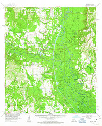
(323)- 1960 Map of Mobile
 1960 Mobile1960 Print · USGSThe Gulf Coast at the dawn of the sixties shows a landscape of busy ports, military airbases, and barrier islands. Trace the rail lines of the Louisville & Nashville through BILOXI and Pascagoula or find family history in towns like Bayou La Batre and Poplarville.
 - 1960 Map of Helena
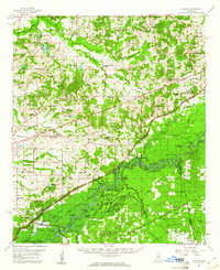
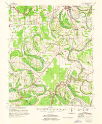
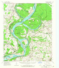
 1960 Helena1960 Print · USGSThe Arkansas and Mississippi Delta regions meet along the great river bends during a period of significant agricultural and rail expansion. Genealogists and historians can trace the paths of the Missouri Pacific railroad through Clarendon or locate landings along the Mississippi River and White River.
 - 1960 Map of Horn Island West, 1961 Print
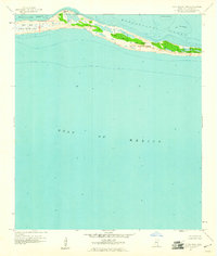 1960 Horn Island West1961 Print · USGSJackson County's barrier islands appear just after the mid-century as a preserved maritime wilderness. Researchers can trace the shifting sands of the Horn Island National Wildlife Refuge and locate unique features like the Flowing Well and The Horseshoe.
 - 1960 Map of Sharon, 1961 Print
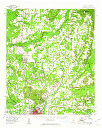
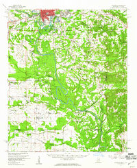
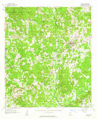
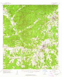
 1960 Sharon1961 Print · USGSMadison County in the early sixties sits at a crossroads as the Pearl River Valley Reservoir begins to take shape. Genealogists and local historians can trace rural roots through landmarks like Zion Chapel Cem, the Sacred Heart Mission, and small hubs like Farmhaven.2 unique versions available
 - 1960 Map of Caledonia, 1961 Print
 1960 Caledonia1961 Print · USGSThe Mississippi-Alabama borderlands in the early sixties reveal a landscape of growing military bases and traditional river commerce. Trace family roots through rural landmarks like Anderson Grove Sch, Waverly Ferry, and the rail lines serving Steens.2 unique versions available
 - 1960 Map of Horn Island East, 1961 Print
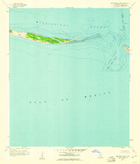 1960 Horn Island East1961 Print · USGSCoastal Jackson County is captured here in the early sixties, showing the vital barrier islands of the Mississippi coast. Maritime historians can trace the deep-water Pascagoula Channel and the shoreline of the Horn Island National Wildlife Refuge.2 unique versions available
 - 1960 Map of Columbus, 1961 Print
 1960 Columbus1961 Print · USGSThe Tombigbee River valley at the start of the 1960s shows a landscape of river-bend farms and rural communities centered around family churches and schools. Researchers can trace historic river crossings like the Nashville Ferry or locate ancestral sites at St Mathis Cem and Plum Grove Sch.2 unique versions available
 - 1960 Map of Horseshoe Lake, 1963 Print
 1960 Horseshoe Lake1963 Print · USGSCrittenden and Tunica counties are shown in the early sixties as a patchwork of Delta plantations and river landings. Genealogists can trace family footprints at Joe Beck Plantation, Happy Ch & Cem, and local schoolhouses like Snowden Sch.2 unique versions available
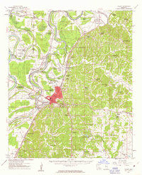
 - 1961 Map of Jackson
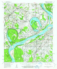
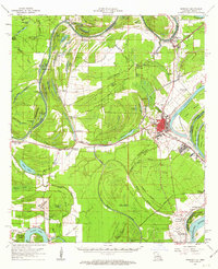
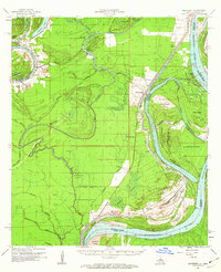
 1961 Jackson1961 Print · USGSThe Lower Mississippi Delta and the state capital area are captured here during the post-war era of infrastructure expansion. Researchers can trace the complex river oxbows and rail lines connecting Vicksburg, Yazoo City, and the Illinois Central Railroad network.
 - 1961 Map of Bayland
 1961 Bayland1961 Print · USGSThe Mississippi Delta's intricate water network and rural communities are captured here in the early sixties. Genealogists and historians can trace family locations through Huddleston Cem, Indian Mounds, and the Humphreys Co Training School.3 unique versions available
 - 1961 Map of Carthage, 1962 Print
 1961 Carthage1962 Print · USGSLeake County and the central Mississippi timberlands are captured here in the early sixties, showing the area as the Bienville National Forest and local rail lines defined the economy. Genealogists can trace family roots through numerous sites like Tribulation Cem, Free Mission Ch, and Ofahoma.3 unique versions available
 - 1961 Map of Liberty, 1962 Print
 1961 Liberty1962 Print · USGSAmite County in the early sixties reveals a landscape of small river settlements and forest land. Researchers can trace family history through dozens of rural sites like Bewelcome, McGeehee Cem, and Amite River Galilee Ch.3 unique versions available
 - 1961 Map of Mossy Lake, 1962 Print
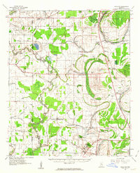
 1961 Mossy Lake1962 Print · USGSLeflore County's intricate Delta wetlands and river bends are captured here in the early sixties, showing a landscape of scattered settlements and rural churches. Researchers can trace the Columbus and Greenville rail line through Itta Bena or locate local landmarks like McIntyre Cem and the Indian Mound.3 unique versions available
 - 1961 Map of Crosby, 1962 Print
 1961 Crosby1962 Print · USGSThe Homochitto River valley and its neighboring oil fields are captured here in the early sixties as they span four Mississippi counties. Researchers can trace rural lineages through numerous family sites like Dorsey Cem, Perrytown Ch, and the Illinois Central Railroad corridor.3 unique versions available
 - 1961 Map of Ferriday, 1962 Print
 1961 Ferriday1962 Print · USGSConcordia Parish and the Mississippi River bottomlands are captured here in the early sixties, showing a landscape of bayous and rail towns. Researchers can locate many rural landmarks including St Peters Ch, Sevier High Sch, and family sites near Clayton and Frogmore.2 unique versions available
 - 1961 Map of Gloster, 1963 Print
 1961 Gloster1963 Print · USGSSouthwest Mississippi is mapped here in the early sixties, showing the rural communities along the Illinois Central line. Genealogists can trace family roots at Wilkinson Cem, Mt Carmel Ch, and the small settlement of Caledonia.2 unique versions available
 - 1961 Map of Monterey, 1963 Print
 1961 Monterey1963 Print · USGSConcordia Parish in the early sixties is a landscape of winding bayous and active oil fields. Genealogists can locate family landmarks like Pt Pleasant Cem and Ashland Cem, or trace the path of the Old Railroad near Monterey.3 unique versions available
 - 1961 Map of Schlater, 1963 Print
 1961 Schlater1963 Print · USGSLeflore County in the early sixties is a landscape of river bends and rail lines before the modern era of consolidation. Genealogists can trace family roots through numerous delta landmarks like Mississippi Vocational College, Shiloh Cem, and Itta Bena.2 unique versions available
 - 1961 Map of Canton, 1963 Print
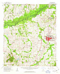 1961 Canton1963 Print · USGSMadison County at the start of the 1960s reveals a transition from the historic rail hub of Canton to the bottomlands of the Big Black River. Genealogists and local historians can trace rural family roots at Mt Pisgah Cem, Livingston, and Campbell Chapel.3 unique versions available
 - 1961 Map of Sun, 1963 Print
 1961 Sun1963 Print · USGSLife along the Louisiana and Mississippi border centered on the river and the rail in the early sixties. Researchers can trace family history through dozens of rural landmarks like Byrds Chapel, Rio, and the Gulf Mobile and Ohio line.3 unique versions available
 - 1961 Map of Valley, 1963 Print
 1961 Valley1963 Print · USGSYazoo City and its rural surroundings are captured in the early sixties as the Delta's agricultural and industrial patterns evolved. Researchers can trace family roots through dozens of local landmarks including Cedar Falls Sch, Bells Chapel, and Coopers Cem.2 unique versions available
 - 1961 Map of Mellwood, 1965 Print
 1961 Mellwood1965 Print · USGSThe Mississippi River delta in the early sixties was a landscape shaped by recent engineering and historic floods. Researchers can trace the results of the Knowlton Crevasse (1912) and locate vanished landmarks like Zion Traveler Ch or Laconia Circle.
 - 1961 Map of Latour, 1965 Print
 1961 Latour1965 Print · USGSThe riverfront cities of Helena and West Helena are captured here in the early sixties, showing the vital rail-and-river hub at the edge of the St Francis National Forest. Family historians can locate dozens of rural landmarks, from Lexa and Southland to Mt Olive Ch and Trinity Cem.2 unique versions available
 - 1961 Map of Baton Rouge, 1966 Print
 1961 Baton Rouge1966 Print · USGSSoutheastern Louisiana in the early sixties remains a landscape of deep river bends and sprawling coastal lakes. Genealogists and historians can trace the rail-and-river economy through landmarks like Free-Nigger Point, Donaldsonville, and the Illinois Central Railroad.
 - 1961 Map of Horn Lake, 1978 Print
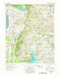 1961 Horn Lake1978 Print · USGSDeSoto County and the Mississippi River bottoms are captured here in the early sixties as rural life centered on the river and rail lines. Genealogists can locate family landmarks like Howard Plantation, Lakeside Cem, and numerous country churches like New Hope Ch.
Showing maps 1-25 of 323
Top cities of Mississippi
- Jackson historical maps
- Gulfport historical maps
- Biloxi historical maps
- Hattiesburg historical maps
- Southaven historical maps
- Meridian historical maps
See more
Top counties of Mississippi
- Hinds County historical maps
- Harrison County historical maps
- DeSoto County historical maps
- Rankin County historical maps
- Jackson County historical maps
- Madison County historical maps
See more
Frequently asked questions
- What are the different types of historical maps available for Mississippi?
- What is the oldest map of Mississippi?
- Where can I purchase historical maps of Mississippi for my home or office?
- Where can I download high-res historical maps of Mississippi?
- Are there historical topographic maps available for Mississippi?
- Is there historical aerial imagery available for Mississippi?
- Where are historical maps of Mississippi sourced from?