1980s Maps of Mississippi
Explore 405 historic maps of Mississippi from the 1980s. These maps offer a rare glimpse into what life looked like during the 1980s — showing old roads, neighborhoods, homes, and landmarks that have changed or disappeared over time.
Whether you're researching your family's past, planning a metal detecting trip, or studying how Mississippi's landscape evolved across the 1980s, these high-resolution maps are a powerful tool for exploring the history of this region.
- Focus on a specific era: All maps on this page are from the 1980s, giving you a focused view of this time period.
- See what’s changed: Compare century-old streets, trails, and buildings to today's modern landscape using overlays and satellite layers.
- Research with precision: Use these maps for genealogy, historical research, land use analysis, or educational projects.
- View, download, or print: Maps are fully viewable online in high resolution, and can be downloaded or printed for your own records.
Start exploring Mississippi's history through authentic maps from the 1980s. This is your window into the past.
Mississippi maps
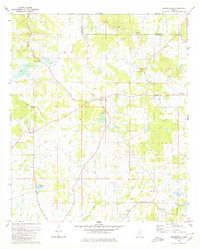
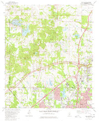
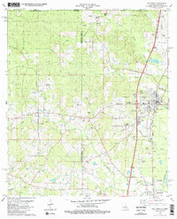
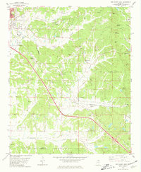
(405)- 1980 Map of Whitfield
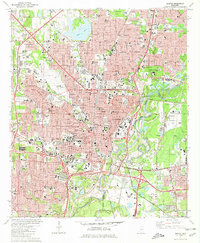
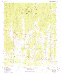
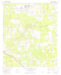 1980 Whitfield1980 Print · USGSRankin County during the late seventies and early eighties shows a landscape of institutional landmarks and tight-knit rural settlements. Genealogists can locate family-named landmarks and institutions like the State Hospital, Wesley College, and Jerusalem Ch.
 - 1980 Map of New Byram
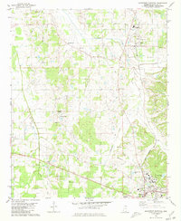
 1980 New Byram1980 Print · USGSHinds County during the late 1970s and early 1980s reveals a landscape where the rural South met suburban growth south of Jackson. Researchers can trace family history through sites like Spring Ridge Cem, Wynndale Ch, and the settlement of New Byram.2 unique versions available
 - 1980 Map of Florence
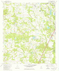
 1980 Florence1980 Print · USGSRankin and Hinds counties are shown here as the capital's southern outskirts grew in the late seventies. Genealogists and historians can trace family locations through Sykes Sch & Ch, McGowen Cem, and the historic banks of the Pearl River.2 unique versions available
 - 1980 Map of Terry NW
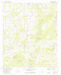 1980 Terry NW1980 Print · USGSHinds County in the 1980s reveals a landscape of small crossroads settlements and family-named landmarks. Genealogists can trace rural roots through features like Fairchilds Crossroads, the Bedwell Cem, and country churches such as Hamilton Grove Ch and Spring Hill Ch.
 - 1980 Map of Brownsville
 1980 Brownsville1980 Print · USGSHinds and Madison counties meet here in the late seventies, showing a quiet rural network of family cemeteries and country churches. Genealogists can trace local history through sites like Lula Cem, Hill of Zion Ch, and the settlement of Orangeville.
 - 1980 Map of Raymond
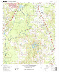
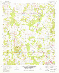
 1980 Raymond1980 Print · USGSThe area around Raymond and Bolton comes into focus in the early eighties, showcasing a mix of educational hubs and oil-rich landscapes. Researchers can trace genealogical sites like Mt Elizabeth Ch, Zion Chapel Cem, and the sprawling Hinds Jr College campus.2 unique versions available
 - 1980 Map of Clinton
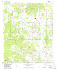
 1980 Clinton1980 Print · USGSClinton and West Jackson were rapidly evolving in the early eighties as educational and federal institutions expanded. Researchers can trace local landmarks like Mississippi College, the Jackson International Speedway, and the Cowles Meade Cem.3 unique versions available
 - 1980 Map of Jackson SE
 1980 Jackson SE1980 Print · USGSRankin County enters a period of modern expansion in the 1980s, where traditional settlements meet the growing infrastructure of the Pearl River corridor. Researchers can trace family sites at Drakes Ch, Flora Hills Cem, and the neighborhoods of McLaurin Heights.2 unique versions available
 - 1980 Map of Ridgeland
 1980 Ridgeland1980 Print · USGSThe northern reaches of the Mississippi capital region are captured here in 1980, as the area around Ridgeland and Tougaloo continues to develop. Researchers can locate historic institutions such as Tougaloo College and find rural landmarks like Ridley Ridge Ch and the Natchez Trace Parkway.3 unique versions available
 - 1980 Map of Pocahontas
 1980 Pocahontas1980 Print · USGSThe Hinds and Madison county line area in the early eighties shows a landscape of traditional church communities and modern parkways. Trace the history of Pocahontas Mounds or locate family sites like Tinnin Cem and Shady Grove Ch.3 unique versions available
 - 1980 Map of Madison
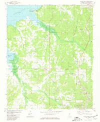
 1980 Madison1980 Print · USGSThe outskirts of Jackson and the newly developed Madison area are captured in the late 1970s as suburban life began to flourish near the Ross Barnett Reservoir. Genealogists and local historians can trace family markers at Jessamine Cem or explore the corridor of the Natchez Trace Parkway.
 - 1980 Map of Coles Point, 1981 Print
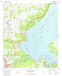
 1980 Coles Point1981 Print · USGSLafayette and Panola counties are shown during the 1980s as the regional landscape adjusted to the presence of the Sardis reservoir. You can trace family roots and old land patterns through features like Emery Cem, Spring Hill Ch, and the high ground of Carter Mountain.
 - 1980 Map of Kentwood, 1981 Print
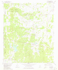
 1980 Kentwood1981 Print · USGSKentwood and Tangipahoa appear during the early 1980s as the railroad and timber landscape of the Louisiana-Mississippi line remains firmly established. Researchers can find dozens of family burial sites like Westmoreland Cem and the Camp Moore Confederate Cem.2 unique versions available
 - 1980 Map of Northwest Pontotoc, 1981 Print
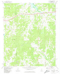
 1980 Northwest Pontotoc1981 Print · USGSPontotoc and Ecru are captured here in the mid-1970s as agricultural traditions met modernizing infrastructure. Local researchers can trace family roots through sites like Weatherall Cem, Wardlow Cem, and the town center of Ecru.
 - 1980 Map of Thaxton, 1981 Print
 1980 Thaxton1981 Print · USGSNortheast Mississippi during the late seventies reveals a landscape of small agricultural hubs and national forest land. Researchers can pinpoint rural congregations and family cemeteries like Sand Spring Ch, Bellvue Ch, and Laodicea Cem.
 - 1980 Map of Splinter, 1981 Print
 1980 Splinter1981 Print · USGSLafayette and Panola counties appear here in the early eighties as a landscape of rural crossroads and wooded hills. Genealogists can trace ancestral sites like Browning Cem, Acree Hill Ch, and the community of Orwood.
 - 1980 Map of Jackson, 1981 Print
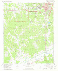
 1980 Jackson1981 Print · USGSJackson and the Pearl River valley appear here in the early eighties as a thriving capital city and regional hub. Genealogists and researchers can trace family roots through numerous sites like Cedar Lawn Cemetery and Jackson State University.2 unique versions available
 - 1980 Map of Oxford South, 1981 Print
 1980 Oxford South1981 Print · USGSOxford and the University of Mississippi expanded southward during the late seventies as the surrounding landscape remained a mix of rural valley and rail corridor. Researchers can locate family landmarks like Craig Cem, New Hope Ch, and the high point at Thacker Mountain.2 unique versions available
 - 1980 Map of New Albany West, 1981 Print
 1980 New Albany West1981 Print · USGSUnion County during the early eighties showcases a landscape defined by the intersection of three major railroads and the waters of the Little Tallahatchie River. Trace family history through rural sites like Ingomar, the Union Hill Cem, and numerous country churches including Zion Chapel.
 - 1980 Map of Puskus Lake, 1981 Print
 1980 Puskus Lake1981 Print · USGSLafayette and Marshall counties were largely wooded and rural at the start of the eighties, defined by the Holly Springs National Forest. Researchers can find numerous family-centric sites like Shiloh Cem, Jefferson Cem, and the settlement of Cambridge.
 - 1980 Map of New Albany East, 1981 Print
 1980 New Albany East1981 Print · USGSNortheast Mississippi in the early eighties shows a landscape of rail-connected towns and rural hill country. You can trace the St Louis-San Francisco rail line through Wallerville or locate family markers at Oak Grove Ch Cem and Adair Cem.
 - 1980 Map of Oxford North, 1981 Print
 1980 Oxford North1981 Print · USGSLafayette County in the early eighties shows the northern approach to the university town alongside the waters of the Sardis Lake reservoir. Genealogists can trace family roots through several local landmarks like College Hill, St Peter Cem, and Hammitt Hill Ch.2 unique versions available
 - 1980 Map of Northeast Pontotoc, 1981 Print
 1980 Northeast Pontotoc1981 Print · USGSNortheast Mississippi in the 1980s reveals a rural landscape defined by historic creek bottoms and dispersed settlements. Genealogists and historians can trace family locations near Poplar Springs, Cherry Creek, and Spring Hill Cem while locating the route of the Old Natchez Trace Park.
 - 1980 Map of Etta, 1981 Print
 1980 Etta1981 Print · USGSNortheast Mississippi’s river bottoms and timberlands are well-preserved here in the early eighties, just as modern infrastructure began to weave through the forest. Genealogists can trace family footprints through numerous rural landmarks like West Union Sch, Salem Ch, and Friendship Cem.
 - 1980 Map of Denmark, 1981 Print
 1980 Denmark1981 Print · USGSLafayette County was still largely defined by its forested hills and river bottoms in the early eighties. Genealogists can trace family footprints through rural sites like Denmark Ch, Cornish, and the numerous small burial grounds including Spring Hill Cem.
Showing maps 1-25 of 405
Top cities of Mississippi
- Jackson historical maps
- Gulfport historical maps
- Biloxi historical maps
- Hattiesburg historical maps
- Southaven historical maps
- Meridian historical maps
See more
Top counties of Mississippi
- Hinds County historical maps
- Harrison County historical maps
- DeSoto County historical maps
- Rankin County historical maps
- Jackson County historical maps
- Madison County historical maps
See more
Frequently asked questions
- What are the different types of historical maps available for Mississippi?
- What is the oldest map of Mississippi?
- Where can I purchase historical maps of Mississippi for my home or office?
- Where can I download high-res historical maps of Mississippi?
- Are there historical topographic maps available for Mississippi?
- Is there historical aerial imagery available for Mississippi?
- Where are historical maps of Mississippi sourced from?