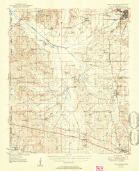
1950s Maps of Mississippi
Explore 138 historic maps of Mississippi from the 1950s. These maps offer a rare glimpse into what life looked like during the 1950s — showing old roads, neighborhoods, homes, and landmarks that have changed or disappeared over time.
Whether you're researching your family's past, planning a metal detecting trip, or studying how Mississippi's landscape evolved across the 1950s, these high-resolution maps are a powerful tool for exploring the history of this region.
- Focus on a specific era: All maps on this page are from the 1950s, giving you a focused view of this time period.
- See what’s changed: Compare century-old streets, trails, and buildings to today's modern landscape using overlays and satellite layers.
- Research with precision: Use these maps for genealogy, historical research, land use analysis, or educational projects.
- View, download, or print: Maps are fully viewable online in high resolution, and can be downloaded or printed for your own records.
Start exploring Mississippi's history through authentic maps from the 1950s. This is your window into the past.
Mississippi maps
(138)- 1950 Map of Kentwood
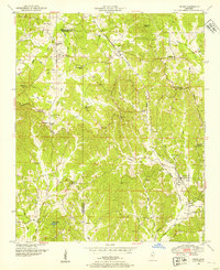
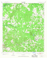
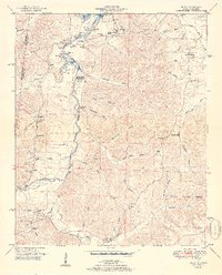
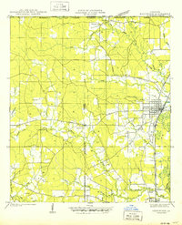 1950 Kentwood1950 Print · USGSKentwood and Tangipahoa thrive along the Illinois Central rail corridor during the mid-century, marking a period of established rural settlement along the Mississippi state line. Researchers can locate numerous family burial sites and churches, including the Camp Moore Confederate Cem, Barnes Cem, and Bethel Ch.
 - 1950 Map of Helena
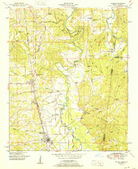
 1950 Helena1950 Print · USGSMid-century Phillips County and the surrounding Delta region are shown at a peak of rail and river commerce. Genealogists and historians can trace family locations through numerous rural communities like Old Austin, Cotton Plant, and West Helena, or follow the routes of the Missouri Pacific RR across Grand Prairie.2 unique versions available
 - 1950 Map of Haaswood
 1950 Haaswood1950 Print · USGSThe Pearl River bottomlands at the turn of the 1950s showcase a maze of islands and bayous along the Louisiana and Mississippi state line. Researchers can locate community anchors like Indian Village Sch, Hartsell Ch, and the riverside settlement of Logtown.
 - 1950 Map of Ashland, 1952 Print
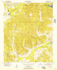
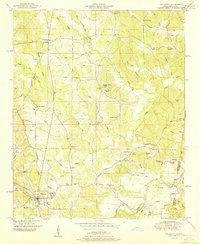
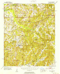 1950 Ashland1952 Print · USGSBenton County at the mid-century is captured here as a landscape of small timber towns and forest clearings before modern development. You can trace early school sites like Holloway Sch and family-centered landmarks such as Whitten Town and Hunters Chapel.3 unique versions available
 - 1950 Map of Corinth, 1952 Print
 1950 Corinth1952 Print · USGSAlcorn County's rail-and-river landscape comes alive in the early fifties as Corinth expands at the junction of three major railroads. Genealogists can trace family roots through dozens of rural landmarks like Wesley Chapel, Kossuth, and the National Cemetery.3 unique versions available
 - 1950 Map of Kendrick, 1953 Print
 1950 Kendrick1953 Print · USGSThe Mississippi-Tennessee borderlands in the mid-twentieth century show a landscape of rural schools and rail intersections. Genealogists can trace family names at Marvin Cem and Wyly Cem, or locate lost landmarks like McGlathery Sch and Fraley Chapel.3 unique versions available
 - 1950 Map of Paden, 1954 Print
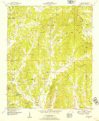
 1950 Paden1954 Print · USGSIn the Tishomingo hills during the early 1950s, the rural life of northeast Mississippi centered on rail sidings and remote creek crossings. Researchers can locate family landmarks like Stricklen Cem, follow the Illinois Central through Paden, and trace the historic Natchez Trace.3 unique versions available
 - 1950 Map of Burnsville, 1954 Print
 1950 Burnsville1954 Print · USGSTishomingo County at mid-century reveals a landscape of rural schools, family cemeteries, and critical rail junctions during the post-war era. Researchers can trace ancestral roots at Opossum Trot Cem or locate the old Gravel Hill School and Hazard Switch.3 unique versions available
 - 1950 Map of Glens, 1954 Print
 1950 Glens1954 Print · USGSThe crossroads at Jacinto and the rail stop at Glens anchor this mid-century survey of the Alcorn and Prentiss county border. Genealogists can locate family landmarks like Piney Grove Cem and Macedonia Sch.3 unique versions available
 - 1950 Map of Altitude, 1954 Print
 1950 Altitude1954 Print · USGSThe hills of northern Prentiss County come into focus during the early fifties, showing a rural landscape of ridge-top roads and creek-side settlements. Researchers can locate many family landmarks, including Jones Chapel, the New Candler School, and the Blue Hill Lookout Tower.3 unique versions available
 - 1950 Map of Doskie, 1954 Print
 1950 Doskie1954 Print · USGSNortheast Mississippi and southern Tennessee appear here just after the war, showing the area near Doskie and the Tishomingo County Game Refuge. Researchers can trace rural life at Lambs Chapel School, Shady Grove Ch, and the Beaver Pond gaging station.3 unique versions available
 - 1950 Map of Dog Keys Pass, 1958 Print
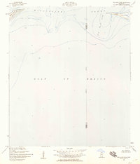 1950 Dog Keys Pass1958 Print · USGSThe Mississippi barrier islands and their deep-water channels are captured here at mid-century, documenting the coastal boundary between Harrison and Jackson counties. Marine researchers and historians can trace the 1950s shorelines of Ship Island and Horn Island near the vital Dog Keys Pass.3 unique versions available
 - 1950 Map of Ship Island, 1958 Print
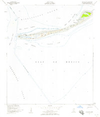 1950 Ship Island1958 Print · USGSCoastal Mississippi in the 1950s is defined here by the thin, strategic arc of Ship Island before modern storms reshaped its shores. Trace the maritime history of the sound through landmarks like Old Fort Massachusetts and the Ship Island Lighthouse.3 unique versions available
 - 1950 Map of Slidell, 1962 Print
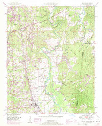
 1950 Slidell1962 Print · USGSThe Northshore of Lake Pontchartrain comes into focus at mid-century, showing the growing rail hubs and marshland settlements. Genealogists can trace family footprints at Forest Glen School, the Parker Cemetery, and rural outposts like Hickory or Florenville.2 unique versions available
 - 1950 Map of Forest, 1966 Print
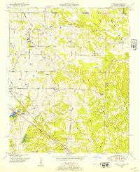
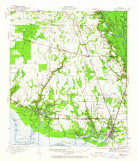
 1950 Forest1966 Print · USGSMid-century Scott County centers on the rail-driven growth of Forest and its surrounding timberlands. Local historians can trace family ties through Singleton Settlement, rural schools like Sylvester Sch, and the Patrons Union Campground.2 unique versions available
 - 1950 Map of Pelahatchie, 1968 Print
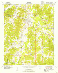
 1950 Pelahatchie1968 Print · USGSRankin County's rural landscape is captured here at mid-century, from the busy rails of Brandon to the quiet reaches of Goshen Springs. Researchers can trace old family names at Andrews Chapel, St Helens Ch, or the Spring Hill Cem while following the historic Choctaw Treaty Line of 1820.2 unique versions available
 - 1950 Map of Belmont, 1971 Print
 1950 Belmont1971 Print · USGSTishomingo County at mid-century shows a landscape of ridge-top settlements and growing infrastructure like the Natchez Trace Parkway. Researchers can trace the path of the Illinois Central Railroad through Belmont or locate rural landmarks like Liberty Ch and Russell Cem.2 unique versions available
 - 1950 Map of Bishop, 1974 Print
 1950 Bishop1974 Print · USGSWestern Colbert County at mid-century shows a landscape of border-town settlements and river-valley farms just as the modern parkway was arriving. Trace the old community footprints at Allsboro, Maud, and Bishop, or locate family sites like Twitty Cem and Asphalt Rock Church.2 unique versions available
 - 1950 Map of Tishomingo, 1974 Print
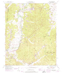
 1950 Tishomingo1974 Print · USGSTishomingo and the surrounding hill country of northeast Mississippi are captured here in the mid-twentieth century. Researchers can trace the development of the Natchez Trace Parkway and locate rural landmarks like Boggs Chapel, Petertown, and the Illinois Central rail line.3 unique versions available
 - 1951 Map of Red Bay
 1951 Red Bay1951 Print · USGSRed Bay and the surrounding borderlands of Alabama and Mississippi are captured here in the early fifties. Local historians can trace the rail-side growth of Red Bay and locate rural landmarks like Banner Sch, Sims Memorial Church, and the Burgess Cem.3 unique versions available
 - 1951 Map of Bishop
 1951 Bishop1951 Print · USGSThe Alabama-Mississippi state line and the historic Natchez Trace corridor are captured here during the mid-century. Researchers can locate family roots at Allsboro and Maud, or trace historic burial sites like Alsobrook Cem and Liberty Cem.2 unique versions available
 - 1951 Map of Belmont
 1951 Belmont1951 Print · USGSTishomingo County, Mississippi, and the Alabama borderlands come alive in the early fifties as the Illinois Central railroad links the rural south. Genealogists can trace family roots through numerous landmarks like Russell Cem, Forest Grove School, and the settlement of Belmont.
 - 1951 Map of Tishomingo
 1951 Tishomingo1951 Print · USGSThe Tennessee and Mississippi borderland comes into focus in the early 1950s as the Natchez Trace winds through the hills of Tishomingo. Researchers can trace the Illinois Central rail line, find the Indian mound near the state line, or locate family sites like Hodges Cem and Boggs Chapel.
 - 1951 Map of Morton
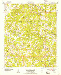
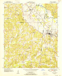
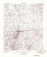 1951 Morton1951 Print · USGSMid-century Scott and Rankin counties are mapped here just as the modern highway system began to overshadow the rail era. Genealogists can locate family landmarks like Peagler Store and numerous rural sites such as Simmons Grove Ch and Latham Cem.3 unique versions available
 - 1951 Map of New Albany
 1951 New Albany1951 Print · USGSMississippi's hill country comes into focus in the early fifties, showing a landscape defined by the GULF MOBILE AND OHIO railroad and the Tallahatchie River. Researchers can trace rural lineages through numerous local sites like Possum Trot, Turnpike Ch, and Ingomar.2 unique versions available
Showing maps 1-25 of 138
Top cities of Mississippi
- Jackson historical maps
- Gulfport historical maps
- Biloxi historical maps
- Hattiesburg historical maps
- Southaven historical maps
- Meridian historical maps
See more
Top counties of Mississippi
- Hinds County historical maps
- Harrison County historical maps
- DeSoto County historical maps
- Rankin County historical maps
- Jackson County historical maps
- Madison County historical maps
See more
Frequently asked questions
- What are the different types of historical maps available for Mississippi?
- What is the oldest map of Mississippi?
- Where can I purchase historical maps of Mississippi for my home or office?
- Where can I download high-res historical maps of Mississippi?
- Are there historical topographic maps available for Mississippi?
- Is there historical aerial imagery available for Mississippi?
- Where are historical maps of Mississippi sourced from?