1950s Maps of Iron County, Utah
Explore 43 historic maps of Iron County from the 1950s. These maps offer a rare glimpse into what life looked like during the 1950s — showing old roads, neighborhoods, homes, and landmarks that have changed or disappeared over time.
Whether you're researching your family's past, planning a metal detecting trip, or studying how Iron County's landscape evolved across the 1950s, these high-resolution maps are a powerful tool for exploring the history of this region.
- Focus on a specific era: All maps on this page are from the 1950s, giving you a focused view of this time period.
- See what’s changed: Compare century-old streets, trails, and buildings to today's modern landscape using overlays and satellite layers.
- Research with precision: Use these maps for genealogy, historical research, land use analysis, or educational projects.
- View, download, or print: Maps are fully viewable online in high resolution, and can be downloaded or printed for your own records.
Start exploring Iron County's history through authentic maps from the 1950s. This is your window into the past.
Iron County, UT maps
(43)- 1950 Map of Cedar City NW
 1950 Cedar City NW1950 Print · USGSIron County ranching and mining meet in the mid-century Cedar Valley, where the Union Pacific railroad connects small settlements and desert basins. Researchers can trace the layout of Hamiltons Fort, explore the numerous workings of the Great Western Mine, or locate Quichapa Lake.
 - 1950 Map of Kanarraville
 1950 Kanarraville1950 Print · USGSSouthern Utah ranching and settlement life are captured here at mid-century, where the town of Kanarraville meets the Hurricane Cliffs. Trace old pathways like the Rock Trail or locate family sites near Kanarra Creek and the local Cemetery.5 unique versions available
 - 1950 Map of Antelope Peak, 1952 Print
 1950 Antelope Peak1952 Print · USGSIron County in the early fifties is captured here as a landscape of remote desert ranges and essential water holes. Researchers can trace the path of Antelope Road and locate critical desert waypoints like Antelope Springs and Table Butte.2 unique versions available
 - 1950 Map of Enoch, 1952 Print
 1950 Enoch1952 Print · USGSSettlement and irrigation projects define this mid-century look at the Iron County desert as the community of Enoch expanded. Researchers can trace early land history through Stevensville (Site), the Enoch Cem, and family outposts like Adams Ranch.3 unique versions available
 - 1950 Map of Cedar City, 1952 Print
 1950 Cedar City1952 Print · USGSCedar City at mid-century is a thriving mountain-valley hub where the railroad and early aviation meet. Genealogists and local historians can trace the town's development through landmarks like the Branch Agricultural College, the Stock Yards, and the local Cemetery.6 unique versions available
 - 1950 Map of Enoch, 1957 Print
 1950 Enoch1957 Print · USGSIron County ranching and mining operations are captured here at mid-century as the landscape transitioned between historic forts and modern industry. Researchers can locate the Fort Johnson site, the old Union Pacific corridor, and the waters of Rush Lake.2 unique versions available
 - 1950 Map of Iron Mountain, 1959 Print
 1950 Iron Mountain1959 Print · USGSSouthern Utah's mining and ranching heritage is on full display in the 1950s as industry expands across the Harmony Mountains. Researchers can locate specific operations like the Columbia Steel Mine alongside historical landmarks such as Old Irontown and Page Ranch.
 - 1950 Map of Cedar City, 1959 Print
 1950 Cedar City1959 Print · USGSIron County entered the 1950s as a thriving hub of mining and education centered on Cedar City. Local historians can trace the rail-to-mine connections of the Union Pacific or locate early landmarks like the College of Southern Utah and Hamiltons Fort.
 - 1950 Map of The Three Peaks, 1964 Print
 1950 The Three Peaks1964 Print · USGSIron County in the mid-twentieth century was a landscape of mineral exploration and vital rail transit. Researchers can trace the legacy of early mining and infrastructure near The Three Peaks and along the Union Pacific line and Iron Springs.2 unique versions available
 - 1950 Map of Cedar Mountain, 1974 Print
 1950 Cedar Mountain1974 Print · USGSSouthern Utah at the mid-century was a landscape of high-altitude industry and water engineering along the Hurricane Cliffs. Trace the region's mining and ranching history through the Tucker Coal Mine, the Meadow Reservoir, and numerous named springs.2 unique versions available
 - 1950 Map of Stoddard Mtn, 1975 Print
 1950 Stoddard Mtn1975 Print · USGSIron County at mid-century reveals a landscape of industrial rail and seasonal mountain camps. Researchers can trace the Union Pacific line to the Iron Mountain Wye or locate the site of the Coal Mine (Inactive) and Kelsey Deer Camp.
 - 1950 Map of Enoch NE, 1976 Print
 1950 Enoch NE1976 Print · USGSIron County, Utah, is captured here at mid-century, showing a landscape defined by desert water sources and early roads. Researchers can trace the path of Minersville Road or locate historical water features like Lost Spring and the Windmill.
 - 1950 Map of Silver Peak, 1977 Print
 1950 Silver Peak1977 Print · USGSIron County in the early fifties shows a landscape shaped by mining and rugged terrain. Researchers can locate remote water sources and geologic landmarks like Silver Peak, Bullion Canyon, and the slopes of Iron Mountain.3 unique versions available
 - 1950 Map of Desert Mound, 1979 Print
 1950 Desert Mound1979 Print · USGSIron County's mining heart is on full display in the mid-century, where the high desert terrain meets industrial expansion. Researchers can trace the path of the Union Pacific railroad and locate sites like the Woolsey Ranch or the Open Pit Iron Mine.
 - 1950 Map of Page Ranch, 1979 Print
 1950 Page Ranch1979 Print · USGSIron County mining and ranching culture are preserved here in the mid-twentieth century as industrial pits and historic ruins dot the landscape. Genealogists and historians can trace pioneer roots at the Old Irontown (Historic Site) and local cattle history at Page Ranch or The Dairy.
 - 1950 Map of Avon SE, 1979 Print
 1950 Avon SE1979 Print · USGSIron County's desert landscape is captured here at mid-century, dominated by the Union Pacific rail line and the arid reaches of the Antelope Range. Trace the paths of Dick Palmer Wash, local windmills, and the historic alignment of Antelope Road.2 unique versions available
 - 1951 Map of Avon SE
 1951 Avon SE1951 Print · USGSThe high basin of the Utah desert is shown in the early fifties as the Union Pacific railroad and Antelope Road facilitated transit through the arid interior. Researchers can trace land use through drainage features like Dick Palmer Wash and isolated Windmill sites.
 - 1951 Map of Silver Peak
 1951 Silver Peak1951 Print · USGSIron County in the early fifties was a land of high peaks and vital water sources for local ranchers and miners. Researchers can trace historic drainages and landmark summits like Silver Peak, Bullion Canyon, and the prominent Iron Mtn.
 - 1951 Map of Desert Mound
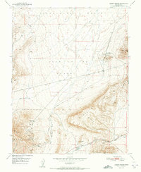 1951 Desert Mound1951 Print · USGSIron County’s mining and ranching heritage is on display during the early 1950s as the railroad pushes toward the mineral pits. Genealogists and historians can trace industrial sites like the Open Pit Iron Mine, the rural Woolsey Ranch, and the Union Pacific line.2 unique versions available
 - 1951 Map of The Three Peaks
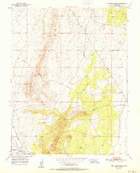 1951 The Three Peaks1951 Print · USGSIron County's mining and ranching landscape is recorded here in the early fifties, centered on the railroad hub at Iron Springs. Genealogists and historians can trace the Union Pacific line, find early Prospects, and locate the Hole in the Wall.
 - 1951 Map of Kanarraville
 1951 Kanarraville1951 Print · USGSKanarraville and the Cedar Valley are captured here in the early 1950s, showing the town's original footprint along the Hurricane Cliffs. Genealogists and local historians can locate the Cemetery, trace the path of Kanarra Creek, and identify early water features like Mud Springs.
 - 1951 Map of Stoddard Mtn
 1951 Stoddard Mtn1951 Print · USGSThe Harmony Mountains of southern Utah are captured here in the early fifties, showing a rugged interior at the Iron and Washington county line. Researchers can trace the Union Pacific spur to Iron Mountain Wye and locate remote outposts like Kelsey Deer Camp and an inactive coal mine.
 - 1951 Map of Page Ranch
 1951 Page Ranch1951 Print · USGSIron County ranching and heavy industry intersect at the start of the fifties as iron mining intensifies on the mountain slopes. Researchers can locate the Old Irontown Ruins, trace the Union Pacific line to the Columbia Steel Mine, and find family outposts like Page Ranch.2 unique versions available
 - 1951 Map of Avon, 1952 Print
 1951 Avon1952 Print · USGSThe mid-century Utah desert comes into focus on this 1951 survey of Iron County during the height of the steam-to-diesel rail transition. Trace the path of the Union Pacific through the Escalante Desert and find early landmarks like Avon and Dick Palmer Wash.
 - 1951 Map of Avon NW, 1952 Print
 1951 Avon NW1952 Print · USGSThe arid expanses of the Iron County desert are captured here in the early fifties, showing a landscape defined by ranching and rail. Genealogists and historians can locate Johnston Ranch, trace the Union Pacific line, and find remote water sources like Websters Well.3 unique versions available
Showing maps 1-25 of 43
Top cities of Iron County
- Cedar City historical maps
- Enoch historical maps
- Parowan historical maps
- Paragonah historical maps
- Newcastle historical maps
- Kanarraville historical maps
See more
Frequently asked questions
- What are the different types of historical maps available for Iron County?
- What is the oldest map of Iron County?
- Where can I purchase historical maps of Iron County for my home or office?
- Where can I download high-res historical maps of Iron County?
- Are there historical topographic maps available for Iron County?
- Is there historical aerial imagery available for Iron County?
- Where are historical maps of Iron County sourced from?