1950s Maps of Wyoming
Explore 1,365 historic maps of Wyoming from the 1950s. These maps offer a rare glimpse into what life looked like during the 1950s — showing old roads, neighborhoods, homes, and landmarks that have changed or disappeared over time.
Whether you're researching your family's past, planning a metal detecting trip, or studying how Wyoming's landscape evolved across the 1950s, these high-resolution maps are a powerful tool for exploring the history of this region.
- Focus on a specific era: All maps on this page are from the 1950s, giving you a focused view of this time period.
- See what’s changed: Compare century-old streets, trails, and buildings to today's modern landscape using overlays and satellite layers.
- Research with precision: Use these maps for genealogy, historical research, land use analysis, or educational projects.
- View, download, or print: Maps are fully viewable online in high resolution, and can be downloaded or printed for your own records.
Start exploring Wyoming's history through authentic maps from the 1950s. This is your window into the past.
Wyoming maps
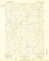
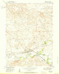
- 1950 Map of Glendo
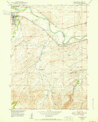
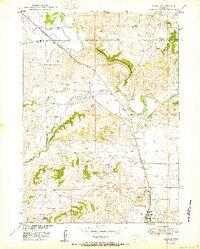 1950 Glendo1950 Print · USGSThe high plains of eastern Wyoming are captured here in the post-war era as the rail-and-river economy centered on the North Platte River matured. Genealogists and historians can trace the early layout of Glendo and locate vanished siding stops like Bona along the Chicago Burlington and Quincy tracks.
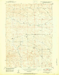
 - 1950 Map of Campbell Hill
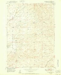
 1950 Campbell Hill1950 Print · USGSConverse and Natrona counties are captured here at mid-century, where the burgeoning oil industry meets traditional high-plains ranching. Local historians can trace family landholdings like the K Lazy S Ranch or the legacy of the Big Muddy Coal Mine (Abandoned).
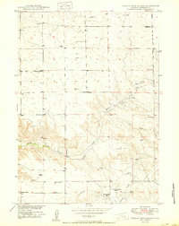
 - 1950 Map of Clausen Ranch
 1950 Clausen Ranch1950 Print · USGSRanching and early energy development meet in 1950s Wyoming, where the range is marked by cattle operations and a long-distance oil line. Genealogists can trace family holdings like Clausen Ranch and find the sites of Clausen School (Abandoned).
 - 1950 Map of Spring Creek
 1950 Spring Creek1950 Print · USGSPlatte County ranching country is captured here at mid-century during the Missouri River Basin development project. Genealogists and historians can trace old water rights and livestock improvements along Horseshoe Creek, Whiskey Gulch, and several Windmill sites.
 - 1950 Map of Careyhurst
 1950 Careyhurst1950 Print · USGSConverse County ranching and rail history are on full display in the mid-century North Platte River valley. Genealogists and historians can trace family-named sites like Careyhurst Ranch and the corridors of the Chicago and Northwestern railroad.
 - 1950 Map of Lockett
 1950 Lockett1950 Print · USGSThe North Platte River valley at the mid-century shows a distinct mix of Wyoming ranching and energy production. Genealogists and historians can trace family land at the Old Webble Ranch and Lamb Ranch or explore the early infrastructure of the Big Muddy Oil Field.
 - 1950 Map of Poison Lake
 1950 Poison Lake1950 Print · USGSThe Converse County rangelands in the late 1940s show a transition from pioneer trails to established ranching life. Genealogists and historians can locate legacy operations like Norton Ranch and trace the historic Site of Old La Bonte Stage Station.
 - 1950 Map of Amend Ranch
 1950 Amend Ranch1950 Print · USGSConverse County ranching life is captured here at mid-century, showing the isolated homesteads and vital water sources of the high plains. Genealogists and historians can trace family holdings like Amend Ranch and Reese Bros Ranch, or locate the Prairie View Cem.
 - 1950 Map of Ragged Top Mountain
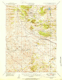
 1950 Ragged Top Mountain1950 Print · USGSHigh plains ranching and military maneuvers converge in Albany County during the mid-century, where the Medicine Bow National Forest meets the open range. Genealogists and historians can trace legacy holdings like the King Brothers Ranch or the industrial footprint of the Feldspar Strip Mine.
 - 1950 Map of Brookhurst
 1950 Brookhurst1950 Print · USGSMid-century Natrona County is documented here as ranching traditions and railroad industry converged along the North Platte River. Researchers can trace early rural infrastructure through the Muddy Sch, Mystery Bridge, and family holdings like Hat Six Ranch.
 - 1950 Map of Gilbert Lake
 1950 Gilbert Lake1950 Print · USGSConverse County ranchlands are captured here at mid-century as part of the Missouri River Basin development program. Researchers can trace historic water rights and land use through features like Smith Ranch, the Gilbert Ditch, and Sage Creek.
 - 1950 Map of Cedar Top
 1950 Cedar Top1950 Print · USGSThe high plains of eastern Wyoming are captured here at mid-century, straddling the border of Niobrara and Platte counties. Researchers can trace the ranching landscape through landmarks like Spanish Diggings and the elevations of Sheep Mountain and Horse Tooth.
 - 1950 Map of Leuenberger Ranch
 1950 Leuenberger Ranch1950 Print · USGSConverse County ranching life is captured here at mid-century, defined by isolated homesteads and high plains cattle country. Genealogists and historians can locate family landmarks like Leuenberger Ranch, Negley Ranch, and Keenan Ranch.
 - 1950 Map of Parkerton
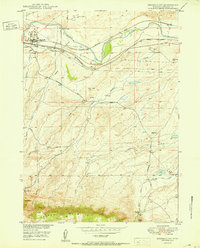
 1950 Parkerton1950 Print · USGSMid-century Converse County is defined here by the industrial energy of the Big Muddy Oil Field and the vital transport corridor of the North Platte River. Genealogists and historians can trace the growth of Glenrock, locate the Oil Refinery, and follow the path of the Chicago and Northwestern railroad.
 - 1950 Map of Prairie View School
 1950 Prairie View School1950 Print · USGSThe high plains of Niobrara County come alive in this mid-century survey of Wyoming's ranching country. Researchers can trace the layout of family holdings like the Hester Ranch and Richardson Ranch or locate the community center at Prairie View Sch.2 unique versions available
 - 1950 Map of Douglas
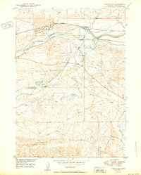
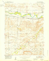
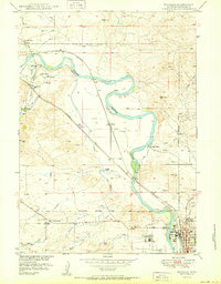 1950 Douglas1950 Print · USGSThe Douglas area in the mid-twentieth century was a vital crossroads of rail and river, deeply rooted in its frontier past. Trace the path of historical migrations at the Bozeman Trail Marker or locate the Site of Old Fort Fetterman and State Fair Grounds.
 - 1950 Map of Orin
 1950 Orin1950 Print · USGSRanching and railroading define this Converse County corridor during the late 1940s, centered on the vital waters of the North Platte. Genealogy researchers can trace family landmarks like Townsend Ranch and Schneider Ranch or locate the historic McKinley (PO).
 - 1950 Map of Orpha
 1950 Orpha1950 Print · USGSConverse County ranching and rail infrastructure are captured here in the post-war era as irrigation transformed the North Platte valley. Genealogists can locate family holdings like Hart Ranch and Burk Ranch or find vanished schoolhouses including Whiting Sch and Pleasant Valley Sch.
 - 1950 Map of Irvine
 1950 Irvine1950 Print · USGSConverse County rangeland and the Platte River valley are captured here at mid-century as the rail and ranching economy thrived. Genealogists and historians can locate family-named landmarks like Miller and Foster, or trace the paths of the Chicago and Northwestern and the Burlington railroads.
 - 1950 Map of Glenrock NW
 1950 Glenrock NW1950 Print · USGSConverse County at the dawn of the fifties shows a landscape of ranching and early energy development. Researchers can trace the layout of the South Cole Creek Unit and find local landmarks like Hyland Ranch, Spence, and the CAA Building.
 - 1950 Map of Sherman Mountains
 1950 Sherman Mountains1950 Print · USGSHigh Wyoming ranching and military lands are captured here at mid-century as the Lincoln Highway and Union Pacific cross the Laramie Mountains. Genealogists can locate named homesteads like the Davis Ranch and the landmark Ames Monument.2 unique versions available
 - 1950 Map of Pratts Soda Lakes
 1950 Pratts Soda Lakes1950 Print · USGSNatrona County's mid-century landscape is defined by the energy and mining industries, showing a vast network of infrastructure. Trace old energy routes and mining sites like the Swigart Coal Mine, Cole Creek Oil Field, and Suicide Soda Lake.
 - 1950 Map of Antelope Creek
 1950 Antelope Creek1950 Print · USGSConverse County ranching country is captured here at mid-century, showing the isolated homesteads and vital water sources of the high plains. Genealogists and local historians can locate Combs Ranch, Wallis Ranch, and the Graves School (Abandoned).
 - 1950 Map of Glenrock
 1950 Glenrock1950 Print · USGSGlenrock and the surrounding Converse County ranchlands are captured here at mid-century, where the railroad corridor follows the winding river. Genealogists and historians can locate the H A Unthank Grave, the Macy Place, and the industrial Glenrock Gravel Pit.
 - 1950 Map of Shawnee
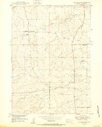
 1950 Shawnee1950 Print · USGSConverse County at the start of the 1950s shows a landscape organized by rail and river. Trace the development of small settlements like Shawnee and Fisher along the Chicago and Northwestern line near the North Platte River.
Showing maps 1-25
Top cities of Wyoming
- Cheyenne historical maps
- Casper historical maps
- Laramie historical maps
- Gillette historical maps
- Rock Springs historical maps
- Sheridan historical maps
See more
Top counties of Wyoming
- Laramie County historical maps
- Natrona County historical maps
- Campbell County historical maps
- Sweetwater County historical maps
- Fremont County historical maps
- Albany County historical maps
See more
Frequently asked questions
- What are the different types of historical maps available for Wyoming?
- What is the oldest map of Wyoming?
- Where can I purchase historical maps of Wyoming for my home or office?
- Where can I download high-res historical maps of Wyoming?
- Are there historical topographic maps available for Wyoming?
- Is there historical aerial imagery available for Wyoming?
- Where are historical maps of Wyoming sourced from?