1970s Maps of Wyoming
Explore 403 historic maps of Wyoming from the 1970s. These maps offer a rare glimpse into what life looked like during the 1970s — showing old roads, neighborhoods, homes, and landmarks that have changed or disappeared over time.
Whether you're researching your family's past, planning a metal detecting trip, or studying how Wyoming's landscape evolved across the 1970s, these high-resolution maps are a powerful tool for exploring the history of this region.
- Focus on a specific era: All maps on this page are from the 1970s, giving you a focused view of this time period.
- See what’s changed: Compare century-old streets, trails, and buildings to today's modern landscape using overlays and satellite layers.
- Research with precision: Use these maps for genealogy, historical research, land use analysis, or educational projects.
- View, download, or print: Maps are fully viewable online in high resolution, and can be downloaded or printed for your own records.
Start exploring Wyoming's history through authentic maps from the 1970s. This is your window into the past.
Wyoming maps
- 1970 Map of Purdy Reservoir, 1973 Print
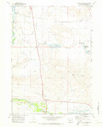
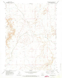
 1970 Purdy Reservoir1973 Print · USGSRanching and energy development define this Wyoming landscape during the early seventies. Genealogists can trace family-named landmarks like George Hess Draw or locate the Purdy Reservoir and the historic TA Hills.2 unique versions available
 - 1970 Map of Daniel Junction, 1973 Print
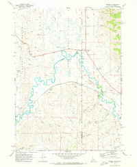
 1970 Daniel Junction1973 Print · USGSUpper Green River ranching country in the early seventies is defined here by a sophisticated network of canals and reservoirs. Genealogists and local historians can trace family-named landmarks and water rights via Ashley Ditch, Jenkins Ditch, and the settlement of Bronx.
 - 1970 Map of Border, 1973 Print
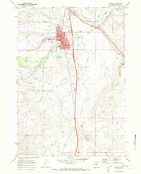
 1970 Border1973 Print · USGSThe Idaho-Wyoming border comes alive in the early seventies, capturing a high-desert landscape defined by the Bear River and the Union Pacific Railroad. Genealogists and historians can trace old homestead sites near Chausse or explore the transit history of Border and Border Junction.2 unique versions available
 - 1970 Map of Buffalo, 1973 Print
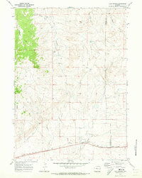
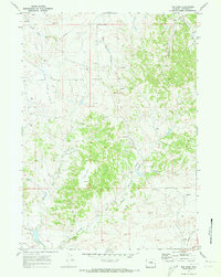
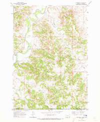
 1970 Buffalo1973 Print · USGSBuffalo was a growing hub of Johnson County in the early seventies, centered on the banks of Clear Creek. Researchers can trace the Old Military Reservation Boundary and locate local landmarks like Willow Grove Cemetery and the Fairground.2 unique versions available
 - 1970 Map of Lost Springs, 1973 Print
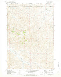
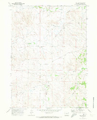
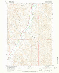
 1970 Lost Springs1973 Print · USGSLost Springs and the surrounding high plains of Converse County are shown in detail during the early 1970s. Local researchers can trace the Chicago and North Western rail line, the mining operations at Rosin Mine, and terrain features like Rocky Top.
 - 1970 Map of Budd Reservoir, 1973 Print
 1970 Budd Reservoir1973 Print · USGSIn the early seventies, this part of Wyoming was characterized by its essential water infrastructure and high-plains terrain. You can trace the path of the Joe Budd Supply Ditch to Budd Reservoir or locate Dead Indian Dome.
 - 1970 Map of South Barrel Spring, 1973 Print
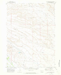
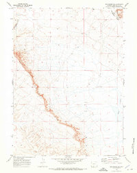
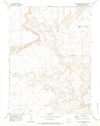
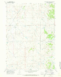
 1970 South Barrel Spring1973 Print · USGSSweetwater and Carbon counties appear here in the early 1970s, characterized by isolated water sources and high-desert draws. Researchers can trace remote infrastructure like West Hangout Road and locate critical water points including South Barrel Spring and Dad Dail Reservoir.
 - 1970 Map of Mexican Flats, 1973 Print
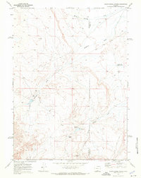
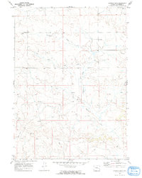
 1970 Mexican Flats1973 Print · USGSCarbon County's high plains in the early seventies reveal a landscape of ranching and resource extraction. Genealogists and researchers can trace the Pool Ranch and find remnants of early energy exploration like the Oil Well and Pipeline across Mexican Flats.
 - 1970 Map of Red Desert SW, 1973 Print
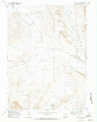
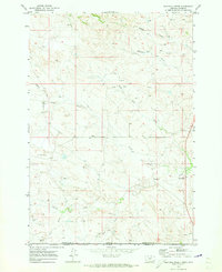
 1970 Red Desert SW1973 Print · USGSHigh desert terrain in Sweetwater County comes into focus in 1970, showing the high plateaus of the Red Desert. Researchers can trace the Continental Divide along the prominent Delaney Rim and locate landmarks like Wells Bluff.
 - 1970 Map of O T O Ranch, 1973 Print
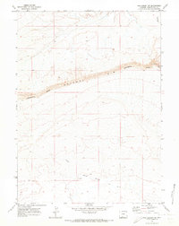
 1970 O T O Ranch1973 Print · USGSThe Montana and Wyoming state line bisects this ranching landscape during the early 1970s, showing the high-country drainages of the Badger Hills. Researchers can trace the boundaries of the 77 Ranch and OTO Ranch near Spring Creek.2 unique versions available
 - 1970 Map of Red Desert SE, 1973 Print
 1970 Red Desert SE1973 Print · USGSSweetwater County's high desert landscape is documented here during the early 1970s, showing the intersection of energy exploration and open range. Trace the path of the Continental Divide past the steep Wells Bluff Delaney Rim and isolated drill holes.
 - 1970 Map of Younts Peak, 1973 Print
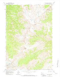
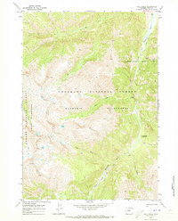
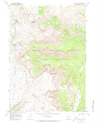 1970 Younts Peak1973 Print · USGSThe Absaroka Range in the early 1970s reveals a wilderness of high peaks and river headwaters where the Continental Divide splits the county lines. Trace historic travel routes over Marston Pass or follow the Pack Trail along the South Fork Yellowstone River.2 unique versions available
 - 1970 Map of Cow Creek Reservoir, 1973 Print
 1970 Cow Creek Reservoir1973 Print · USGSSweetwater County's high desert landscape comes into focus in the early 1970s, showing a remote network of range improvements and desert landmarks. Researchers can trace the drainage of Shell Creek and locate remote catchments like Petrified Wood Reservoir and Adobe Town Rim.
 - 1970 Map of Prehistoric Rim, 1973 Print
 1970 Prehistoric Rim1973 Print · USGSSweetwater County's high desert landscape is documented in the early 1970s, showcasing the intricate drainage of the Prehistoric Rim. Local researchers can trace early resource exploration and navigation routes through features like the drill hole and the rugged Jeep Trail.
 - 1970 Map of Sheep Mesa, 1973 Print
 1970 Sheep Mesa1973 Print · USGSPark County, Wyoming, is captured in the early 1970s as a high-country wilderness before modern trail modifications. Researchers can trace historical routes like the FISHHAWK TRAIL and identify landmarks including Blackwater Natural Bridge and Battlement Mountain.
 - 1970 Map of The Park, 1973 Print
 1970 The Park1973 Print · USGSConverse County at the start of the 1970s shows a landscape being reshaped by the energy industry and changing transportation. Researchers can trace the Flat Top Oil and Gas Field, find an isolated Cemetery, or follow the path of an Old Railroad Grade.2 unique versions available
 - 1970 Map of Bill 4 SE, 1973 Print
 1970 Bill 4 SE1973 Print · USGSConverse County ranching and energy development come into focus in the early 1970s. Researchers can trace land use patterns near Moore Ranch and locate remote infrastructure like the isolated Landing Strip and various Flowing Wells.2 unique versions available
 - 1970 Map of Powder Mountain NE, 1973 Print
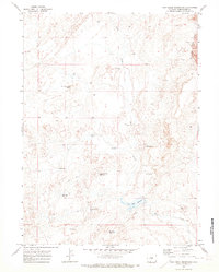
 1970 Powder Mountain NE1973 Print · USGSHigh-desert ranching and survey lands in Sweetwater County are captured in the early seventies, showing a landscape defined by seasonal water and navigation. Trace historic access routes along Jeep Trails past prominent landmarks like Church Butte and Sandy Butte Reservoir.
 - 1970 Map of Belle Creek South, 1973 Print
 1970 Belle Creek South1973 Print · USGSThe Montana-Wyoming borderlands at the start of the 1970s reveal a landscape in transition from ranching to energy. Researchers can locate the Walloth Sch, the Belle Creek Oil Field, and the Ridge Cem among the high plains.
 - 1970 Map of Moorhead, 1973 Print
 1970 Moorhead1973 Print · USGSThe Montana-Wyoming border comes alive in the early seventies, centered on the Powder River and the small settlement of Moorhead. Trace the topographic detail of The Devils Backbone and find water markers like the Flowing Well and Gaging Sta.
 - 1970 Map of Fall Creek, 1973 Print
 1970 Fall Creek1973 Print · USGSPark County at the start of the 1970s shows a high-country wilderness shaped by mining history and the South Fork Shoshone River. Researchers can trace the Stinkingwater Mining Region, the remote Majo Ranch, and miles of high-altitude pack trails.2 unique versions available
 - 1970 Map of Buffalo NE, 1973 Print
 1970 Buffalo NE1973 Print · USGSJohnson County’s landscape in the early seventies reveals a complex system of water management and local settlement. Genealogists and historians can trace the paths of Big Bonanza Ditch and Des Moines Ditch, or locate landmarks like Section School.2 unique versions available
 - 1970 Map of Walker Creek School, 1973 Print
 1970 Walker Creek School1973 Print · USGSConverse County, Wyoming, is captured here in the early seventies, showing a landscape shaped by water and early energy infrastructure. Trace local landmarks like the Walker Creek School and early industrial sites including a Pumping Sta and pipeline.
 - 1970 Map of Simpson Draw, 1973 Print
 1970 Simpson Draw1973 Print · USGSConverse County ranching and emerging energy interests appear in detail here during the early seventies. Genealogists and historians can locate family holdings such as Sybrant and Hall Ranch or trace the course of Shawnee Creek.2 unique versions available
 - 1970 Map of Wild Bill Creek, 1973 Print
 1970 Wild Bill Creek1973 Print · USGSThe Montana Wyoming borderlands are captured here in the early seventies, detailing a landscape of ranch land and energy prospecting. Trace the drainage of Wild Bill Creek and Blacktail Creek or locate scattered Drill Holes and an Oil Well from the era's oil boom.
Showing maps 1-25
Top cities of Wyoming
- Cheyenne historical maps
- Casper historical maps
- Laramie historical maps
- Gillette historical maps
- Rock Springs historical maps
- Sheridan historical maps
See more
Top counties of Wyoming
- Laramie County historical maps
- Natrona County historical maps
- Campbell County historical maps
- Sweetwater County historical maps
- Fremont County historical maps
- Albany County historical maps
See more
Frequently asked questions
- What are the different types of historical maps available for Wyoming?
- What is the oldest map of Wyoming?
- Where can I purchase historical maps of Wyoming for my home or office?
- Where can I download high-res historical maps of Wyoming?
- Are there historical topographic maps available for Wyoming?
- Is there historical aerial imagery available for Wyoming?
- Where are historical maps of Wyoming sourced from?