1930s Maps of Wyoming
Explore 27 historic maps of Wyoming from the 1930s. These maps offer a rare glimpse into what life looked like during the 1930s — showing old roads, neighborhoods, homes, and landmarks that have changed or disappeared over time.
Whether you're researching your family's past, planning a metal detecting trip, or studying how Wyoming's landscape evolved across the 1930s, these high-resolution maps are a powerful tool for exploring the history of this region.
- Focus on a specific era: All maps on this page are from the 1930s, giving you a focused view of this time period.
- See what’s changed: Compare century-old streets, trails, and buildings to today's modern landscape using overlays and satellite layers.
- Research with precision: Use these maps for genealogy, historical research, land use analysis, or educational projects.
- View, download, or print: Maps are fully viewable online in high resolution, and can be downloaded or printed for your own records.
Start exploring Wyoming's history through authentic maps from the 1930s. This is your window into the past.
Wyoming maps
- 1931 Map of Jackson, 1961 Print
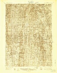
 1931 Jackson1961 Print · USGSJackson and the upper Snake River canyon are documented here in the early thirties, showcasing a wilderness era of ranching and forestry. Researchers can trace early outposts like Browns Ranch or locate family history at the Etna Cem and Johnny Counts Flat.
 - 1932 Map of Irwin
 1932 Irwin1932 Print · USGSThe Snake River corridor and the high mountain basins of eastern Idaho are captured here in the early 1930s. Researchers can trace early river crossings like Edwards Ferry or find small-community landmarks like Rainy Dale and Pumpkin Center Sch.2 unique versions available
 - 1932 Map of Savery
 1932 Savery1932 Print · USGSSouthern Wyoming ranching and mining country meet at the edge of the Rockies in the early thirties. Genealogists and historians can locate rural schools like Ketchum Sch, the operations of Pioneer Coal Co, and the remote Tullis settlement.3 unique versions available
 - 1935 Map of Irwin
 1935 Irwin1935 Print · USGSThe Idaho-Wyoming borderlands are captured here in the 1930s as the river economy and mountain ranching defined the region. Researchers can trace the early road networks and rural institutions from Edwards Ferry to local schools like Fidelity Sch and Blowout Sch.3 unique versions available
 - 1935 Map of Jackson
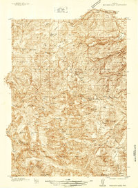
 1935 Jackson1935 Print · USGSThe high valleys of the Teton and Gros Ventre ranges are captured here in the mid-thirties, showing the early infrastructure of the upper Snake River region. Researchers can locate early schools and ranching outposts like Porcupine Sch, Browns Ranch, and the Jackson Mine.2 unique versions available
 - 1936 Map of Cokeville
 1936 Cokeville1936 Print · USGSWestern Wyoming in the mid-1930s reveals a landscape where pioneer history and rail infrastructure meet. Trace the routes of the Oregon Trail and Dempsey Trail past remote schools like Upper Hams Fork Sch and the Fontenelle Ranger Sta.
 - 1937 Map of Moccasin Lake
 1937 Moccasin Lake1937 Print · USGSThe high Wind River Range in the late thirties is documented here along the divide. Genealogists and researchers can trace early administrative outposts like Washakie Park Ranger Sta and North Fork Guard Sta among peaks like Mt Popo Agie.5 unique versions available
 - 1938 Map of Mt Bonneville, 1955 Print
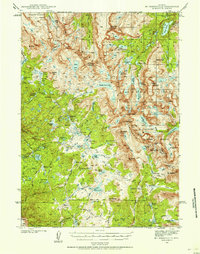 1938 Mt Bonneville1955 Print · USGSThe high alpine wilderness of Sublette and Fremont Counties is captured here in the late thirties, centered on the Continental Divide. Researchers can trace early forest service outposts like South Fork Guard Sta and the intricate path of the High Line Trail past Grave Lake and Mt Bonneville.6 unique versions available
 - 1939 Map of Saratoga
 1939 Saratoga1939 Print · USGSThe North Platte valley comes alive in the late 1930s as a vital corridor for ranching and transport. Researchers can trace the Saratoga and Encampment Railroad or locate early rural schools like Benton Creek Sch and the Big Cr Mine.3 unique versions available
 - 1939 Map of Big Piney, 1957 Print
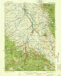
 1939 Big Piney1957 Print · USGSSublette County ranching country and the Green River valley are shown here just before the war. You can trace the historic Lander Trail and locate early sites like Site of Old Ft Bonneville and Halfway.
End of results
Showing maps 1-10
Top cities of Wyoming
- Cheyenne historical maps
- Casper historical maps
- Laramie historical maps
- Gillette historical maps
- Rock Springs historical maps
- Sheridan historical maps
See more
Top counties of Wyoming
- Laramie County historical maps
- Natrona County historical maps
- Campbell County historical maps
- Sweetwater County historical maps
- Fremont County historical maps
- Albany County historical maps
See more
Frequently asked questions
- What are the different types of historical maps available for Wyoming?
- What is the oldest map of Wyoming?
- Where can I purchase historical maps of Wyoming for my home or office?
- Where can I download high-res historical maps of Wyoming?
- Are there historical topographic maps available for Wyoming?
- Is there historical aerial imagery available for Wyoming?
- Where are historical maps of Wyoming sourced from?