1940s Maps of Wyoming
Explore 49 historic maps of Wyoming from the 1940s. These maps offer a rare glimpse into what life looked like during the 1940s — showing old roads, neighborhoods, homes, and landmarks that have changed or disappeared over time.
Whether you're researching your family's past, planning a metal detecting trip, or studying how Wyoming's landscape evolved across the 1940s, these high-resolution maps are a powerful tool for exploring the history of this region.
- Focus on a specific era: All maps on this page are from the 1940s, giving you a focused view of this time period.
- See what’s changed: Compare century-old streets, trails, and buildings to today's modern landscape using overlays and satellite layers.
- Research with precision: Use these maps for genealogy, historical research, land use analysis, or educational projects.
- View, download, or print: Maps are fully viewable online in high resolution, and can be downloaded or printed for your own records.
Start exploring Wyoming's history through authentic maps from the 1940s. This is your window into the past.
Wyoming maps
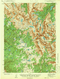
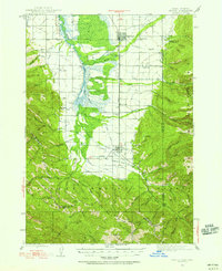
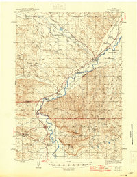
(49)- 1940 Map of Savery
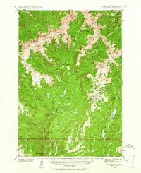
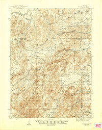
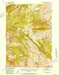
 1940 Savery1940 Print · USGSThe high country of the Wyoming-Colorado border is captured here as the ranching and forest service outposts of the early twentieth century were becoming established. Researchers can trace the remote Snake River drainage and find historic sites like Tullis, Savery, and the Rambler Ranger Sta.2 unique versions available
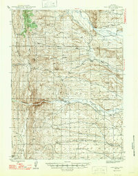
 - 1940 Map of Mt Wallace, 1963 Print
 1940 Mt Wallace1963 Print · USGSPark County high country is documented here at the start of the 1940s, where national forest and park lands converge. Researchers can trace remote routes like the Poacher Trail and find isolated outposts such as Bull Moose Cabin and Hellroaring Ranger Station.3 unique versions available
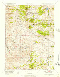
 - 1941 Map of Mt Bonneville
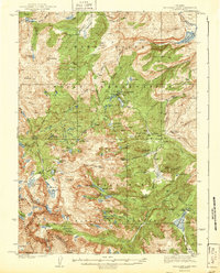
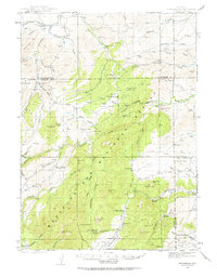
 1941 Mt Bonneville1941 Print · USGSThe high country of the Wind River Range is captured here in the late thirties, documenting the remote alpine terrain of the Washakie National Forest. Researchers can trace historic backcountry routes like the High Line Trail and find isolated landmarks such as the John Day Cabin or Cow Camp.
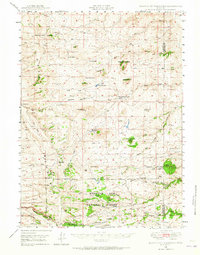
 - 1942 Map of Cokeville
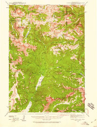
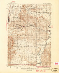
 1942 Cokeville1942 Print · USGSWestern Wyoming migration routes are frozen in time on this survey of Lincoln County in the late thirties. Genealogists and historians can trace the physical paths of the Oregon Trail, find the Upper Hams Fork Sch, and locate remote outposts like Smiths Fork Guard Station.3 unique versions available
 - 1942 Map of Big Piney
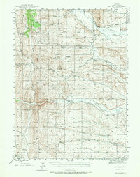
 1942 Big Piney1942 Print · USGSSublette County ranching and frontier history are captured here in the early 1940s, just as the region's irrigation and land management systems were maturing. Genealogists can locate family names and remote landmarks like the Bronx Sch, the Site of Old Ft Bonneville, and the State Fish Hatchery.
 - 1942 Map of Mt Bonneville
 1942 Mt Bonneville1942 Print · USGSHigh mountain wilderness near the Fremont and Sublette County line is documented here in the late thirties. Researchers can locate remote outposts like the South Fork Guard Sta and John Day Cabin along the Continental Divide Trail.2 unique versions available
 - 1942 Map of Cutoff Mtn, 1959 Print
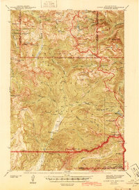
 1942 Cutoff Mtn1959 Print · USGSThe Absaroka-Beartooth wilderness along the Montana-Wyoming border is captured here in the early 1940s. Researchers can trace the high-country trails and sites like the Independence Mine, Silver Tip Ranch, and the Cooke Ranger Sta.4 unique versions available
 - 1943 Map of Mt Wallace
 1943 Mt Wallace1943 Print · USGSThe Absaroka wilderness at the edge of Yellowstone comes to life in the late 1930s, showing a remote landscape of high basins and ranger outposts. Trace the early trails and lookouts of the era, from Hellroaring Ranger Station to the Bull Moose Cabin and Poacher Trail.3 unique versions available
 - 1943 Map of Moccasin Lake
 1943 Moccasin Lake1943 Print · USGSThe Wind River high country is captured here just before the mid-century, spanning the Continental Divide and tribal lands. Researchers can trace the original Washakie Trail and locate remote outposts like the North Fork Guard Sta and Mosquito Park.2 unique versions available
 - 1943 Map of Driggs, 1955 Print
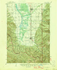
 1943 Driggs1955 Print · USGSTeton Valley during the mid-forties is depicted as a thriving agricultural and rail corridor between the high peaks of the Teton Mountains. Researchers can trace the heritage of local rural life through labels for Bates Sch, Darby Ch, and the Union Pacific line.3 unique versions available
 - 1943 Map of Esterbrook, 1963 Print
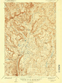
 1943 Esterbrook1963 Print · USGSThe Laramie Range high country comes into focus in the early 1940s, showing a landscape of remote mountain ranches and forest lookouts. Researchers can trace historic family holdings like La Bonte Ranch and find small rural schoolhouses such as Morton Sch and Hanks Sch.
 - 1944 Map of Cutoff Mtn
 1944 Cutoff Mtn1944 Print · USGSThe northern gateway to Yellowstone and the high Absaroka wilderness are documented in the early 1940s, just as the park’s modern boundaries were being refined. Trace the historic Northeast Entrance, the remote Silver Tip Ranch, and the high-altitude Independence Mine.2 unique versions available
 - 1944 Map of Red Lodge, 1946 Print
 1944 Red Lodge1946 Print · USGSCarbon County’s coal and ranching economy is captured here in the mid-1940s, from the railhead at Red Lodge to the banks of the Clarks Fork Yellowstone River. Genealogists and industrial historians can trace the operations of the Smith Mine, the Ohio Oil Co Camp, and the rural Clear Creek Sch.3 unique versions available
 - 1945 Map of Esterbrook
 1945 Esterbrook1945 Print · USGSThe Converse and Albany county line in the 1940s reveals a high-plains landscape of remote mountain schools and family ranches. Genealogists can locate family landmarks like La Bonte Ranch and Morton Sch or trace the old Horseshoe Trail.2 unique versions available
 - 1945 Map of Kirby, 1958 Print
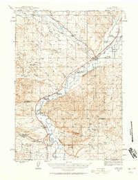 1945 Kirby1958 Print · USGSThe Bighorn River valley in the mid-1940s shows a region transitioning from its peak coal-mining years. Genealogists and historians can trace defunct operations like Crosby Mine, rail stops at Chatham Sta, and old frontier landmarks like The Willows (Old Stage Sta).2 unique versions available
 - 1945 Map of Fort Hill, 1970 Print
 1945 Fort Hill1970 Print · USGSLincoln County ranching and water history come alive in this mid-century survey of the high Wyoming plains. Researchers can locate established homesteads like Herschler Ranch and trace the vital irrigation paths of the La Barge Canal.2 unique versions available
 - 1946 Map of Driggs
 1946 Driggs1946 Print · USGSThe Teton Valley was a landscape of remote mountain peaks and irrigated ranch land during the mid-forties. Genealogists and historians can trace old homestead sites near Bates Sch and Sorensen or follow the historic Union Pacific rail line between Driggs and Victor.
 - 1946 Map of Kirby
 1946 Kirby1946 Print · USGSThe Bighorn River valley in the mid-1940s reveals a transition from active coal extraction to a rail-and-ranching economy. Researchers can locate the remnants of the Crosby Mine, the site of The Willows (Old Stage Sta), and the settlement of Gebo.
 - 1947 Map of Fort Hill
 1947 Fort Hill1947 Print · USGSThe high ranchlands of western Wyoming are captured in the late 1940s, showing the early infrastructure of Lincoln County. Genealogists and historians can locate family landmarks like the Facenelli Ranch, Herschler Ranch, and the prominent Fort Hill.
 - 1947 Map of Bozeman, 1948 Print
 1947 Bozeman1948 Print · USGSBozeman and the surrounding mountain ranges are captured here just after the war, showing the vital rail and river networks of southwestern Montana. Genealogists and historians can trace routes to early settlements like Virginia City, Gallatin Gateway, and the mountain community of Jardine.
 - 1948 Map of Bozeman, 1951 Print
 1948 Bozeman1951 Print · USGSSouthern Montana in the late 1940s is shown as a high-country crossroads of rail lines and river headwaters. Genealogists and historians can trace old town sites like Virginia City and McLeod alongside the Northern Pacific and Milwaukee Road railroads.
 - 1948 Map of Sherman Mountains, 1958 Print
 1948 Sherman Mountains1958 Print · USGSThe high Wyoming plateau between Laramie and Cheyenne is captured here after the war, showing the legendary Lincoln Highway corridor and Medicine Bow ranching life. Researchers can trace the path of the Union Pacific through Sherman and Buford or locate historic family outposts like the K P Ranch.2 unique versions available
 - 1948 Map of Ragged Top Mountain, 1965 Print
 1948 Ragged Top Mountain1965 Print · USGSAlbany County ranching and mining operations are captured here just after the war, showing a high-country network of family-owned land and federal reserves. Researchers can trace historic homesteads like Coles Ranch or locate industrial sites such as the Feldspar Strip Mine and University Quarry.2 unique versions available
 - 1949 Map of Pat O'Hara Mountain, 1952 Print
 1949 Pat O'Hara Mountain1952 Print · USGSPark County ranching and wilderness are captured here in the late Forties, just as the Missouri River Basin project was shaping the region's development. Researchers can trace historic homesteads and outposts like Mooncrest Ranch, Pearson Cabin, and the remote Robbers Roost Cabin.5 unique versions available
 - 1949 Map of Shawnee, 1958 Print
 1949 Shawnee1958 Print · USGSConverse County rangeland comes into focus in the late 1940s as the Missouri River Basin development project began. Genealogists can locate the local Cem near Shawnee or trace the early path of the Chicago and Northwestern railroad past Fisher.
Showing maps 1-25 of 49
Top cities of Wyoming
- Cheyenne historical maps
- Casper historical maps
- Laramie historical maps
- Gillette historical maps
- Rock Springs historical maps
- Sheridan historical maps
See more
Top counties of Wyoming
- Laramie County historical maps
- Natrona County historical maps
- Campbell County historical maps
- Sweetwater County historical maps
- Fremont County historical maps
- Albany County historical maps
See more
Frequently asked questions
- What are the different types of historical maps available for Wyoming?
- What is the oldest map of Wyoming?
- Where can I purchase historical maps of Wyoming for my home or office?
- Where can I download high-res historical maps of Wyoming?
- Are there historical topographic maps available for Wyoming?
- Is there historical aerial imagery available for Wyoming?
- Where are historical maps of Wyoming sourced from?