1960s Maps of Wyoming
Explore 828 historic maps of Wyoming from the 1960s. These maps offer a rare glimpse into what life looked like during the 1960s — showing old roads, neighborhoods, homes, and landmarks that have changed or disappeared over time.
Whether you're researching your family's past, planning a metal detecting trip, or studying how Wyoming's landscape evolved across the 1960s, these high-resolution maps are a powerful tool for exploring the history of this region.
- Focus on a specific era: All maps on this page are from the 1960s, giving you a focused view of this time period.
- See what’s changed: Compare century-old streets, trails, and buildings to today's modern landscape using overlays and satellite layers.
- Research with precision: Use these maps for genealogy, historical research, land use analysis, or educational projects.
- View, download, or print: Maps are fully viewable online in high resolution, and can be downloaded or printed for your own records.
Start exploring Wyoming's history through authentic maps from the 1960s. This is your window into the past.
Wyoming maps
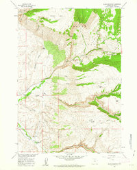
(828)- 1960 Map of Ogden
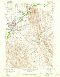
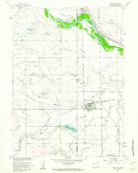
 1960 Ogden1960 Print · USGSIn the mid-1950s, this region of the American West balanced military expansion with frontier history along the Union Pacific RR. Genealogists and historians can trace old settlements like Fort Bridger, the residential growth of Washington Terrace, and industrial sites from the Hill AFB complex to the coal mines of Kemmerer.
 - 1960 Map of Tremain
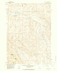
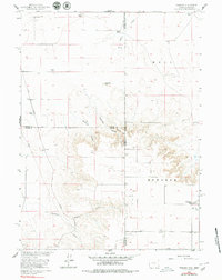 1960 Tremain1960 Print · USGSThe high plains of the Wyoming-Nebraska border come into focus in 1960, showing a landscape defined by cattle ranching and rail infrastructure. Researchers can trace historic family-named homesteads like Bull Canyon Ranch and Spahr Ranch alongside the Epworth Cem.3 unique versions available
 - 1960 Map of Ashton
 1960 Ashton1960 Print · USGSThe Idaho-Montana-Wyoming borderlands at the dawn of the sixties show a landscape defined by the Continental Divide and early wilderness tourism. Genealogists and historians can trace rail-stop settlements like Trude Siding, old outposts like Warm River, and early lodging at Snowball Inn.
 - 1960 Map of Salt Lake City
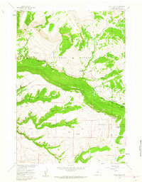
 1960 Salt Lake City1960 Print · USGSThe Wasatch Front and High Uintas are captured mid-century as the Salt Lake Valley underwent significant postwar expansion. Genealogists and historians can trace rail lines like the Union Pacific and locate established landmarks such as Fort Douglas, Camp Williams, and the Bingham Canyon Mine.
 - 1960 Map of Craig
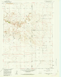
 1960 Craig1960 Print · USGSNorthwest Colorado in the 1950s is a landscape of mountain summits and industrial growth at the headwaters of the West. Genealogists and historians can trace rail-town development along the Denver and Salt Lake line, while locating Uranium Mines and settlements like Craig, Meeker, and Steamboat Springs.
 - 1960 Map of Vernal
 1960 Vernal1960 Print · USGSNortheastern Utah was a rugged frontier of mineral extraction and federal conservation in the mid-twentieth century. Genealogists and historians can trace the growth of Vernal, locate Gilsonite mining operations near Bonanza, and explore the 1950s boundaries of Dinosaur National Monument.
 - 1960 Map of Lander, 1961 Print
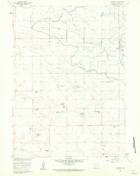
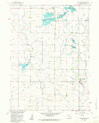
 1960 Lander1961 Print · USGSLander and the Popo Agie River valley are captured here in the early 1960s, showing a landscape defined by irrigation and early industry. Researchers can trace the Chicago and Northwestern tracks to Hudson Siding or locate local landmarks like Mt Hope Cem and the historic Ft McGraw.3 unique versions available
 - 1960 Map of Fuller Reservoir, 1961 Print
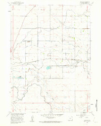
 1960 Fuller Reservoir1961 Print · USGSFremont County ranchlands and early oil exploration are documented here during the early sixties. Researchers can trace the development of water resources through Fuller Reservoir and Deadman Reservoir along the old Shoshoni Road.3 unique versions available
 - 1960 Map of Habig Spring, 1962 Print
 1960 Habig Spring1962 Print · USGSThis Goshen County landscape was captured in the early sixties as irrigation infrastructure reshaped the high plains near the historic river valley. Genealogists and historians can trace the paths of the Fort Laramie Canal and Emigrant Trail Canal past landmarks like Whitehorse Butte and Habig Spring.3 unique versions available
 - 1960 Map of Huntley, 1962 Print
 1960 Huntley1962 Print · USGSAgricultural Goshen County comes into focus in the early sixties, showing the rural communities and irrigation networks of the Wyoming plains. Genealogists and researchers can trace local landmarks like Huntley, Holly, and the Hillview Home alongside the Fort Laramie Canal.3 unique versions available
 - 1960 Map of Shell Falls, 1962 Print
 1960 Shell Falls1962 Print · USGSBighorn National Forest at the start of the 1960s shows a landscape geared toward recreation and resource management. Researchers can trace the mid-century forest infrastructure, from the Shell Creek Ranger Sta to remote sites like Snowshoe Pass and Cabin Creek Campground.2 unique versions available
 - 1960 Map of Veteran, 1962 Print
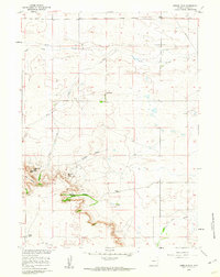
 1960 Veteran1962 Print · USGSIn the early 1960s, this Goshen County landscape centered on the vital water-sharing infrastructure of the Wyoming plains. Researchers can trace the Union Pacific line to Veteran or locate family landmarks like the E G House Ranch and Millies Hill.2 unique versions available
 - 1960 Map of Diamond Flat, 1962 Print
 1960 Diamond Flat1962 Print · USGSThe Goshen County landscape near Diamond Flat was surveyed in the early sixties, showing a ranching region defined by its watercourses and landmarks. Family historians and researchers can locate the Bear Creek Ch and trace the paths of Fox Creek and Lone Tree Canyon.
 - 1960 Map of Mc Compsey Pass, 1962 Print
 1960 Mc Compsey Pass1962 Print · USGSThe Wyoming-Nebraska borderlands in the early sixties reveal a landscape defined by isolated ranches and essential water sources. Trace the movement of livestock and early settlers through Mc Compsey Pass, the Spahr Ranch, and remote landmarks like Devils Armchair.3 unique versions available
 - 1960 Map of White Sulphur Spring, 1962 Print
 1960 White Sulphur Spring1962 Print · USGSBig Horn County in the early sixties is a landscape of high basins and critical water sources. Researchers can trace the drainage patterns of Webber Canyon or locate natural landmarks like Devils Leap and White Sulphur Spring.
 - 1960 Map of Black Mountain, 1962 Print
 1960 Black Mountain1962 Print · USGSThe Bighorn National Forest high country comes into focus in the early sixties, showing the rugged ranching and research outposts of the era. Locate remote landmarks like the Iowa State Univ Geology Camp, Trapper Lodge Ranch, and the Post Creek Picnic Area.3 unique versions available
 - 1960 Map of Petsch Reservoir, 1962 Print
 1960 Petsch Reservoir1962 Print · USGSLaramie and Goshen counties were defined by isolated ranching outposts and vital irrigation works in the early sixties. Genealogists can locate family landmarks like Gregory Ranch and Johnson Ranch or trace the route of the Union Pacific rail line.2 unique versions available
 - 1960 Map of Devil Slide, 1962 Print
 1960 Devil Slide1962 Print · USGSHot Springs County at the start of the 1960s shows a landscape of cattle basins and deep canyons shaped by ancient drainages. Family-named sites like Nickelson Place and Jack Welch Basin offer a detailed look at mid-century ranching life.2 unique versions available
 - 1960 Map of Ross, 1962 Print
 1960 Ross1962 Print · USGSThe high plains of Converse County are shown here in the early sixties, a landscape where the legendary Bozeman Trail still leaves its mark. Genealogists and local historians can locate remote family outposts like Spearhead Ranch, the Bozeman Trail Monument, and the settlement at Ross.2 unique versions available
 - 1960 Map of Coyote Hill, 1962 Print
 1960 Coyote Hill1962 Print · USGSMid-century petroleum development in the Wyoming basins is captured here just as energy infrastructure began to crisscross the county line. Researchers can trace early energy sites like the Kirby Creek Oil Field and Murphy Dome, or locate specific landmarks like Wild Horse Butte and Malcolm Spring.2 unique versions available
 - 1960 Map of Blue Hill, 1962 Print
 1960 Blue Hill1962 Print · USGSHot Springs County ranching and seasonal camps are documented here in the early sixties, showing a landscape defined by seasonal water and isolated outposts. Researchers can locate named landmarks like Johnson Ranch, Fuller Summer Camp, and Jack Welch Basin.
 - 1960 Map of Hawk Springs, 1962 Print
 1960 Hawk Springs1962 Print · USGSGoshen County, Wyoming, is defined by its mid-century irrigation network and rail connectivity in this 1960s study. Researchers can trace the Union Pacific line through Hawk Springs and locate early water landmarks like Bump-Sullivan Reservoir and Sinnard Reservoir.2 unique versions available
 - 1960 Map of Needle Rock, 1962 Print
 1960 Needle Rock1962 Print · USGSGoshen County ranching country is captured here in the early sixties, showing the remote homesteads and rugged breaks above the Platte River basin. Genealogists and historians can locate the Trelona (Site) and family landmarks like Otto Ranch or Needle Rock.3 unique versions available
 - 1960 Map of Barnes, 1962 Print
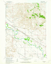 1960 Barnes1962 Print · USGSGoshen County at the start of the 1960s shows a landscape defined by the North Platte River and deep frontier history. Trace the path of the Emigrant Trail near the site of the Grattan Massacre Historical Mon and the Fort Laramie Military Reservation.3 unique versions available
 - 1960 Map of Lyman, 1962 Print
 1960 Lyman1962 Print · USGSThe Nebraska-Wyoming border comes alive in the early sixties, showing the agricultural heart of the North Platte valley. Researchers can trace the Emigrant Trail, locate the Historical Mon, and study the rail sidings of Lyman and Henry.3 unique versions available
Showing maps 1-25 of 828
Top cities of Wyoming
- Cheyenne historical maps
- Casper historical maps
- Laramie historical maps
- Gillette historical maps
- Rock Springs historical maps
- Sheridan historical maps
See more
Top counties of Wyoming
- Laramie County historical maps
- Natrona County historical maps
- Campbell County historical maps
- Sweetwater County historical maps
- Fremont County historical maps
- Albany County historical maps
See more
Frequently asked questions
- What are the different types of historical maps available for Wyoming?
- What is the oldest map of Wyoming?
- Where can I purchase historical maps of Wyoming for my home or office?
- Where can I download high-res historical maps of Wyoming?
- Are there historical topographic maps available for Wyoming?
- Is there historical aerial imagery available for Wyoming?
- Where are historical maps of Wyoming sourced from?