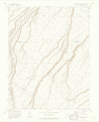
1973 Map of Government Springs
USGS Topo · Published 1976About this map
Uncompahgre National Forest dominates this landscape along the border of Montrose and Ouray counties, where deep drainage systems like Happy Canyon and Dolores Canyon carve through the high terrain. The map documents a network of water sources vital to the region, including Branson Spring, Brown Spring, and the namesake Government Springs. High-altitude routes such as the Old Paradox Road and Dave Wood Road traverse the ridges, reflecting the area's history of movement through difficult mountain passes.
Find a feature on this map
24 named features on this map. Tap any name to fly to it.
Don’t see what you’re looking for? This feature index may not catch every label — zoom into the map to look around manually.
Map Details
Editions of this 1973 Government Springs Map
3 editions found
Other maps of this area

1909 · Montrose
USGS Topo · 1:125,000

1911 · Montrose
USGS Topo · 1:125,000

1956 · Montrose
USGS Topo · 1:250,000

1956 · Moab
USGS Topo · 1:250,000

1959 · Moab
USGS Topo · 1:250,000

1959 · Montrose
USGS Topo · 1:250,000

1960 · Montrose
USGS Topo · 1:250,000

1960 · Moab
USGS Topo · 1:250,000

1962 · Moab
USGS Topo · 1:250,000
1962 · Montrose East
USGS Topo · 1:24,000