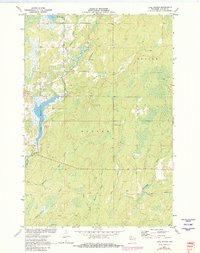
1971 Map of Lake Winter
USGS Topo · Published 1982About this map
Lake Winter and the Brunet River dominate this Sawyer County landscape, captured in a period of recreational development and forest management. The presence of the Winter Lookout Tower signifies the region's active fire monitoring history, while several named trails, including the Snowmobile Trail and Winter Trail, point to the area's transition into a seasonal outdoor destination. The drainage network is particularly detailed, showing the flow of Island Creek, Casey Creek, and Deadman Creek through the townships of Winter and Draper. Resource extraction is noted by a Gravel Pit near the lake's western edge, alongside small water bodies like South Barber Lake and Beaver Creek. This map preserves the mid-century hydrological and topographical state of the Northwoods before more modern infrastructure changes.
Find a feature on this map
18 named features on this map. Tap any name to fly to it.
Don’t see what you’re looking for? This feature index may not catch every label — zoom into the map to look around manually.
Map Details
Editions of this 1971 Lake Winter Map
2 editions found
Other maps of this area

1944 · Exeland
USGS Topo · 1:48,000

1944 · Draper
USGS Topo · 1:48,000

1944 · Radisson
USGS Topo · 1:48,000

1945 · Ingram
USGS Topo · 1:48,000

1947 · Exeland
USGS Topo · 1:48,000

1947 · Ingram
USGS Topo · 1:48,000

1947 · Draper
USGS Topo · 1:48,000

1949 · Radisson
USGS Topo · 1:48,000

1953 · Rice Lake
USGS Topo · 1:250,000

1959 · Rice Lake
USGS Topo · 1:250,000